How AI and Thermal Drones Are Accelerating Humanitarian Demining
By pairing unmanned aerial vehicles with deep learning algorithms, researchers and NGOs are drastically increasing the speed and safety of landmine detection in post-conflict zones.
By Factlen Editorial Team
- AI & Robotics Researchers
- Focused on algorithmic accuracy, sensor fusion, and overcoming environmental variables.
- Humanitarian Demining NGOs
- Focused on practical deployment, speed, and returning land to communities.
- International Policy Makers
- Focused on the evolving nature of warfare and the need for technological adaptation.
What's not represented
- · Local farmers awaiting land clearance
- · Manufacturers of traditional demining equipment
Why this matters
Traditional manual demining is painstakingly slow, leaving agricultural land unusable for decades and putting civilians at risk. Automating detection with AI allows organizations to clear land exponentially faster, safely returning vital farmland and infrastructure to recovering communities.
Key points
- Traditional metal detectors struggle with modern plastic landmines and metallic battlefield debris.
- Drones equipped with thermal cameras can detect the heat signatures of surface-level and shallowly buried explosives.
- AI models process these images to automatically identify and map hazardous zones with over 96% accuracy.
- Automated systems can survey up to 10,000 square meters per day, a 20-fold increase over manual methods.
- This technology drastically reduces the cost of surveys and lowers the accident rate for human deminers by 90%.
For decades, humanitarian demining has been a painstakingly slow and perilous endeavor. Traditional clearance protocols rely heavily on human operators sweeping fields inch by inch with electromagnetic induction (EMI) detectors, a process that exposes deminers to immense physical risk and requires massive investments of time and personnel.[3]
The limitations of EMI technology have become increasingly apparent in modern post-conflict zones. Battlefields are saturated with metallic debris, leading to a high rate of false positives that slow progress to a crawl. Furthermore, modern scatterable munitions, such as the plastic PFM-1 "butterfly" mine, contain minimal metal, rendering traditional detectors dangerously unreliable.[3]
To bridge this technological disconnect, a coalition of humanitarian organizations, academic researchers, and the United Nations is deploying a new standard: unpiloted aerial vehicles (UAVs) paired with artificial intelligence. This evidence-based approach shifts the initial burden of detection from humans on the ground to algorithms in the sky.[2][5]
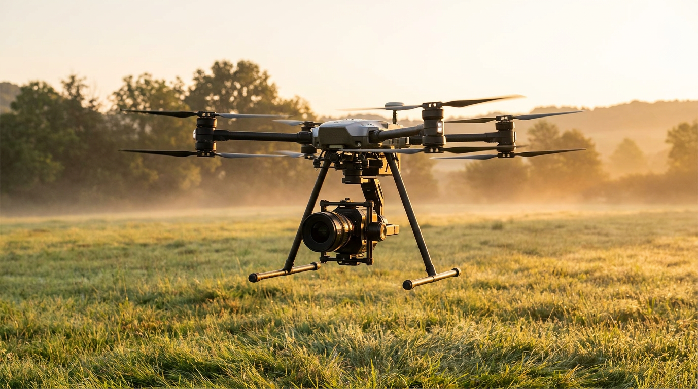
The mechanism begins with drones equipped with high-resolution optical and thermal infrared cameras flying grid patterns over suspected hazardous areas. Because landmines and the surrounding soil absorb and radiate solar heat at different rates, thermal sensors can detect the distinct temperature anomalies of surface-level or shallowly buried explosives.[2][4]

These massive aerial datasets are then fed into machine learning algorithms, specifically Convolutional Neural Networks (CNNs) like Faster R-CNN and YOLOv8. Rather than requiring humans to manually scrutinize thousands of images, the AI automatically identifies the geometric and thermal signatures of landmines, drawing bounding boxes and assigning precise GPS coordinates to each threat.[3][4]
The primary advantage of this automated approach is the sheer volume of land that can be processed. Industry case studies demonstrate that an automated drone system can survey up to 10,000 square meters per day. This represents a 20-fold increase over manual methods, which typically cover only 500 square meters in the same timeframe.[4]
For organizations like The HALO Trust, the greatest value of AI lies in "area reduction"—forensically proving where mines are not located. In Ukraine, initial estimates suggested 174,000 square kilometers were contaminated. By marrying satellite data, drone imagery, and AI, demining teams have canceled out vast swathes of safe land, reducing the suspected hazardous area to roughly the size of Massachusetts.[1]
For organizations like The HALO Trust, the greatest value of AI lies in "area reduction"—forensically proving where mines are not located.
Peer-reviewed trials indicate that deep learning models are achieving unprecedented accuracy rates. A recent study utilizing the MobileNetV3 architecture on thermal images achieved a test accuracy of 96.14%, proving the model's effectiveness in identifying landmines across different terrains.[2]

Even using standard visible-light (RGB) imagery, researchers have trained models to identify scatterable plastic mines with up to 91.8% accuracy, a massive improvement over early proof-of-concept models. When fused with thermal data, the AI can reliably distinguish between a plastic explosive device and a harmless rock or piece of debris.[3]
The integration of AI significantly alters the economics and risk profile of humanitarian demining. Automated surveys have driven the cost of detection down to approximately $1 per square meter, an 80% reduction from the $5 per square meter cost of manual surveys.[4]
More importantly, removing humans from the initial detection phase drastically reduces casualties. Data indicates that AI drone systems have reduced the accident rate to 0.5 incidents per 1,000 operations, a 90% decrease compared to traditional manual surveys.[4]
The urgency to adopt these technologies is driven by a shift in how modern conflicts are fought. The UN Mine Action Service (UNMAS) notes that the majority of mines in recent conflicts are deployed remotely via artillery, rockets, or drones, rather than being buried by hand.[5]

Because these remotely deployed munitions often sit on the surface or are only partially obscured by vegetation, they are prime targets for aerial detection. The very tactics that have accelerated the contamination of agricultural land have inadvertently made drone-based detection highly viable.[1][5]
Despite the promising data, researchers and NGOs stress transparent uncertainty regarding the technology's current limitations. AI models still struggle with deeply buried mines, dense vegetation can obscure thermal signatures, and highly mineralized soil can confuse sensors.[1][2]
The human element remains essential. AI models require continuous training on local terrain data, and human verification is mandatory before any land is officially declared safe for civilian return. As The HALO Trust notes, AI is an auxiliary tool that must be backed up by traditional survey methods.[1][6]

As machine learning models grow more sophisticated and thermal sensors become lighter and cheaper, the humanitarian demining sector is undergoing a fundamental transformation. By treating landmine detection as a data science problem, the international community is finally gaining ground in the race to restore safe, productive land to post-conflict communities.[1][6]
How we got here
Pre-2010s
Humanitarian demining relies almost exclusively on manual probing and electromagnetic induction (metal detectors).
2018
Early proof-of-concept studies begin testing commercial drones for mapping minefields.
2021
Researchers achieve over 91% accuracy using Convolutional Neural Networks to detect surface-level plastic mines from drone imagery.
2024-2026
NGOs and the UN deploy AI and thermal imaging at scale in conflict zones, drastically reducing suspected hazardous areas.
Viewpoints in depth
Humanitarian Demining NGOs
Focused on practical deployment, speed, and returning land to communities.
For organizations on the ground, the primary metric of success is how quickly and safely land can be returned to farmers and civilians. They view AI not as a replacement for human deminers, but as a critical 'area reduction' tool. By using drones to definitively prove where mines are not located, NGOs can concentrate their limited manual clearance resources on confirmed hazardous zones, drastically accelerating the overall recovery timeline.
AI & Robotics Researchers
Focused on algorithmic accuracy, sensor fusion, and overcoming environmental variables.
The academic and engineering community approaches demining as a complex data classification problem. Their focus is on training Convolutional Neural Networks (CNNs) to distinguish between the thermal signature of a plastic explosive and a sun-warmed rock. They are actively working to overcome current limitations, such as dense vegetation and deeply buried munitions, by fusing data from multispectral cameras, ground-penetrating radar, and thermal sensors.
International Policy Makers
Focused on the evolving nature of warfare and the need for technological adaptation.
Agencies like the UN Mine Action Service (UNMAS) emphasize that the rules of engagement have changed. With modern conflicts relying heavily on remotely deployed scatterable mines, the rate of contamination has outpaced traditional clearance methods. Policy makers argue that adopting high-tech countermeasures is no longer optional; it is a mandatory evolution required to win the 'arms race' against increasingly sophisticated explosive devices.
What we don't know
- How effectively AI models can be trained to detect deeply buried mines that do not emit strong thermal signatures.
- The long-term durability and maintenance costs of deploying advanced drone fleets in harsh, resource-poor environments.
- Whether international funding will scale sufficiently to equip all local demining teams with these advanced technologies.
Key terms
- PFM-1 Mine
- A widely used scatterable anti-personnel landmine made largely of plastic, often referred to as a 'butterfly mine' due to its shape.
- Thermal Imaging
- Camera technology that detects and visualizes heat signatures, allowing operators to spot objects that are warmer or cooler than their surroundings.
- Electromagnetic Induction (EMI)
- The underlying technology used in traditional metal detectors, which senses metallic objects buried underground.
- Area Reduction
- The process of using data and surveys to definitively prove an area is free of explosives, allowing clearance teams to focus only on genuinely contaminated zones.
- Convolutional Neural Network (CNN)
- A type of artificial intelligence specifically designed to process and analyze visual imagery, used here to identify the shapes and thermal signatures of landmines.
Frequently asked
Can drones physically remove the landmines?
No. Drones and AI are used exclusively for detection and mapping. Once a hazardous area is precisely mapped, human deminers or mechanical clearance vehicles are sent in to safely neutralize the explosives.
Why are traditional metal detectors failing?
Many modern scatterable mines are made primarily of plastic with minimal metal content. Additionally, post-conflict zones are heavily littered with metallic debris, causing traditional detectors to register constant false positives.
Does weather affect drone demining?
Yes. Thermal imaging relies on temperature differentials. Drones are typically flown during specific times of day, such as early morning or late afternoon, when the soil and the landmines heat up or cool down at different rates.
Sources
Source coverage
6 outlets
3 viewpoints surfaced


[1]The HALO TrustHumanitarian Demining NGOs
AI and mine clearance: How technology is accelerating humanitarian demining
Read on The HALO Trust →[2]IEEE AccessAI & Robotics Researchers
Deep Learning-Based Approach Utilizing Unmanned Aerial Vehicles Equipped With Thermal Imaging Cameras for Landmine Detection
Read on IEEE Access →[3]MDPI Applied SciencesAI & Robotics Researchers
Automated Detection of Scatterable Antipersonnel Landmines in Wide-Area Surveys Using UAVs
Read on MDPI Applied Sciences →[4]Blackthorn.aiAI & Robotics Researchers
AI Drone System for Landmine Detection: Case Study
Read on Blackthorn.ai →[5]UN NewsInternational Policy Makers
Deminers must innovate to win 'arms race' against high-tech landmines
Read on UN News →[6]Factlen Editorial Team
Synthesis by Factlen editorial team
Read on Factlen Editorial Team →
Every angle. Every day.
Get defense security stories with full source coverage and perspective breakdowns delivered to your inbox.