How Defense-Grade AI and Satellites Are Eradicating the Ocean's 'Dark Fleet'
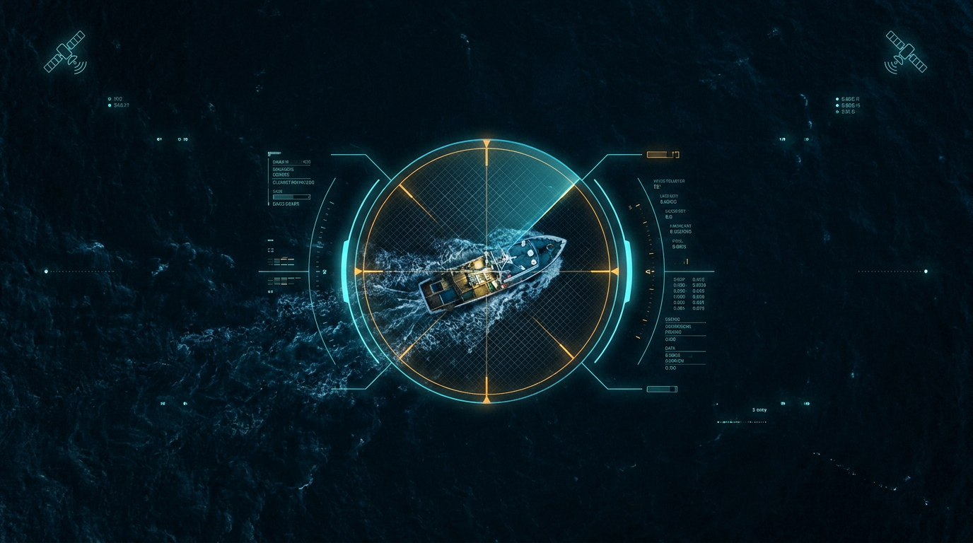
A fusion of synthetic aperture radar and machine learning is exposing illegal fishing vessels that disable their tracking transponders, giving global coast guards the tools to enforce maritime law from space.
By Factlen Editorial Team
- National Security & Defense
- Views dark fleet tracking as essential for maintaining geopolitical stability, protecting sovereign waters, and disrupting transnational crime networks.
- Conservation & NGOs
- Focuses on using open-source AI to protect marine biodiversity, enforce marine protected areas, and end human rights abuses at sea.
- Technology Developers
- Prioritizes the optimization of machine learning models, edge computing in space, and the fusion of multimodal satellite data.
What's not represented
- · Commercial Fishing Industry
- · Small-Scale Artisanal Fishers
Why this matters
Illegal fishing costs the global economy up to $24 billion annually and drives marine ecosystems toward collapse. By making the oceans fully transparent, this technology protects global food security, disrupts human trafficking networks, and allows nations to defend their sovereign waters without relying solely on expensive physical patrols.
Key points
- Up to 75% of industrial fishing vessels in some regions operate as a 'dark fleet' by disabling their tracking transponders.
- AI models analyzing Synthetic Aperture Radar (SAR) imagery can now detect these hidden vessels through clouds and darkness.
- Defense agencies are integrating these open-source algorithms to automate maritime domain awareness and direct physical patrols.
- New satellites are processing AI data in orbit, reducing the time to locate illegal ships from days to hours.
- Recent studies confirm that strongly protected marine areas have nine times fewer vessels, proving that enforcement works.
For decades, the sheer vastness of the ocean has provided a perfect cover for illicit activity. Commercial vessels are required to broadcast their locations using the Automatic Identification System (AIS), primarily to prevent collisions at sea. However, captains engaged in illegal, unreported, and unregulated (IUU) fishing routinely disable these transponders, effectively vanishing from public surveillance systems. This "dark fleet" operates with near impunity, plundering protected marine reserves and crossing into sovereign Exclusive Economic Zones (EEZs) undetected.[2][4]
The scale of this evasion is staggering. Recent AI-powered mapping initiatives have revealed that up to 75% of industrial fishing vessels in certain coastal regions operate without broadcasting their locations. Globally, roughly one in five fish caught originates from IUU fishing, a black-market economy valued between $10 billion and $24 billion annually. Beyond environmental devastation, these dark vessels are frequently linked to severe human rights abuses, including forced labor and human trafficking, making their detection a top priority for national security agencies worldwide.[2][4][6]

The technological breakthrough changing the balance of power is the fusion of Synthetic Aperture Radar (SAR) satellite imagery with advanced machine learning algorithms. Unlike traditional optical cameras, which are blinded by cloud cover and darkness, SAR works by beaming microwave pulses down to the ocean surface and measuring the backscatter. Steel ship hulls reflect these pulses intensely, appearing as bright, unmistakable signatures against the dark backdrop of the sea, regardless of weather conditions or time of day.[1][4]
Claim 1: AI can accurately map the dark fleet at a global scale. The evidence for this capability is now robust. Organizations like Global Fishing Watch, in partnership with Google Earth Engine, have processed petabytes of SAR and optical imagery using deep learning models. By cross-referencing radar detections with known AIS broadcasts, these models isolate the vessels that are intentionally hiding. This has allowed researchers to create the first-ever global map depicting true human activity at sea, proving that the footprint of industrial fishing is vastly larger than previously understood.[2][6]

Claim 1: AI can accurately map the dark fleet at a global scale.
Claim 2: Defense agencies are successfully operationalizing this data for real-time enforcement. The U.S. Defense Innovation Unit (DIU) accelerated this transition through its xView3 challenge, which crowdsourced the best open-source algorithms for detecting dark vessels in SAR imagery. The winning models have since been integrated into SeaVision, a maritime domain awareness platform used by the U.S. Coast Guard and over 100 partner nations. Instead of manually scanning thousands of square miles of satellite imagery, analysts now receive automated alerts, allowing them to dispatch intercept vessels directly to the coordinates of suspected offenders.[1][7]
Claim 3: Edge computing in space is drastically reducing detection latency. Historically, downloading massive, high-resolution radar images to ground stations for processing could take days—long enough for a dark vessel to finish fishing and flee. To solve this, the European Space Agency (ESA) has deployed systems like REMIS, which utilize on-board AI to pre-filter images directly on the satellite. By identifying ships in orbit and downlinking only the relevant data crops, the system reduces the time between detection and alerting authorities from days to mere hours.[3]

Claim 4: Marine Protected Areas (MPAs) are highly effective when backed by satellite enforcement. A recent peer-reviewed study analyzing 1,380 highly protected MPAs used this exact combination of SAR and AI to validate compliance. The data showed that over 78% of these protected zones experienced zero industrial fishing activity, and strongly protected areas had nine times fewer vessels than unprotected coastal waters. The technology provides the definitive proof required to show that legal protections, when paired with the threat of unblinking orbital surveillance, serve as a powerful deterrent.[4]
Despite these massive leaps, transparent uncertainties remain in the evidence base. Current SAR resolutions and AI models still struggle to reliably detect small, wooden, or fiberglass artisanal boats under 15 meters in length, which do not reflect radar pulses as strongly as steel hulls. Furthermore, detecting vessels within two kilometers of the shoreline remains computationally difficult due to radar artifacts bouncing off coastal topography. Researchers are actively developing multimodal fusion architectures—combining SAR, optical imagery, and radio frequency data—to close these remaining blind spots.[1][5]
How we got here
2021
The Defense Innovation Unit and Global Fishing Watch launch the xView3 challenge to crowdsource AI models for detecting dark vessels.
2022
Global Fishing Watch releases the first global map of previously undetected dark fleets, revealing massive gaps in public tracking.
2023
The U.S. Coast Guard integrates the winning xView3 algorithms into the SeaVision platform to automate vessel detection.
2024
The European Space Agency tests on-board AI to process satellite imagery directly in space, drastically reducing alert times.
2025
Peer-reviewed research confirms that AI and SAR combinations successfully validate compliance in Marine Protected Areas.
Viewpoints in depth
National Security & Defense
Views dark fleet tracking as essential for maintaining geopolitical stability, protecting sovereign waters, and disrupting transnational crime networks.
For defense agencies, illegal fishing is not just an environmental issue; it is a direct threat to national sovereignty and economic security. Organizations like the Defense Innovation Unit (DIU) and the U.S. Coast Guard view the dark fleet as a vector for broader geopolitical instability, often linked to state-sponsored resource extraction, drug smuggling, and human trafficking. By automating the detection of these vessels using AI, militaries can shift from reactive, resource-heavy physical patrols to highly targeted interceptions, effectively denying bad actors the cover of the open ocean.
Conservation & NGOs
Focuses on using open-source AI to protect marine biodiversity, enforce marine protected areas, and end human rights abuses at sea.
Environmental groups and non-profits like Global Fishing Watch emphasize the ecological and humanitarian imperatives of maritime transparency. They argue that without accurate data, international agreements on overfishing and marine protected areas are unenforceable. By democratizing access to AI-processed satellite data, these organizations empower developing nations to police their own waters and provide journalists and human rights advocates with the hard evidence needed to expose forced labor and ecological devastation in the global seafood supply chain.
Technology Developers
Prioritizes the optimization of machine learning models, edge computing in space, and the fusion of multimodal satellite data.
For the engineers and data scientists building these systems, the challenge lies in the sheer volume and complexity of the data. Processing petabytes of radar imagery requires immense computational power. Researchers are focused on pushing the boundaries of edge computing—running neural networks directly on satellites to pre-filter data before it is beamed to Earth. They are also working to fuse SAR data with optical imagery and radio frequency signals to overcome current limitations, such as the inability to reliably detect small wooden boats or filter out radar artifacts near coastlines.
What we don't know
- How quickly illicit fleets will adapt to these new surveillance methods, such as by deploying radar-absorbing materials or altering their operational patterns.
- Whether international legal frameworks will evolve fast enough to prosecute vessels based primarily on AI-generated satellite evidence.
- How effectively these technologies can be scaled to detect smaller, non-industrial wooden boats that make up a significant portion of local illegal fishing.
Key terms
- Dark Fleet
- Vessels that intentionally disable their tracking transponders to evade detection while engaging in illicit activities.
- Automatic Identification System (AIS)
- A radio frequency transponder system that broadcasts a ship's identity, location, and course, primarily used for collision avoidance.
- Synthetic Aperture Radar (SAR)
- A form of radar used to create two-dimensional images of objects, capable of penetrating cloud cover and operating at night.
- Exclusive Economic Zone (EEZ)
- An area of the sea in which a sovereign state has special rights regarding the exploration and use of marine resources.
- Edge Computing
- Processing data at or near the source of data generation—such as on the satellite itself—rather than relying on a central data center on Earth.
Frequently asked
Why do ships turn off their AIS transponders?
Captains disable their tracking systems to hide illicit activities, such as fishing in protected marine reserves, transshipping embargoed goods, or engaging in human trafficking.
How does radar find ships that cameras cannot see?
Synthetic Aperture Radar (SAR) bounces microwave pulses off the ocean surface. Steel ship hulls reflect these pulses strongly, appearing as bright spots even through heavy cloud cover or in total darkness.
Can this technology catch small, artisanal fishing boats?
Currently, SAR and AI models struggle to reliably detect smaller wooden or fiberglass boats under 15 meters, focusing primarily on large industrial vessels.
Sources
Source coverage
7 outlets
3 viewpoints surfaced


[1]Defense Innovation UnitNational Security & Defense
Integrating xView3 Machine Learning Algorithms Into the SeaVision Maritime Domain Awareness Platform
Read on Defense Innovation Unit →[2]Global Fishing WatchConservation & NGOs
Revealing all vessel traffic at sea
Read on Global Fishing Watch →[3]European Space AgencyNational Security & Defense
AI in space to detect ships
Read on European Space Agency →[4]Global Investigative Journalism NetworkConservation & NGOs
Using AI and Satellites to Track Illegal Fishing in Marine Protected Areas
Read on Global Investigative Journalism Network →[5]MDPITechnology Developers
Deep Learning for Maritime Security: A Review
Read on MDPI →[6]GoogleTechnology Developers
Global Fishing Watch is releasing AI-powered datasets that map global ocean infrastructure
Read on Google →[7]Factlen Editorial TeamTechnology Developers
Synthesis by Factlen editorial team
Read on Factlen Editorial Team →
Every angle. Every day.
Get defense security stories with full source coverage and perspective breakdowns delivered to your inbox.