How AI and Drone Swarms Are Revolutionizing Humanitarian Landmine Clearance
Advanced machine learning models and multi-sensor drones are compressing landmine detection times from days to hours, offering a safer path to clearing the world's 100 million unexploded munitions.
By Factlen Editorial Team
- Humanitarian Deminers
- Focused on the practical application of technology to save lives and return land to local communities.
- Defense Technology Developers
- Focused on scaling AI capabilities, multi-sensor fusion, and processing speed.
- Academic Researchers
- Focused on rigorous validation, uncertainty quantification, and overcoming edge-case limitations.
What's not represented
- · Local farmers and civilians returning to cleared land
- · Manufacturers of traditional manual demining equipment
Why this matters
With over 100 million unexploded munitions threatening civilians globally, the integration of artificial intelligence into demining operations promises to drastically reduce the time, cost, and human casualties associated with returning war-torn land to productive use.
Key points
- Humanitarian demining traditionally relies on slow, dangerous manual probing, with over 100 million unexploded mines threatening civilians globally.
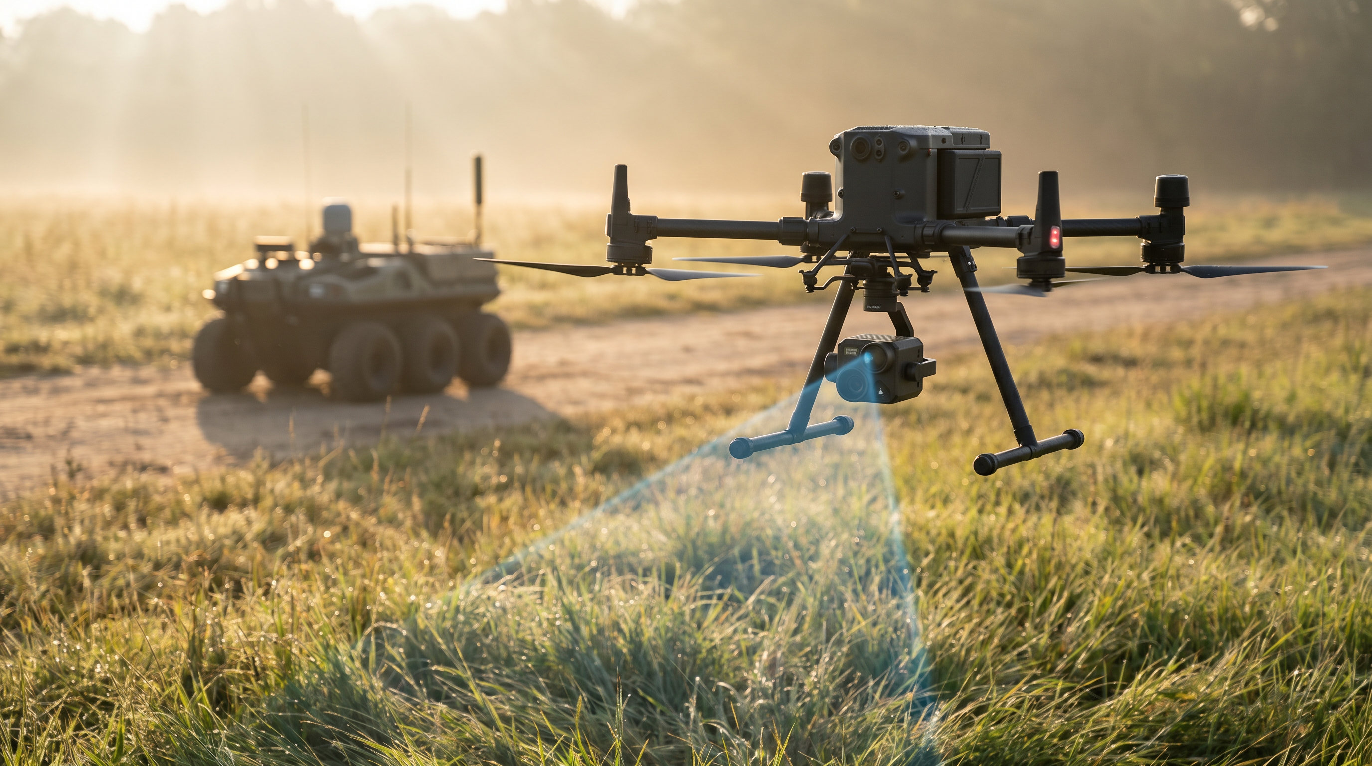
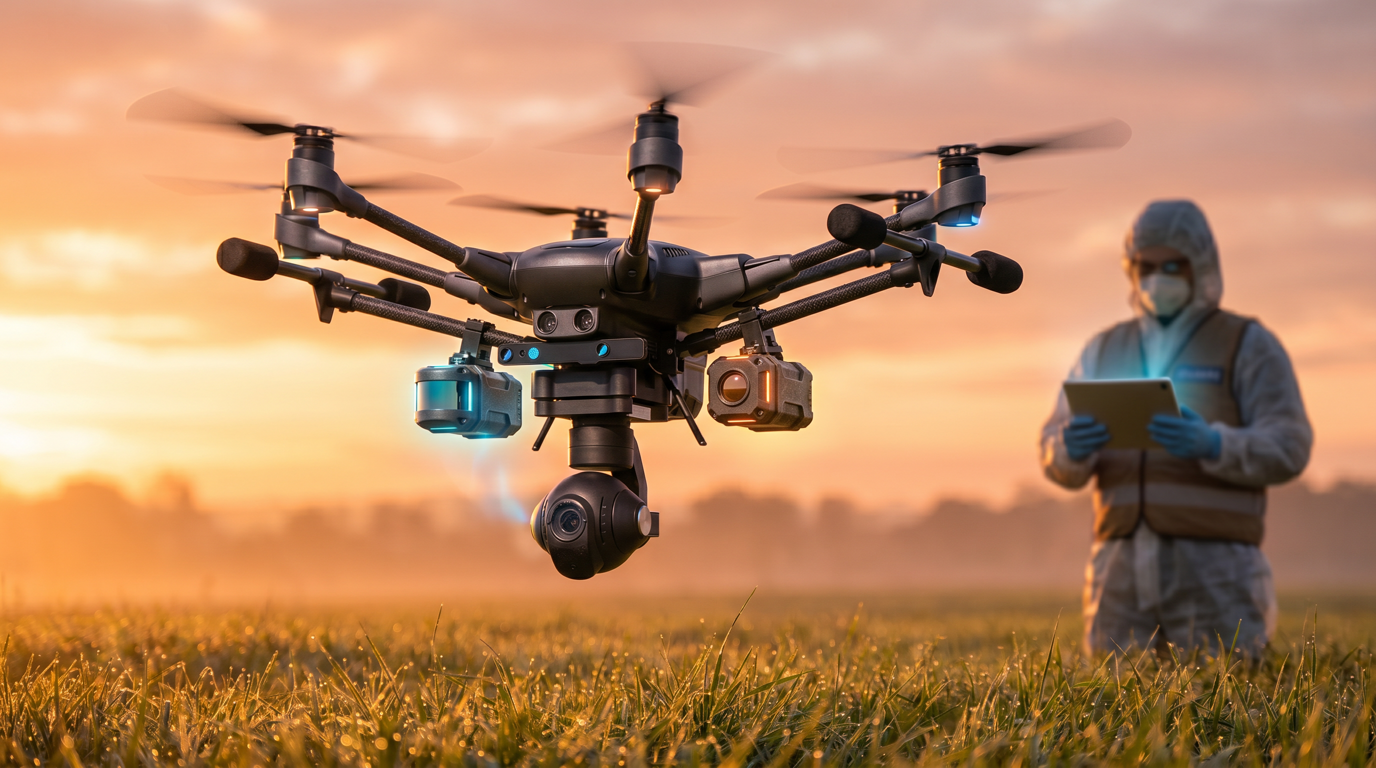
- Multi-sensor drones equipped with visual, thermal, and magnetic sensors are now mapping suspected hazard zones from the air.
- Artificial intelligence models process this aerial data, compressing minefield analysis time from several days down to mere hours.
- Recent academic studies demonstrate that dual-mode deep learning algorithms can identify unexploded ordnance with over 97% accuracy.
- Algorithmic breakthroughs have solved drone motor interference, allowing highly sensitive magnetometers to detect buried metallic mines.
- While AI acts as a highly efficient triage tool to cancel safe areas, the physical excavation of explosives still requires human or robotic intervention.
For decades, humanitarian demining has been a grueling, millimeter-by-millimeter endeavor that pits human endurance against hidden subterranean threats. With an estimated 100 million unexploded landmines and explosive remnants of war currently scattered across 57 nations, the sheer scale of global contamination vastly outpaces traditional clearance efforts. In heavily mined regions such as Ukraine, where millions of explosives have been systematically deployed across some of the world's most productive agricultural land, clearing the terrain using conventional methods would take generations and cost billions of dollars. The economic paralysis caused by these hidden hazards prevents displaced civilians from returning home, halts farming operations, and stifles post-conflict recovery long after the active hostilities have ceased.[5][9]
The traditional bottleneck in this process lies squarely in the detection phase. Clearance teams have historically relied heavily on handheld metal detectors and manual probing with specialized sticks, a process that inevitably churns up harmless shrapnel, tin cans, and spent bullet casings, leading to agonizingly slow progress. Furthermore, this manual approach carries a devastating and unacceptable human cost; the United Nations estimates that for every 5,000 mines successfully recovered, three deminers are injured or killed in the line of duty. The mine action community has long sought a reliable method to accurately survey contaminated land without putting human operators directly in the blast radius, but technological limitations previously kept aerial detection out of reach.[8][9]
A profound paradigm shift is now underway, driven by the rapid convergence of commercial drone technology and advanced machine learning algorithms. The central claim driving this operational shift is that artificial intelligence can compress the time required to analyze a suspected minefield from several days down to mere hours. By deploying multi-sensor drones to map hazardous areas from the sky, organizations can feed terabytes of high-resolution aerial data into AI models that identify explosives with remarkable accuracy, fundamentally altering the economics, speed, and safety of humanitarian demining operations worldwide.[1][10]

The strongest evidence supporting this acceleration comes from the deployment of visual and thermal imaging models. Leading organizations like The HALO Trust have partnered with major cloud computing providers to process vast quantities of drone imagery using region-based convolutional neural networks (R-CNNs). By training these algorithms on extensive datasets collected from real-world conflict zones, the systems can spot surface-level and partially buried ordnance that human eyes might miss. For example, thermal sensors can reliably detect the widely deployed PFM-1 'butterfly' mine by registering the subtle temperature differentials between the plastic explosive casing and the surrounding soil as the ground heats up during the day.[1][9]
Recent academic validations of these visual models demonstrate striking accuracy rates under controlled testing conditions. A comprehensive 2025 study published in IEEE Xplore detailed a dual-mode detection method utilizing the YOLOv5 deep learning architecture, specifically optimized for low-altitude unmanned aerial vehicles. By intelligently fusing visible light and infrared imagery, the model successfully mitigated the camouflage effects of dense vegetation and uneven terrain. The researchers reported an impressive 97.1% accuracy rate in identifying unexploded ordnance (UXO), processing up to 60 frames per second to deliver near real-time analysis to operators on the ground.[3]
Recent academic validations of these visual models demonstrate striking accuracy rates under controlled testing conditions.
However, visual and thermal sensors possess inherent physical limitations; they struggle significantly with deeply buried anti-tank mines, dense jungle canopy cover, and adverse weather conditions that obscure surface visibility. To address these critical edge cases, defense researchers are increasingly integrating airborne magnetometry into their drone payloads. Drones equipped with highly sensitive magnetometers can detect the localized magnetic anomalies caused by the metallic components of buried mines. Historically, the severe magnetic interference generated by the drone's own electric motors rendered this approach unworkable, producing too much electromagnetic noise to isolate the incredibly faint signal of a buried explosive.[4]
New algorithmic breakthroughs have largely solved this specific interference problem, significantly strengthening the case for multi-sensor fusion. A recent academic paper detailed the successful use of a two-step automated interference removal system, originally designed for spaceflight magnetometers, adapted for commercial drones. By applying the Wavelet-Adaptive Interference Cancellation (WAIC-UP) method alongside unsupervised detection algorithms, researchers successfully isolated the magnetic signatures of landmines from the drone's electromagnetic noise. This software-driven approach achieves high-fidelity detection without requiring the complex, heavy sensor booms that previously made drone-based magnetometry too cumbersome for rapid field deployment.[4]

The real-world deployment of these fused technologies is already yielding unprecedented results in active recovery zones. In Ukraine, the AI-enabled defense company Safe Pro Group recently surpassed a major milestone of 50,000 confirmed landmine and UXO detections. Utilizing a proprietary dataset containing over 2.75 million drone images, their SpotlightAI platform can autonomously identify more than 150 different types of explosive threats, plotting them on sub-centimeter-resolution maps for clearance teams. This massive scale of automated detection provides a novel and highly scalable approach to battlefield situational awareness and post-conflict remediation.[2]
Similarly, The HALO Trust has utilized drone-assisted mapping to clear over 36,000 explosives, effectively returning 20 million square meters of vital land to Ukrainian families and farmers. The integration of artificial intelligence does not replace human deminers; rather, it acts as a highly efficient triage and area-reduction tool. By definitively proving which specific sectors are free of explosives, AI allows organizations to confidently cancel suspected hazard zones entirely, focusing their manual clearance efforts and limited resources exclusively on confirmed threats rather than sweeping empty fields.[5][6]
Despite these robust field results, transparent uncertainties remain within the current evidence base. Machine learning models are inherently constrained by the quality and diversity of their training data. While algorithms perform exceptionally well on documented munitions in familiar terrain, their efficacy drops when encountering novel improvised explosive devices (IEDs) or operating in highly mineralized soils that produce false magnetic positives. Academic researchers emphasize the critical need for publicly available benchmark datasets to validate AI models outside of controlled test environments, ensuring they do not dangerously overfit to specific regional data.[7]

Furthermore, AI detection solves only the first half of the complex demining equation. The 'last mile' of clearance—the physical excavation and neutralization of the threat—remains a highly dangerous, manual task. While organizations are actively testing micro-excavators, remote-controlled flails, and robotic rovers to detonate mines safely, the physical removal process has not yet experienced the same exponential technological leap as the detection phase. The mine action community remains appropriately cautious, noting that in this specific field, algorithmic hallucinations or false negatives carry immediate and lethal consequences for the operators.[5][6][8]
Looking ahead, the trajectory of this technology points toward fully autonomous clearance ecosystems. The next phase of research focuses heavily on edge computing, where drones process magnetometry and visual data locally on onboard servers, completely eliminating the need for high-bandwidth internet connections in remote, infrastructure-poor conflict zones. As these AI models continue to mature and eventually integrate with autonomous ground robotics, the ambitious goal of eradicating the world's legacy minefields within our lifetime is steadily transitioning from a distant humanitarian dream to a quantifiable engineering challenge.[4][8][10]
How we got here
Pre-2020
Humanitarian demining relies almost exclusively on handheld metal detectors, manual probing, and trained animals, progressing at a painstakingly slow rate.
2022-2023
The conflict in Ukraine creates one of the most heavily mined landscapes in the world, prompting an urgent influx of defense tech innovation.
2024
Organizations like The HALO Trust begin partnering with cloud providers to process drone imagery using early machine learning models.
2025
Academic researchers achieve 97%+ accuracy rates using dual-mode AI models, and algorithmic filters solve drone motor magnetic interference.
Early 2026
AI platforms surpass major milestones, with tens of thousands of confirmed autonomous detections accelerating land release in post-conflict zones.
Viewpoints in depth
Humanitarian Deminers
Focused on the practical application of technology to save lives and return land to local communities.
For organizations like The HALO Trust and the UN, the primary metric of success is not just finding mines, but safely returning agricultural land to civilian use. They view AI as a critical triage tool that allows them to 'cancel' suspected hazardous areas quickly, proving land is safe without putting human boots on the ground. However, they remain highly cautious about over-relying on unproven tech, emphasizing that a single false negative from an AI model can result in a fatal accident during the physical clearance phase.
Defense Technology Developers
Focused on scaling AI capabilities, multi-sensor fusion, and processing speed.
Commercial defense contractors and tech startups approach demining as a massive data processing challenge. Their focus is on building hyper-scalable cloud architectures and edge-computing solutions that can process terabytes of drone imagery in near real-time. By compiling proprietary datasets of hundreds of UXO variants, they argue that continuous machine learning will eventually drive detection accuracy to near-perfect levels, paving the way for fully autonomous robotic clearance ecosystems.
Academic Researchers
Focused on rigorous validation, uncertainty quantification, and overcoming edge-case limitations.
The academic community provides the foundational algorithmic breakthroughs—such as interference cancellation and neural network architectures—but also serves as a skeptical check on commercial claims. Researchers emphasize the transparent uncertainties of AI, noting that models trained in one environment often fail in another due to different soil mineralogy or vegetation. They advocate for open-source benchmark datasets to ensure algorithms are rigorously tested against edge cases before being deployed in life-or-death scenarios.
What we don't know
- How effectively current AI models will generalize to novel improvised explosive devices (IEDs) not present in their training datasets.
- Whether the cost of multi-sensor drones and edge-computing hardware can be driven low enough for ubiquitous use by underfunded NGOs.
- How quickly the 'last mile' of physical excavation can be automated to match the exponential speed increases in the detection phase.
Key terms
- Unexploded Ordnance (UXO)
- Explosive weapons such as bombs, shells, grenades, and landmines that did not explode when they were deployed and still pose a risk of detonation.
- Magnetometry
- The technique of measuring and mapping patterns of magnetism in the soil to detect buried metallic objects.
- Sensor Fusion
- The process of combining data from multiple different sensors, like thermal cameras and magnetometers, to improve detection accuracy and reduce false alarms.
- Edge Computing
- Processing data locally on the drone's onboard computer rather than relying on an internet connection to send data to a centralized cloud server.
- False Positive
- An instance where the AI incorrectly identifies a harmless object, like a tin can or mineral deposit, as an explosive threat.
Frequently asked
How does AI detect buried landmines?
AI models process data from drone-mounted thermal cameras, ground-penetrating radar, and magnetometers to identify the heat signatures and magnetic anomalies of buried explosives.
Can AI replace human deminers?
Not entirely. AI acts as a triage tool to map hazards and cancel safe areas, but the physical excavation and neutralization of the mines still require human operators or specialized robotics.
What happens if the drone's motors interfere with the sensors?
Recent algorithmic breakthroughs, such as the WAIC-UP method, allow onboard computers to filter out the electromagnetic noise generated by the drone's motors, isolating the mine's magnetic signature.
Does this technology work in all environments?
Current models struggle in highly mineralized soils that cause false magnetic positives, and dense jungle canopies that block visual and thermal sensors, though multi-sensor fusion is improving reliability.
Sources
Source coverage
10 outlets
3 viewpoints surfaced


[1]The HALO TrustHumanitarian Deminers
Artificial Intelligence to Help Accelerate Landmine Clearance
Read on The HALO Trust →[2]Safe Pro GroupDefense Technology Developers
Safe Pro Celebrates 50,000th AI-Powered Landmine Detection Milestone
Read on Safe Pro Group →[3]IEEE XploreAcademic Researchers
A Dual Mode Detection Method for Unexploded Ordnance Based on YOLOv5 for Low Altitude Unmanned Aerial Vehicle
Read on IEEE Xplore →[4]arXivAcademic Researchers
A Drone-mounted magnetometer system for automatic interference removal and landmine detection
Read on arXiv →[5]Geo Week NewsHumanitarian Deminers
How Drones and AI Are Helping Clear 36,000 Landmines in Ukraine
Read on Geo Week News →[6]National Defense MagazineDefense Technology Developers
Ukraine War Spurs Demining Tech Advancements
Read on National Defense Magazine →[7]ZME ScienceAcademic Researchers
New AI Drone Can Spot Hidden Land mines Ten Times Faster Than Humans to Save Thousands of Lives
Read on ZME Science →[8]UN NewsHumanitarian Deminers
Deminers race to keep up with military technology
Read on UN News →[9]Columbia MagazineAcademic Researchers
Drones and AI Are New Recruits in Battle Against Land Mines
Read on Columbia Magazine →[10]Factlen Editorial Team
Synthesis by Factlen editorial team
Read on Factlen Editorial Team →

More in defense security
See all 8 stories →Demining Tech
How AI and Autonomous Robotics Are Solving the Global Landmine Crisis
8 sources
Humanitarian Tech
AI and Multi-Sensor Drones Are Rewriting the Math on Global Landmine Clearance
9 sources
Quantum Defense
Evidence Pack: The National Security Migration to Post-Quantum Cryptography
7 sources

Demining Tech
How AI and Sensor-Fused Drones Are Solving the Global Landmine Crisis
9 sources
Every angle. Every day.
Get defense security stories with full source coverage and perspective breakdowns delivered to your inbox.