The Democratization of Intelligence: How Citizen OSINT is Reshaping Global Truth
Once the exclusive domain of state spy agencies, open-source intelligence (OSINT) tools like satellite imagery and geolocation are now empowering citizens to debunk disinformation and verify global events.
By Factlen Editorial Team
- Independent Investigators
- Argue that OSINT democratizes truth and provides necessary accountability against state and corporate narratives.
- Traditional Intelligence Agencies
- View OSINT as a critical, high-volume supplement to classified collection, though they caution against amateur misinterpretation.
- Privacy & Ethics Advocates
- Highlight the risks of crowdsourced misidentification, doxxing, and the ethical dilemmas of ubiquitous surveillance.
What's not represented
- · Commercial Satellite Operators
- · Open-Source Software Developers
Why this matters
By understanding how open-source intelligence works, readers can better navigate the modern information environment, verify claims themselves, and rely on a growing network of independent truth-seekers holding institutions accountable.
Key points
- Open-source intelligence (OSINT) uses public data to verify global events.
- Commercial satellites now provide daily, high-resolution imagery to the public.
- Geolocation techniques allow citizens to mathematically prove where videos were filmed.
- Public flight and maritime databases expose illicit movements and sanctions evasion.
- State intelligence agencies now rely heavily on open-source data collection.
- Strict verification methodologies are required to prevent crowdsourced misidentification.
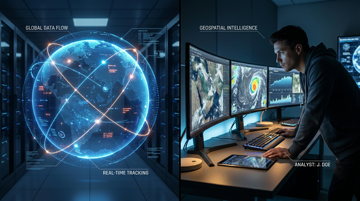
The era of the trench-coated spy holding a monopoly on global secrets is rapidly giving way to a new paradigm: the citizen investigator equipped with a laptop and an internet connection. This shift is driven by the explosion of Open-Source Intelligence (OSINT), a discipline that transforms publicly available data into rigorous, actionable evidence.[1][2]
At its core, OSINT is the systematic collection and analysis of information from unclassified sources. While intelligence agencies have always read foreign newspapers, the modern OSINT landscape is defined by the sheer volume and accessibility of digital exhaust, ranging from social media metadata to public shipping registries.[2]
To understand how we know what we know in the modern information environment, it is essential to examine the evidence-pack approach. The foundation of contemporary open-source verification rests on three primary pillars: commercial satellite imagery, digital geolocation, and public transmission databases.[1][3]
The first major claim of the OSINT revolution is that commercial satellite imagery has fundamentally altered global transparency. Previously, only superpowers with multi-billion-dollar space programs had the capability to monitor the Earth from orbit.[3]

The evidence supporting this shift is overwhelming. Today, commercial aerospace companies operate constellations consisting of hundreds of satellites. These platforms provide daily, and sometimes hourly, optical and synthetic aperture radar (SAR) imagery at resolutions as sharp as 30 centimeters per pixel, making it possible to identify individual vehicles from space.[3]
This democratization means that large-scale events—such as troop movements, illegal logging in protected rainforests, and the construction of covert facilities—can no longer be easily hidden from the public eye. Independent researchers and journalists can now purchase or access this data to independently verify state claims.[1][3]
The second major claim is that geolocation and chronolocation techniques provide rigorous verification of ground-level events. When a controversial video surfaces online, professional OSINT investigators do not take the footage at face value; they mathematically prove where and when it was recorded.[4]
The evidence for this lies in the methodology of spatial analysis. By analyzing the angle of shadows, the shape of distant mountain ranges, the layout of street signs, and even the specific foliage of trees, researchers can pinpoint the exact coordinates of a camera lens using tools like Google Earth and Mapillary.[4]

Furthermore, tools like SunCalc allow investigators to reverse-engineer the exact time of day a photograph was taken based on shadow length, solar trajectory, and historical weather data. This creates an immutable timeline of events that can debunk manipulated narratives.[1][4]
This creates an immutable timeline of events that can debunk manipulated narratives.
The third pillar involves public transmission databases, which expose illicit global movements. International maritime and aviation laws require ships and aircraft to constantly broadcast their locations to prevent collisions.[6]
The Automatic Identification System (AIS) for maritime vessels and the Automatic Dependent Surveillance-Broadcast (ADS-B) for aircraft generate terabytes of location data daily. This data is aggregated and made accessible via public platforms like Flightradar24 and MarineTraffic.[6]
By cross-referencing these databases with satellite imagery, civilian investigators have successfully tracked sanctioned oligarch yachts, exposed illegal fishing fleets operating in protected waters, and mapped clandestine arms shipments across the globe.[4][6]

The fourth major claim is that the traditional intelligence community itself now relies heavily on open-source data. State apparatuses, including the National Geospatial-Intelligence Agency (NGA), openly acknowledge that the sheer volume of public data outpaces their classified collection capabilities.[5]
Estimates from defense think tanks suggest that up to 80% of actionable intelligence now originates from open sources. State agencies are increasingly partnering with commercial OSINT firms to triage global crises, effectively outsourcing the first layer of intelligence gathering to the public domain.[2][5]
Despite these capabilities, there is transparent uncertainty in the OSINT methodology. The primary vulnerability is the human element—specifically, the risk of crowdsourced misidentification and the lack of institutional oversight in amateur investigations.[7]
The infamous Reddit investigation of the 2013 Boston Marathon bombing serves as a foundational cautionary tale for the community. In that instance, amateur sleuths falsely identified innocent individuals, highlighting the critical need for rigorous editorial standards and ethical frameworks.[7]

Furthermore, the rapid advancement of generative AI and deepfakes presents a looming challenge to OSINT verifiers. As synthetic media becomes increasingly indistinguishable from reality, the burden of proof shifts heavily toward multi-source corroboration.[1][7]
To combat this uncertainty, professional OSINT organizations have developed strict methodologies. A standard practice now requires at least three independent vectors of verification—such as satellite data, ground video, and historical weather records—before publishing a definitive conclusion.[4][7]
How we got here
2014
Independent researchers use social media and satellite data to trace the missile system that downed MH17, bringing OSINT into the mainstream.
2020
The commercial space boom drastically lowers the cost of high-resolution satellite imagery, making it accessible to newsrooms and NGOs.
2022
Citizen journalists use open-source tools to track troop movements in real-time during the outbreak of the war in Ukraine.
2026
OSINT methodologies become standard practice in major newsrooms, fundamentally changing how digital evidence is verified.
Viewpoints in depth
Independent Investigators
Argue that OSINT democratizes truth and provides necessary accountability against state and corporate narratives.
For independent research collectives and citizen journalists, OSINT is a great equalizer. It allows non-state actors to bypass official spokespeople and verify facts on the ground using empirical data. This camp argues that the widespread availability of satellite imagery and tracking data makes it nearly impossible for governments to hide large-scale human rights abuses, environmental destruction, or military build-ups. They view the democratization of these tools as a fundamental upgrade to global civil society.
Traditional Intelligence Agencies
View OSINT as a critical, high-volume supplement to classified collection, though they caution against amateur misinterpretation.
State intelligence apparatuses recognize that they can no longer rely solely on classified collection methods. Agencies like the NGA view OSINT as a vital triage tool—using public data to monitor broad global trends while reserving expensive, classified assets for highly specific targets. However, professionals in this camp frequently warn about the lack of tradecraft among amateur sleuths, noting that raw data without proper context or rigorous verification can lead to dangerous misinterpretations during fast-moving crises.
Privacy & Ethics Advocates
Highlight the risks of crowdsourced misidentification, doxxing, and the ethical dilemmas of ubiquitous surveillance.
Media ethicists and privacy advocates point out the darker side of democratized intelligence. They argue that when thousands of untrained internet users attempt to solve crimes or identify individuals, the results can be disastrous—often leading to doxxing and the harassment of innocent people. Furthermore, this camp raises concerns about the normalization of ubiquitous surveillance, questioning whether the public availability of high-resolution satellite imagery and location tracking databases infringes on global privacy rights.
What we don't know
- How effectively the OSINT community will be able to scale verification against the rising tide of generative AI and deepfakes.
- Whether governments will attempt to heavily regulate or restrict public access to commercial satellite imagery in the future.
Key terms
- OSINT
- Open-Source Intelligence; the collection and analysis of publicly available information to produce actionable insights.
- Geolocation
- The process of identifying the real-world geographic location of an object, person, or camera based on visual clues in an image or video.
- Chronolocation
- The technique of determining the exact date and time a piece of media was captured, often using shadow analysis and historical weather data.
- AIS / ADS-B
- Public transmission systems used by ships (AIS) and aircraft (ADS-B) to broadcast their locations, speed, and headings for safety purposes.
Frequently asked
Is open-source intelligence legal?
Yes. By definition, OSINT relies exclusively on publicly available information, commercial data, and open databases, avoiding hacking or classified breaches.
How do investigators find the exact time a photo was taken?
They use a technique called chronolocation, which involves measuring the length and angle of shadows in the image and cross-referencing them with solar trajectory tools like SunCalc.
Can artificial intelligence defeat OSINT verification?
While deepfakes pose a challenge, professional OSINT relies on multi-source corroboration. A fake video cannot easily fake corresponding satellite imagery, weather records, and flight data simultaneously.
Sources
Source coverage
7 outlets
3 viewpoints surfaced


[1]Factlen Editorial TeamIndependent Investigators
Synthesis by Factlen editorial team
Read on Factlen Editorial Team →[2]RAND CorporationTraditional Intelligence Agencies
The Democratization of Intelligence: Open Source Data in the 21st Century
Read on RAND Corporation →[3]Center for Strategic and International StudiesTraditional Intelligence Agencies
Commercial Satellites and Global Transparency
Read on Center for Strategic and International Studies →[4]BellingcatIndependent Investigators
Advanced Guide to Geolocation and Chronolocation
Read on Bellingcat →[5]National Geospatial-Intelligence AgencyTraditional Intelligence Agencies
The Future of Open Source Intelligence
Read on National Geospatial-Intelligence Agency →[6]Journal of Intelligence and National SecurityPrivacy & Ethics Advocates
AIS and ADS-B Tracking Methodologies in Non-State Verification
Read on Journal of Intelligence and National Security →[7]Columbia Journalism ReviewPrivacy & Ethics Advocates
The Ethics of Open Source Investigations
Read on Columbia Journalism Review →
Every angle. Every day.
Get defense security stories with full source coverage and perspective breakdowns delivered to your inbox.