How Classified Missile-Warning Satellites Are Becoming America's First Line of Wildfire Defense
The Department of Defense and National Guard are increasingly declassifying military-grade satellite imagery and deploying combat AI to detect and track civilian natural disasters.
By Factlen Editorial Team
- Defense & Intelligence Agencies
- Argue that leveraging existing multi-billion-dollar classified assets for domestic disaster response maximizes taxpayer value and fulfills a duty to protect the homeland.
- Civilian Forestry Officials
- Value the unprecedented early-warning capabilities but push for purpose-built, unclassified civilian constellations to avoid military red tape.
- Tech Policy Watchdogs
- Warn that blending humanitarian disaster response with military AI creates a 'humanitarian halo' that obscures the lethal applications of dual-use technology.
What's not represented
- · Local civilian firefighters on the ground
- · Communities living in high-risk wildfire zones
Why this matters
By repurposing multi-billion-dollar military space assets to track natural disasters, the defense sector is dramatically reducing the time it takes to detect and extinguish wildfires. This dual-use approach not only saves civilian lives and property but is accelerating the development of next-generation environmental AI.
Key points
- The U.S. military is using classified missile-warning satellites to detect civilian wildfires before they produce visible smoke.
- The National Guard's FireGuard program strips classified metadata from orbital imagery to provide real-time maps to civilian firefighters.
- Defense agencies are deploying artificial intelligence to process a rapidly growing deluge of satellite data and predict fire behavior.
- The success of military monitoring has inspired the upcoming FireSat constellation, a civilian network launching in 2026.
- Ethics watchdogs warn that blending disaster response with military AI creates a 'humanitarian halo' that obscures the technology's combat applications.
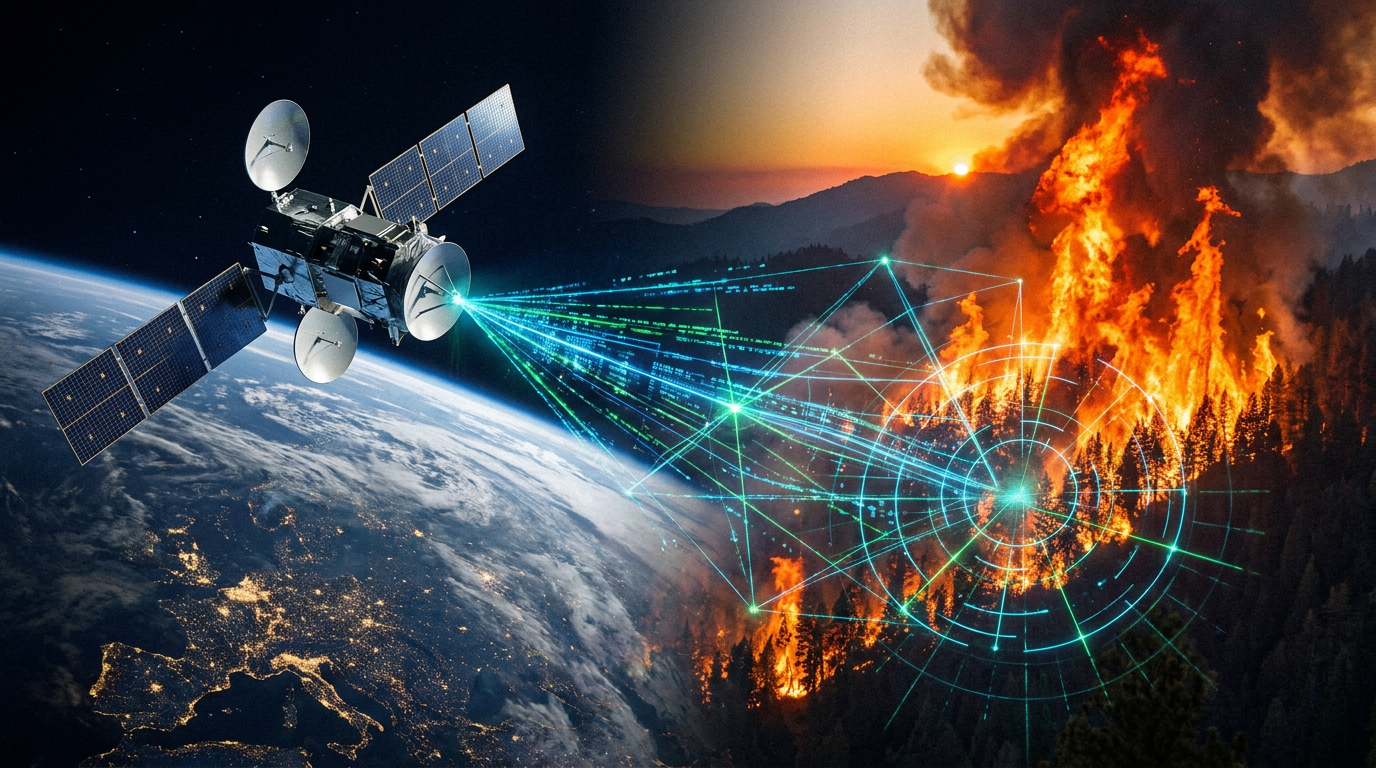
The U.S. military's orbital architecture was largely designed to detect the apocalyptic heat bloom of an intercontinental ballistic missile. Today, those same multi-billion-dollar sensors are being turned inward to fight a more immediate adversary: catastrophic wildfires.[2][8]
As climate change accelerates the frequency and intensity of natural disasters, the Department of Defense and the National Guard have quietly repurposed classified space assets for civilian environmental protection. This dual-use approach is transforming how the United States responds to ecological crises, turning combat intelligence into a life-saving public utility.[2][3]
The core of this capability lies in the sheer precision of military hardware. Defense satellites, such as the Space-Based Infrared System (SBIRS), possess infrared sensors sensitive enough to spot a missile launch from thousands of miles away. When pointed at domestic forests, these sensors can detect a campfire-sized heat anomaly before smoke is even visible to human lookouts.[2][4]
Furthermore, military Synthetic Aperture Radar (SAR) can penetrate thick cloud cover, heavy smoke, and darkness. While civilian Earth observation satellites often have data refresh times measured in days, defense constellations provide near-real-time continuous monitoring, allowing for rapid intervention during the critical early hours of a blaze.[2][8]

The primary vehicle for this intelligence sharing is the FireGuard program. Launched as a pilot following California's devastating 2017 and 2018 fire seasons, FireGuard relies on a dedicated team of 60 National Guard intelligence analysts. Operating out of specialized hubs in California and Colorado, these specialists work 12-hour shifts to monitor the entire North American continent.[1][4]
The workflow is a masterclass in interagency data laundering. Analysts pull highly classified feeds from the National Geospatial-Intelligence Agency (NGA) and the Department of Defense. They then rapidly strip away the classified metadata—obscuring the exact capabilities of the spy satellites—to generate unclassified, actionable maps for the U.S. Forest Service and local fire departments.[1][4]
The evidence of FireGuard's efficacy is substantial. Since its inception in 2019, the program has generated more than 127,000 geospatial products and location analyses, covering nearly 9,000 distinct fires across the United States. In 2023 alone, the combination of military satellites and ground-based sensors detected over 14,000 wildfires, allowing rapid-response teams to extinguish many before they expanded.[1][3]

However, the sheer volume of geospatial data is rapidly outpacing human capacity. The NGA projects that the amount of available satellite imagery will triple over the next five years. To manage this deluge, the defense sector is increasingly relying on artificial intelligence and computer vision to automate the detection process.[7][8]
However, the sheer volume of geospatial data is rapidly outpacing human capacity.
Programs like the NGA's Analytic Services Production Environment for the NSG (ASPEN) are designed to let machine learning algorithms handle the initial broad-area search. By training AI on decades of historical fire data and live sensor feeds, the system can automatically flag thermal anomalies and alert human analysts only when a high-probability threat is detected.[7]
This integration of AI has dramatically reduced the latency between ignition and detection. In California, the National Guard's collaboration with the Defense Innovation Unit (DIU) and Silicon Valley tech firms has enabled predictive modeling. The AI not only spots the fire but analyzes terrain, wind speed, and dry vegetation to forecast exactly where the blaze will move next.[4][7]
The success of the military's ad-hoc wildfire monitoring has catalyzed a new wave of purpose-built civilian technology. Because relying on classified military assets involves bureaucratic red tape and competing national security priorities, the civilian sector is now building its own equivalent constellations.[1][8]
The most prominent of these is the FireSat constellation, spearheaded by the nonprofit Earth Fire Alliance and Muon Space. Slated to launch its first operational satellites in mid-2026, FireSat is designed specifically for global wildfire detection. Once its planned network is fully deployed, it aims to sweep the entire Earth every 20 minutes, providing unprecedented spatial resolution without the classification hurdles of military hardware.[1][8]

Despite the clear humanitarian benefits, the deep integration of military intelligence networks with civilian disaster response presents complex ethical and policy challenges. Tech policy researchers refer to this dynamic as the 'humanitarian halo'—a phenomenon where defense contractors highlight the civilian benefits of their technology to obscure its primary lethal applications.[5]
For example, the same underlying data-integration and AI decision-support logic used to track wildfires and coordinate supply chains is also utilized in systems like Palantir's Maven, which the Department of Defense uses for battlefield targeting and kill-chain automation. The dual-use nature of the software means that civilian agencies are effectively beta-testing and normalizing combat architecture.[5]
Furthermore, relying on defense infrastructure for environmental monitoring introduces geopolitical vulnerabilities. Because the satellites are ultimately controlled by national security mandates, access to the data can be throttled or revoked during international crises. In 2025, the U.S. government temporarily restricted commercial satellite imagery access in conflict zones to protect operational security, highlighting the fragility of relying on military-adjacent chokepoints for humanitarian aid.[5]

To address these risks, defense policy experts are urging Congress to establish clear guardrails. Current federal acquisition regulations lack comprehensive guidelines separating the humanitarian use of AI models from their combat applications. Establishing these boundaries is critical to ensuring that civilian agencies can benefit from military-grade technology without becoming entangled in defense operations.[6]
Ultimately, the repurposing of missile-warning satellites and combat AI for climate resilience represents one of the most significant, yet underreported, peace-time dividends of the modern defense budget. As extreme weather events become the new normal, the ability to look down from low-Earth orbit and extinguish a threat before it devastates a community is a powerful testament to technological adaptability.[2][8]
How we got here
2017–2018
Devastating California fire seasons prompt the military to pilot sharing classified satellite data with civilian firefighters.
2019
The National Guard officially launches the FireGuard program to provide 24/7 unclassified fire mapping.
2023
Military and civilian sensor networks successfully detect over 14,000 wildfires across the United States.
May 2024
The Earth Fire Alliance announces the FireSat constellation, a civilian spin-off inspired by military capabilities.
Mid-2026
The first operational FireSat satellites are slated to launch, aiming for a 20-minute global refresh rate.
Viewpoints in depth
Defense & Intelligence Agencies
Maximizing the return on investment for multi-billion-dollar classified assets.
For the Department of Defense and the National Guard, turning spy satellites inward is a matter of maximizing taxpayer value and fulfilling the core mission of homeland defense. Military officials argue that it is illogical to let domestic forests burn when the government already possesses the orbital hardware capable of detecting the flames. By using AI to process this data, defense agencies are not only saving civilian lives but also stress-testing their own intelligence pipelines in real-world, high-stakes scenarios.
Civilian Forestry Officials
Grateful for the intelligence, but eager for purpose-built civilian networks.
Civilian firefighting agencies view the military's data as a game-changer that has fundamentally altered how they respond to initial ignitions. However, relying on the Department of Defense comes with friction. Classified data must be scrubbed before it can be shared, introducing delays, and military satellites can be retasked to overseas conflicts without warning. Consequently, the civilian sector is heavily invested in launching its own unclassified networks, like FireSat, to guarantee uninterrupted, purpose-built coverage.
Tech Policy Watchdogs
Concerned about the normalization of combat AI through disaster relief.
Ethics researchers and tech policy advocates warn of the 'humanitarian halo' effect. They argue that when defense contractors highlight their software's ability to track wildfires or coordinate disaster relief, they are often obscuring the fact that the exact same AI stack is used for battlefield targeting and kill-chain automation. These watchdogs are pushing Congress to establish clear acquisition guardrails, ensuring that civilian agencies can utilize life-saving technology without inadvertently normalizing or funding the expansion of autonomous warfare systems.
What we don't know
- How the Department of Defense will prioritize satellite tasking if a major domestic wildfire coincides with a sudden international military crisis.
- Whether upcoming civilian constellations like FireSat will fully replace the need for military FireGuard data, or simply supplement it.
- How future federal regulations might restrict the dual-use deployment of artificial intelligence in domestic disaster response.
Key terms
- Synthetic Aperture Radar (SAR)
- A form of radar used to create two-dimensional images or three-dimensional reconstructions of landscapes, capable of seeing through thick clouds, smoke, and darkness.
- Space-Based Infrared System (SBIRS)
- A consolidated system of U.S. military satellites designed primarily for missile warning, missile defense, and battlespace characterization.
- Dual-Use Technology
- Software or hardware that can be used for both civilian/humanitarian purposes and military/combat applications.
- Humanitarian Halo
- A concept where the civilian or life-saving applications of a technology are highlighted to obscure its lethal or surveillance-based military uses.
- Data Laundering
- In this context, the process of stripping classified metadata and sources from military intelligence so the underlying facts can be legally shared with civilian agencies.
Frequently asked
How can a missile satellite detect a forest fire?
Military satellites use highly sensitive infrared sensors designed to spot the intense heat bloom of a rocket engine. These same sensors can easily detect the thermal signature of a small fire on the ground before smoke is visible.
Does the military fight the fires directly?
Generally, no. The National Guard provides the intelligence and mapping data to civilian agencies like the U.S. Forest Service, who coordinate the actual firefighting response on the ground.
What is the FireSat constellation?
FireSat is an upcoming civilian satellite network launching in 2026, designed specifically to monitor global wildfires with a 20-minute refresh rate, reducing reliance on classified military hardware.
Why is using military AI for wildfires controversial?
Ethics watchdogs warn of a 'humanitarian halo,' where defense contractors use disaster response to test and normalize AI systems that are ultimately designed for battlefield targeting and combat operations.
Sources
Source coverage
8 outlets
3 viewpoints surfaced


[1]EsriCivilian Forestry Officials
Inside FireGuard: Military Intelligence Meets Wildfire Response
Read on Esri →[2]Just Access
Military Satellites to 'Fight' Against Climate Change
Read on Just Access →[3]National Guard BureauDefense & Intelligence Agencies
National Guard Ready for Potential Record-Breaking Wildfire, Hurricane Season
Read on National Guard Bureau →[4]Air & Space Forces MagazineDefense & Intelligence Agencies
California National Guard Using Satellites to Fight Wildfires
Read on Air & Space Forces Magazine →[5]TechPolicy.PressTech Policy Watchdogs
The 'Humanitarian Halo' When Tech Sells One Stack for Aid and War
Read on TechPolicy.Press →[6]DefenseScoopTech Policy Watchdogs
A policy gap is threatening the Pentagon's AI innovation pipeline
Read on DefenseScoop →[7]National Geospatial-Intelligence AgencyDefense & Intelligence Agencies
GEOINT Artificial Intelligence and ASPEN
Read on National Geospatial-Intelligence Agency →[8]Factlen Editorial Team
Synthesis by Factlen editorial team
Read on Factlen Editorial Team →
Every angle. Every day.
Get defense security stories with full source coverage and perspective breakdowns delivered to your inbox.