How Open-Source Intelligence is Revolutionizing Environmental Defense
Non-governmental organizations and citizen analysts are increasingly using satellite imagery, maritime tracking, and public databases to expose illegal fishing and deforestation, transforming global conservation efforts.
By Factlen Editorial Team
- OSINT Analysts & NGOs
- Argue that public data and machine learning are the most effective tools for exposing illicit supply chains and dark fleets.
- Scientific Community
- Focuses on the peer-reviewed validation of these tracking methods, emphasizing the massive scale of previously unrecorded environmental exploitation.
- International Policymakers
- Views OSINT as a critical force multiplier for under-resourced nations, though acknowledges the gap between intelligence and physical enforcement.
- Factlen Editorial Team
- Synthesizes the shift from state-controlled intelligence to democratized, open-source environmental defense.
What's not represented
- · Local law enforcement agencies
- · Commercial fishing industry representatives
Why this matters
By democratizing intelligence gathering, open-source tools empower underfunded nations and civilian organizations to actively disrupt multi-billion-dollar environmental crime syndicates, shifting conservation from reactive observation to proactive enforcement.
Key points
- Open-source intelligence (OSINT) is democratizing the ability to track and expose environmental crimes globally.
- NGOs use AI and satellite radar to locate 'dark fleets' of illegal fishing vessels that disable their public trackers.
- Terrestrial crimes like illegal logging are tracked by fusing high-frequency satellite imagery with corporate registry data.
- This intelligence-led approach allows under-resourced nations to direct enforcement precisely where crimes are occurring.
- Challenges remain, including advanced data spoofing by criminals and the reliance on commercial satellite providers.
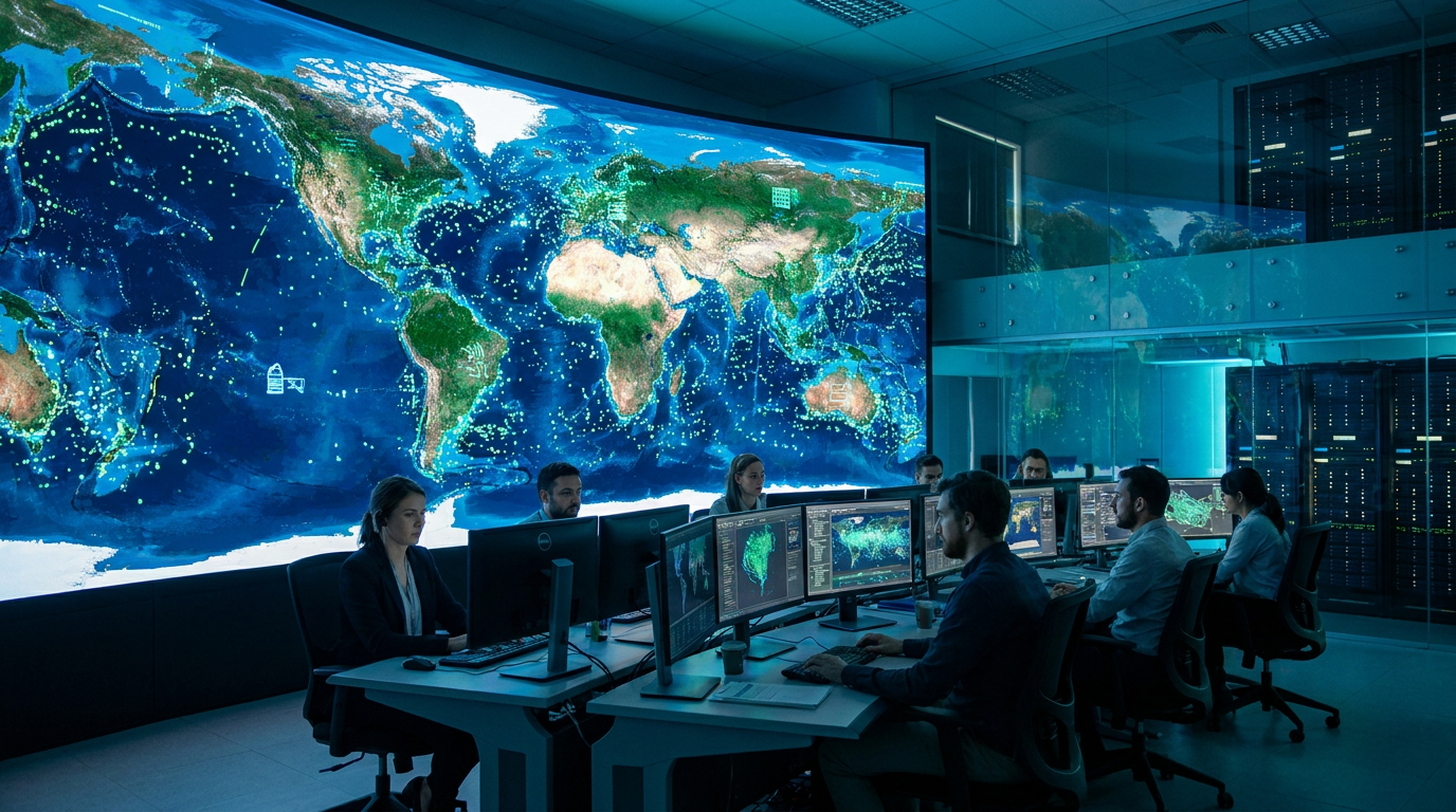
For decades, the word "intelligence" conjured images of classified dossiers, covert operatives, and multi-billion-dollar satellite networks controlled exclusively by nation-states. Today, a quiet revolution is democratizing those capabilities. Open-source intelligence (OSINT)—the collection and analysis of publicly available data—has emerged as one of the most powerful tools in global environmental defense.[6]
Driven by a proliferation of commercial satellites, public shipping registries, and advanced machine learning algorithms, non-governmental organizations and citizen analysts are now tracking environmental crimes in real-time. This shift is transforming how the world combats illegal, unreported, and unregulated (IUU) fishing, illicit logging, and wildlife trafficking.[5]
The evidence for this transformation is most visible on the high seas. Historically, the ocean's vastness provided a perfect cover for illegal fishing fleets, which cost the global economy an estimated $23 billion annually. Traditional maritime patrols could only cover a fraction of the water, leaving massive blind spots for illicit actors to exploit.[1]
Now, organizations like Global Fishing Watch use Automatic Identification System (AIS) data—originally designed for collision avoidance—to map the movements of commercial vessels worldwide. By applying artificial intelligence to billions of AIS data points, analysts can identify suspicious behaviors, such as vessels turning off their transponders near marine protected areas or lingering in patterns indicative of longline fishing.[1][3]
A landmark study published in the journal Nature demonstrated the efficacy of this approach. Researchers combined AIS data with synthetic aperture radar (SAR) imagery, which can see through clouds and darkness, to reveal "dark fleets" operating without broadcasting their locations. The study found that up to 75% of industrial fishing vessels were previously untracked by public monitoring systems.[3]

The implications for enforcement are profound. Coastal nations with limited naval resources can now use OSINT platforms to direct their coast guard vessels precisely to where illegal fishing is occurring, rather than conducting random, fuel-intensive patrols. This intelligence-led approach has led to high-profile vessel seizures and significant drops in illegal incursions in protected waters.[1][5]
Beyond the oceans, OSINT is proving equally disruptive to terrestrial environmental crimes. Illegal logging, which devastates biodiversity and accelerates climate change, relies on complex, opaque supply chains to move timber from protected forests to global markets. Unraveling these networks requires a different kind of intelligence gathering.[2]
Beyond the oceans, OSINT is proving equally disruptive to terrestrial environmental crimes.
Organizations like the Center for Advanced Defense Studies (C4ADS) treat these environmental crimes as transnational security threats. By analyzing corporate registries, customs data, and shipping manifests, OSINT analysts can map the entire illicit supply chain, identifying the shell companies and financial networks that facilitate the trade of illegal timber and wildlife.[2]
Satellite imagery plays a crucial role in this terrestrial intelligence gathering. Commercial providers offer high-resolution, high-frequency imagery that allows analysts to monitor forest canopies on a daily basis. This constant overhead watch makes it nearly impossible to hide large-scale clear-cutting operations.[4]

Bellingcat, a pioneering OSINT collective, has published extensive methodologies on how to use these satellite tools to track environmental destruction. When illegal logging roads begin to snake into protected areas, algorithms can detect the canopy changes and alert authorities before large-scale extraction occurs, shifting the paradigm from post-crime documentation to active prevention.[4]
This fusion of corporate data analysis and geospatial intelligence creates a formidable evidence pack. When NGOs present governments or international bodies with undeniable satellite proof coupled with the financial routing of the perpetrators, it becomes significantly harder for corrupt local officials to ignore the activity or claim ignorance.[2][6]

However, the application of OSINT to environmental defense is not without its limitations and uncertainties. As tracking methodologies have improved, so too have the evasion tactics of illicit actors, creating a continuous cat-and-mouse game between analysts and environmental criminals.[6]
In the maritime domain, sophisticated "spoofing" is becoming more common. Vessels can manipulate their AIS transponders to broadcast false coordinates, making it appear as though they are operating legally in one ocean while actually fishing illegally in another. Distinguishing between genuine equipment failure and intentional spoofing requires complex algorithmic analysis.[1][3]
Furthermore, the reliance on commercial satellite data introduces vulnerabilities. While imagery is more accessible than ever, high-resolution tasking still requires funding, and commercial providers could theoretically restrict access to certain regions or actors. The democratization of data is heavily dependent on the continued goodwill and affordability of the commercial space sector.[4][5]
There is also the challenge of translating intelligence into action. OSINT can pinpoint an illegal logging operation or a dark fishing fleet, but stopping the crime still requires physical enforcement by state authorities. In regions with weak governance or high corruption, even the most robust evidence pack may not lead to prosecution.[2][5]

Despite these hurdles, the trajectory is clear. The monopoly on actionable intelligence has been broken. By crowdsourcing analysis and leveraging public data, the global conservation movement has built an intelligence apparatus that rivals those of mid-sized nations.[6]
This represents a fundamental shift in environmental protection. It moves the field from reactive damage assessment to proactive disruption. As machine learning models become more adept at identifying illicit patterns in massive datasets, the window of impunity for environmental criminals is rapidly closing.[5][6]
How we got here
Early 2000s
The International Maritime Organization mandates AIS transponders for large commercial vessels to prevent collisions.
2014
Global Fishing Watch is founded to apply machine learning to public AIS data for conservation.
2023
A landmark study in Nature reveals that up to 75% of industrial fishing vessels operate off the public radar.
2026
OSINT methodologies become a standard evidentiary tool for international environmental enforcement agencies.
Viewpoints in depth
OSINT Analysts & NGOs
Argue that public data and machine learning are the most effective tools for exposing illicit supply chains.
Organizations like Bellingcat, C4ADS, and Global Fishing Watch believe that radical transparency is the ultimate antidote to environmental crime. By leveraging publicly available data—from AIS pings to corporate registries—they argue that civil society can bypass corrupt local officials and build undeniable evidence packs. Their focus is on continuous technological innovation, using AI to sift through billions of data points to find the needle in the haystack before irreversible ecological damage occurs.
Scientific Community
Focuses on the peer-reviewed validation of these tracking methods and the scale of the hidden exploitation.
Researchers publishing in journals like Nature emphasize the empirical validation of OSINT tools. They point out that traditional estimates of environmental degradation were vastly undercounted because they relied on self-reporting or limited physical patrols. By combining multiple remote sensing technologies (like SAR and optical imagery), the scientific community aims to establish an objective, undeniable baseline of global resource extraction, proving that the scale of illegal activity is much larger than previously understood.
International Policymakers
Views OSINT as a critical force multiplier, but highlights the gap between intelligence and enforcement.
Entities like the UN Environment Programme recognize OSINT as a game-changer for under-resourced coastal and forested nations. However, they caution that intelligence alone does not stop crime. Policymakers emphasize the need for capacity building—ensuring that when an NGO hands a developing nation a satellite dossier proving illegal logging, that nation has the uncorrupted judicial and physical law enforcement framework required to actually seize the assets and prosecute the perpetrators.
What we don't know
- The exact scale and sophistication of AIS spoofing currently employed by state-backed illicit fleets.
- Whether commercial satellite providers will maintain affordable access to high-resolution imagery for non-profit conservation groups long-term.
Key terms
- OSINT
- Open-Source Intelligence; actionable information derived from publicly available data.
- AIS
- Automatic Identification System; a tracking system used on ships to broadcast their location, originally designed to prevent collisions at sea.
- Dark Fleet
- Vessels that intentionally disable their public tracking transponders to engage in illegal, unreported, or unregulated activities.
- SAR
- Synthetic Aperture Radar; a form of radar used to create two-dimensional images or three-dimensional reconstructions of objects, capable of seeing through clouds and darkness.
Frequently asked
What is Open-Source Intelligence (OSINT)?
OSINT is the collection and analysis of data gathered from publicly available sources, such as commercial satellite imagery, corporate registries, and public shipping data, to produce actionable intelligence.
How do analysts find ships that turn off their trackers?
Analysts use Synthetic Aperture Radar (SAR) from satellites, which can penetrate clouds and darkness to detect the physical presence of metal vessels, cross-referencing this with public tracking data to find 'dark' ships.
Can criminals hide from satellite monitoring?
While difficult to hide physical destruction like clear-cutting, illicit actors constantly adapt by spoofing their location data or using complex networks of shell companies to obscure their financial trails.
Sources
Source coverage
6 outlets
4 viewpoints surfaced


[1]Global Fishing WatchOSINT Analysts & NGOs
Tracking the Global Footprint of Fisheries
Read on Global Fishing Watch →[2]C4ADSOSINT Analysts & NGOs
Uncovering Environmental Crime Networks
Read on C4ADS →[3]NatureScientific Community
Satellite monitoring reveals hidden industrial fishing
Read on Nature →[4]BellingcatOSINT Analysts & NGOs
Using Open Source Tools to Track Environmental Destruction
Read on Bellingcat →[5]UN Environment ProgrammeInternational Policymakers
The Role of Data and OSINT in Global Conservation
Read on UN Environment Programme →[6]Factlen Editorial TeamFactlen Editorial Team
Synthesis by Factlen editorial team
Read on Factlen Editorial Team →
Every angle. Every day.
Get defense security stories with full source coverage and perspective breakdowns delivered to your inbox.