How Commercial Satellites and Open-Source Data Are Rewriting Global Intelligence
The U.S. Intelligence Community is officially embracing open-source data and commercial satellite imagery as a core pillar of national security. This unclassified approach is democratizing intelligence, empowering NGOs to track human rights abuses and environmental crimes in real-time.
By Factlen Editorial Team
- National Security Agencies
- Focuses on leveraging commercial data for rapid sharing and cost-effective surveillance while managing the risks of adversary access.
- Human Rights & NGO Advocates
- Views OSINT as a revolutionary tool for independent verification and holding state actors accountable.
- Commercial Space Providers
- Focuses on agile innovation, rapid deployment, and pushing the government to adopt low-latency commercial networks.
- Privacy & Civil Liberties Advocates
- Raises concerns about governments bypassing traditional legal frameworks by purchasing commercial data on citizens.
What's not represented
- · Adversarial state actors whose activities are exposed by OSINT
- · Citizens whose publicly available data is aggregated into intelligence products
Why this matters
The democratization of intelligence means that tracking military movements, environmental crimes, and human rights abuses is no longer restricted to government spy agencies. Citizen analysts and NGOs now have access to the same high-resolution satellite data, making it vastly harder for state actors to hide illicit activities from the public.
Key points
- The U.S. Intelligence Community has elevated open-source intelligence to a core pillar of national security.
- Commercial satellites now provide unclassified, 35-centimeter resolution imagery with revisit rates under 90 minutes.
- Unclassified data allows for instant sharing with international allies and the public during crises.
- NGOs use this democratized data to independently verify human rights abuses and environmental crimes.
- Artificial intelligence is heavily utilized to filter petabytes of public data and prevent information overload.
- Privacy advocates warn that purchasing commercial data may allow governments to bypass traditional warrant requirements.
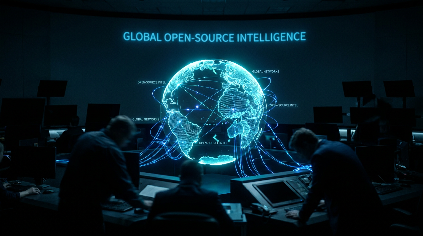
The era of intelligence being exclusively the domain of classified government satellites and clandestine operatives is ending. A new paradigm has emerged where commercially available data and open-source intelligence (OSINT) provide a transparent, unclassified window into global events. Historically, high-resolution earth observation and global communications monitoring were capabilities reserved for superpowers with multi-billion-dollar black budgets. Today, the proliferation of commercial space companies and the exponential growth of digital public records have democratized access to strategic information. This shift is fundamentally altering how governments, non-governmental organizations (NGOs), and citizen journalists observe, verify, and respond to global crises.[7][8]
OSINT encompasses any information that can be legally gathered from public or commercial sources. This includes social media broadcasts, public government records, academic research, and commercially purchased satellite imagery. The Defense Intelligence Agency now considers OSINT a unique and vital national security asset, noting that it provides foundational situational awareness and enables all other intelligence collection disciplines. By focusing on publicly available information, analysts can maintain global awareness of breaking events without risking sensitive clandestine sources or methods, making it a highly efficient baseline for modern investigations.[8]
This operational shift is officially codified in the U.S. Intelligence Community's OSINT Strategy for 2024–2026. Released by the Office of the Director of National Intelligence (ODNI) and the CIA, this framework elevates open-source data from a supplementary, background tool to the "INT of first resort." The strategy directs intelligence agencies to modernize their collection methods, standardize data sharing, and partner heavily with the private sector. It represents a formal acknowledgment that the modern threat environment—characterized by pervasive digital data and rapid technological change—has rendered traditional, closed-off collection methods insufficient on their own.[1][7]

The most visually striking and consequential component of this open-source revolution is commercial geospatial intelligence (GEOINT). Private aerospace companies now operate vast constellations of small satellites capable of delivering 35-centimeter resolution imagery. More importantly, these commercial networks boast global revisit rates of under 90 minutes, allowing analysts to observe, detect, and respond to changes on the ground in near real-time. This level of persistent observation was once the exclusive domain of highly classified military reconnaissance programs, but is now available for purchase by federal agencies, commercial customers, and research institutions.[6]
Furthermore, the deployment of commercial Synthetic Aperture Radar (SAR) satellites has eliminated one of the greatest historical hurdles to earth observation: weather. Unlike traditional optical sensors, SAR technology allows analysts to see through dense cloud cover, heavy rain, and smoke. It effectively strips away the cover of darkness, providing persistent, all-weather observation of logistics hubs, military movements, and environmental changes. This capability ensures that critical intelligence gathering is no longer paused by seasonal weather patterns or nighttime hours, offering an uninterrupted stream of verifiable data.[4]
The primary strategic advantage of commercial OSINT is its inherently unclassified nature. Highly classified government intelligence is heavily compartmentalized; sharing it with international partners requires navigating complex security protocols, which can severely delay critical decision-making during a crisis. In contrast, commercial imagery and open-source reports exist in the public domain and can be instantly shared with foreign allies, non-governmental organizations, and the global public. This friction-free sharing enables the rapid formation of international coalitions and allows governments to publicly expose adversarial actions—such as unprovoked military buildups—without compromising their own classified sources and methods.[3][6]
This democratized access has profoundly empowered NGOs, human rights advocates, and investigative journalists, allowing them to act as independent intelligence analysts. Human rights organizations have successfully utilized commercial GEOINT to uncover and track the construction of illicit detention camps, monitor forced labor facilities, and document war crimes. By comparing high-resolution images taken over time, these groups provide indisputable visual evidence that state actors can no longer easily deny or cover up, fundamentally changing the landscape of global accountability and human rights enforcement.[3][4]

This democratized access has profoundly empowered NGOs, human rights advocates, and investigative journalists, allowing them to act as independent intelligence analysts.
The application of OSINT extends far beyond military and geopolitical conflict, proving highly effective in the realm of global health and environmental protection. Researchers and organizations like the World Health Organization have increasingly utilized open-source data, including social media signals and local news reports, to detect and track infectious disease outbreaks long before official state channels acknowledge them. Similarly, environmental watchdogs use commercial satellite data to track illegal fishing fleets, monitor deforestation in the Amazon, and expose wildlife trafficking routes, turning open data into a powerful tool for planetary public good.[5][7]
However, the sheer volume of publicly available information creates a significant operational hurdle for both government agencies and civilian analysts: information overload. The Defense Intelligence Agency explicitly notes that not all public data has intelligence value, and sifting through petabytes of digital noise requires immense resources and sophisticated filtering. Without proper contextualization, the daily flood of open-source data can easily paralyze decision-makers with false positives, contradictory reports, and irrelevant information. Managing, verifying, and storing this data efficiently has become just as critical—and challenging—as the initial collection process itself.[8]
To solve the challenge of scale, the intelligence community and private sector are heavily integrating artificial intelligence and machine learning into their OSINT platforms. AI models are now routinely deployed to translate dozens of languages in real-time, automatically geolocate images based on subtle terrain features, and flag anomalous behavioral patterns across vast, disparate datasets. This automation acts as a critical force multiplier, drastically reducing the cognitive burden on human analysts. By automating the initial triage of information, AI allows investigators to focus their expertise on high-level strategic assessment and complex verification rather than manual data sorting.[7]
Despite these technological successes, evidence points to significant bureaucratic friction in the government's adoption of these commercial tools. A comprehensive report by the Government Accountability Office (GAO) found that the U.S. defense and intelligence communities maintain a slow, cumbersome approach to acquiring commercial satellite capabilities. The report warns that until these agencies streamline their procurement processes and fully embrace agile commercial innovation, the United States risks losing its technological advantage over rapidly advancing competitors who are aggressively expanding their own earth observation systems.[2][6]

The GAO investigation further highlighted that multiple defense and intelligence organizations are acquiring commercial imagery independently, without clear, centralized guidance on roles and responsibilities. This lack of coordination creates unnecessary financial overlap and limits the government's ability to maximize the utility of commercial space capabilities. Establishing unified performance goals and a cohesive acquisition strategy is essential to ensure that the intelligence community can leverage the full weight of the commercial sector without duplicating efforts or wasting taxpayer resources.[2]
Beyond bureaucratic hurdles, there is transparent uncertainty regarding the legal and ethical frameworks governing the use of commercially purchased data. Privacy advocates and legal scholars point out that purchasing commercially available data—such as aggregated mobile location data or bulk digital footprints—allows government agencies to effectively bypass traditional Fourth Amendment warrant requirements. The lack of updated legislation addressing the government's use of commercial data on its own citizens remains a highly contested gray area, creating friction between the drive for intelligence innovation and the protection of civil liberties.[7]
Furthermore, the reliance on commercial platforms introduces a unique strategic vulnerability for national security: adversaries can purchase and analyze the exact same data. While commercial GEOINT is a powerful force multiplier for the United States and its allies, defense experts warn it cannot entirely replace classified, proprietary government systems. Foreign actors can theoretically target, jam, or exploit commercial satellite constellations through cyberattacks or electronic warfare. Additionally, their equal access to the same unclassified imagery threatens to erode the competitive information edge that intelligence agencies traditionally rely upon to anticipate and counter global threats.[3]

Ultimately, the institutionalization of open-source intelligence represents a permanent, structural shift in global accountability and transparency. By fusing high-resolution commercial satellite imagery with AI-driven public data analysis, a decentralized network of governments, NGOs, and citizen journalists is forging a highly observable international environment. While significant challenges regarding data privacy, rigorous verification standards, and bureaucratic integration remain unresolved, the democratization of intelligence is a net positive for global security. It ensures that human rights abuses, environmental crimes, and covert military actions are increasingly difficult for state actors to hide from the public eye, empowering civil society with the evidence needed to demand justice.[1][3][7]
How we got here
2020
The COVID-19 pandemic accelerates government reliance on unclassified commercial data due to telework constraints.
Feb 2022
Commercial satellite imagery publicly exposes military buildups prior to the invasion of Ukraine, mainstreaming OSINT.
Sep 2022
The GAO issues a report urging the DoD and IC to streamline the acquisition of commercial satellite imagery.
Mar 2024
The ODNI releases the 2024-2026 OSINT Strategy, officially designating open-source data as a core intelligence pillar.
Viewpoints in depth
National Security Agencies
Focuses on leveraging commercial data for rapid sharing and cost-effective surveillance while managing the risks of adversary access.
Defense and intelligence agencies view OSINT as a critical baseline that frees up expensive, classified assets for harder targets. By utilizing commercial satellite imagery, they can instantly share unclassified intelligence with international allies to build coalitions during crises. However, they remain cautious about the strategic vulnerability of adversaries purchasing the exact same commercial data, emphasizing that OSINT must complement, rather than replace, classified government systems.
Human Rights & NGO Advocates
Views OSINT as a revolutionary tool for independent verification and holding state actors accountable.
For non-governmental organizations, the democratization of satellite imagery and public data is a game-changer. It allows independent researchers to bypass state censorship and verify reports of human rights abuses, illegal detention camps, and environmental crimes. This perspective argues that unclassified, publicly available evidence is essential for international legal accountability, as it provides indisputable visual proof that cannot be easily dismissed as classified government propaganda.
Privacy & Civil Liberties Advocates
Raises concerns about governments bypassing traditional legal frameworks by purchasing commercial data on citizens.
Civil liberties advocates warn that the rapid integration of commercial OSINT outpaces existing legal frameworks. They point out that intelligence and law enforcement agencies can purchase aggregated commercial data—such as mobile location histories and digital footprints—that would normally require a Fourth Amendment warrant to obtain directly. This camp advocates for stricter regulations and oversight to ensure that the government's use of commercial data does not infringe upon domestic privacy rights.
What we don't know
- How future legislation will regulate the government's purchase of commercially available data on its own citizens.
- The extent to which adversarial nations are successfully utilizing the same commercial satellite networks to track U.S. and allied movements.
Key terms
- Open-Source Intelligence (OSINT)
- Intelligence derived from publicly or commercially available information, such as social media, public records, and commercial satellite imagery.
- Geospatial Intelligence (GEOINT)
- Intelligence derived from the exploitation and analysis of imagery and geospatial information to describe, assess, and visually depict physical features on Earth.
- Synthetic Aperture Radar (SAR)
- A form of radar used to create two-dimensional images or three-dimensional reconstructions of landscapes, capable of seeing through clouds and darkness.
- Revisit Rate
- The time elapsed between observations of the same point on Earth by a satellite, crucial for tracking rapid developments.
- Information Overload
- The difficulty in understanding an issue and making decisions caused by the presence of too much data, a primary challenge in OSINT analysis.
Frequently asked
What qualifies as open-source intelligence?
OSINT includes any information legally gathered from public or commercial sources, such as social media posts, academic research, public government records, and commercially purchased satellite imagery.
Why is commercial satellite imagery considered unclassified?
Because it is collected by private companies and available for purchase by the general public, NGOs, and foreign governments, it does not carry the security classifications of data collected by proprietary military satellites.
How do non-governmental organizations use OSINT?
NGOs use OSINT to independently verify facts on the ground, such as tracking the construction of illegal detention camps, monitoring deforestation, and exposing wildlife trafficking routes using commercial satellite data.
Does the government need a warrant to buy commercial data?
Currently, this is a legal gray area. Privacy advocates argue that purchasing commercially available data allows agencies to bypass traditional Fourth Amendment warrant requirements, prompting calls for updated legislation.
Sources
Source coverage
8 outlets
4 viewpoints surfaced


[1]Office of the Director of National IntelligenceNational Security Agencies
Intelligence Community OSINT Strategy 2024-2026
Read on Office of the Director of National Intelligence →[2]Government Accountability OfficeNational Security Agencies
National Security Space: Actions Needed to Better Use Commercial Satellite Imagery and Analytics
Read on Government Accountability Office →[3]Brookings InstitutionHuman Rights & NGO Advocates
The not-so-secret value of sharing commercial geospatial and open-source information
Read on Brookings Institution →[4]Payload SpaceCommercial Space Providers
OSINT Via Satellite
Read on Payload Space →[5]National Institutes of HealthHuman Rights & NGO Advocates
Intelligence and global health: assessing the role of open source and social media intelligence analysis in infectious disease outbreaks
Read on National Institutes of Health →[6]BlackSkyCommercial Space Providers
Commercial remote sensing: the critical U.S. national security space imperative
Read on BlackSky →[7]Factlen Editorial TeamPrivacy & Civil Liberties Advocates
Synthesis by Factlen editorial team
Read on Factlen Editorial Team →[8]Defense Intelligence AgencyNational Security Agencies
Open Source Intelligence (OSINT)
Read on Defense Intelligence Agency →
Every angle. Every day.
Get defense security stories with full source coverage and perspective breakdowns delivered to your inbox.