The Democratization of Geospatial Intelligence: How Open-Source Data is Revolutionizing Crisis Response
Once the exclusive domain of military superpowers, high-resolution satellite imagery and open-source intelligence are now empowering NGOs to track environmental crimes, predict climate risks, and coordinate rapid disaster relief.
By Factlen Editorial Team
- Humanitarian & Environmental NGOs
- Focuses on leveraging accessible data to maximize impact with limited resources.
- Commercial Satellite Operators
- Focuses on expanding the market for Earth observation through technological innovation and AI integration.
- Privacy & Ethics Advocates
- Focuses on the risks of ubiquitous surveillance and the need for strict data governance.
What's not represented
- · Local communities mapped without their explicit consent
- · Underfunded municipal emergency managers lacking GIS training
Why this matters
By making the Earth's surface observable in near real-time, commercial satellites and open-source data allow civil society to hold polluters accountable and save lives during natural disasters. This fundamentally shifts the balance of global information power, placing military-grade observational tools into the hands of those protecting the planet.
Key points
- Commercial satellite constellations now provide daily, high-resolution imagery of the entire globe.
- Synthetic Aperture Radar (SAR) allows emergency responders to see through clouds and smoke during disasters.
- NGOs use geospatial data to track illegal logging, mining, and wildlife poaching in remote areas.
- AI and machine learning are required to process the massive volume of daily satellite data.
- Cost and technical capacity remain barriers for smaller grassroots organizations seeking to use these tools.
For decades, the ability to observe the Earth from space was a closely guarded superpower. During the Cold War, geospatial intelligence was the exclusive domain of national defense agencies, used primarily to count missile silos, track troop movements, and monitor geopolitical adversaries. Today, that paradigm has entirely inverted. The proliferation of commercial satellite constellations and the rise of Open-Source Intelligence have democratized the ultimate high ground, placing military-grade observational tools directly into the hands of non-governmental organizations, climate scientists, and citizen journalists.[1][8]
This shift represents one of the most significant technological empowerments of civil society in the 21st century. Commercial operators like Planet, Maxar, and SkyFi, alongside public initiatives like the European Union’s Copernicus program, are capturing the entire globe on a daily basis. The resulting continuous data stream is transforming how humanity responds to its most pressing crises, from sudden natural disasters to the slow-moving catastrophe of climate change, allowing for proactive intervention rather than merely reactive damage assessment.[2][3][6]
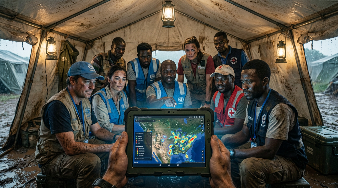
The evidence that geospatial and open-source intelligence dramatically accelerates disaster response is robust and highly visible in recent humanitarian crises. When a natural disaster strikes, the immediate barrier to saving lives is a lack of situational awareness. Ground communications often fail, power grids collapse, and roads become impassable, leaving traditional response teams guessing about where to deploy their limited resources. By utilizing overhead imagery, responders can instantly visualize the scale of the destruction and identify the most critical areas requiring immediate intervention.[3]
During the devastating 7.8 magnitude earthquake in Turkey and Syria, commercial satellite imagery and crowdsourced open-source intelligence were deployed en masse within hours of the initial shock. Platforms aggregated social media distress signals with high-resolution overhead maps to identify collapsed buildings and blocked transit routes. This fused intelligence allowed international rescue teams to bypass destroyed infrastructure and deliver heavy equipment directly to accessible staging grounds, saving critical time during the narrow window when survivors could still be pulled from the rubble.[5][8]

A major limitation of traditional optical satellites is that they cannot see through the thick clouds that accompany hurricanes, the heavy rain of monsoons, or the dense smoke that blankets widespread wildfires. To solve this critical visibility issue, disaster response agencies increasingly rely on the mechanism of Synthetic Aperture Radar (SAR) technology. This specialized equipment allows analysts to pierce through atmospheric interference, ensuring that the mapping of a disaster zone does not have to wait for the weather to clear.[3]
SAR instruments operate by emitting microwave pulses that penetrate atmospheric obstructions and bounce back to the sensor, providing 24/7, all-weather visibility of the Earth's surface. The Copernicus Emergency Management Service, for instance, utilizes Sentinel-1 SAR data to produce rapid flood maps and structural damage assessments, regardless of the weather conditions on the ground. This capability ensures that emergency managers are never flying blind, allowing them to track the expansion of floodwaters in the dead of night and coordinate evacuations accordingly.[3]
Beyond acute natural disasters, democratized intelligence serves as a vital, everyday tool for environmental protection and climate security. Organizations are actively leveraging commercial satellite data to track illegal logging operations, unregulated mining camps, and wildlife poaching in remote areas that are otherwise impossible to patrol on foot. By maintaining a persistent eye in the sky, civil society can document environmental crimes as they happen, providing undeniable visual evidence to international courts and local law enforcement agencies.[5]
Beyond acute natural disasters, democratized intelligence serves as a vital, everyday tool for environmental protection and climate security.
The evidence for this environmental application is supported by numerous successful NGO interventions around the globe. For example, The Nature Conservancy utilizes high-resolution imagery from Planet to map mangroves in the Caribbean and Papua New Guinea. By analyzing these critical 'blue carbon' ecosystems from space, the organization can pinpoint optimal sites for conservation and restoration without requiring prohibitively expensive and time-consuming ground surveys, accelerating their efforts to mitigate the impacts of global climate change.[2]

In the realm of public health, open-source intelligence can predict and track disease crises before they spiral out of control. The fusion of geospatial data with open-source digital exhaust—such as local news feeds, search engine trends, and social media posts—has created powerful early-warning systems for infectious diseases. Epidemiologists can map the geographic spread of symptoms reported online, cross-referencing this data with environmental factors like standing water or deforestation to predict where a vector-borne illness might emerge next.[4]
Studies by the National Institutes of Health highlight platforms like the Global Public Health Intelligence Network (GPHIN) and HealthMap, which automatically collect and collate public data to detect outbreaks. By applying sophisticated algorithms to filter relevant reports from the noise of the internet, these OSINT tools have successfully provided alerts on serious epidemics well before official government channels issued formal warnings, proving that open-source monitoring is a critical component of modern global health security.[4]
To process the sheer volume of data generated by modern satellite constellations, the geospatial industry has turned aggressively to Artificial Intelligence. A single commercial provider might capture millions of square kilometers of high-resolution imagery daily, a scale that is entirely beyond human capacity to analyze manually. Without automated systems to sift through the noise, the democratization of data would simply result in an overwhelming backlog of unexamined photographs, rendering the intelligence useless for rapid response scenarios.[7]
Computer vision models are now trained to establish a baseline of what 'normal' looks like for any given landscape on Earth. When a new image is captured, the artificial intelligence can instantly detect anomalies—such as a newly bulldozed road in a protected rainforest, a sudden change in sea-surface temperature, or the mass movement of displaced populations. This automated tip-and-cue system allows small, under-resourced NGO teams to monitor vast territories efficiently, focusing their human analysts only on the areas where the algorithm has flagged suspicious activity.[7][8]

Despite the unprecedented availability of data, evidence suggests a significant capacity gap remains across the humanitarian sector. A persistent challenge is the technical expertise required to process raw geospatial files and integrate them into operational workflows. While the data might be accessible, turning it into actionable insights requires specialized software and Geographic Information Systems training that many non-profits lack. This skills deficit often leads to underutilized resources, where organizations possess the imagery but cannot extract the necessary intelligence to guide their field operations.[8]
Furthermore, while public datasets like Landsat and Sentinel are free for anyone to download, the high-resolution, on-demand tasking required for precise tactical interventions remains an expensive commodity. Initiatives like Planet's dedicated NGO program aim to subsidize these costs, providing critical access to non-profits. However, severe budgetary constraints still prevent universal access for smaller grassroots organizations, meaning the most advanced intelligence tools are often still reserved for well-funded international agencies rather than the local communities directly affected by a crisis.[2][6]

Finally, the democratization of surveillance technology raises profound ethical and privacy concerns that the industry is only beginning to address. The ability to track individuals, supply chains, and infrastructure from space—combined with aggressive open-source data scraping—creates a complex dual-use dilemma. As these powerful tools become more accessible, the intelligence community and civil society must navigate the fine line between radical transparency and ubiquitous surveillance, ensuring that the power to observe the Earth is used to protect its inhabitants rather than exploit or oppress them.[5][8]
How we got here
Cold War Era
Satellite intelligence remains strictly classified and monopolized by national governments for military espionage.
2014
The European Space Agency launches the Copernicus Sentinel-1 satellite, providing free, open-access radar data to the public.
2022
Commercial operators like Planet launch dedicated NGO programs, subsidizing high-resolution imagery for environmental and humanitarian groups.
February 2023
OSINT and commercial GEOINT are deployed en masse to map the Turkey-Syria earthquake, guiding first responders to accessible routes within hours.
2025-2026
AI and machine learning become standard tools for processing the massive influx of daily satellite data, automating the detection of illegal logging and infrastructure stress.
Viewpoints in depth
Humanitarian & Environmental NGOs
Focuses on leveraging accessible data to maximize impact with limited resources.
For non-profits, the democratization of GEOINT is a force multiplier. Organizations that previously relied on anecdotal reports or expensive field expeditions can now monitor global ecosystems from a desktop. They advocate for increased subsidies from commercial providers and the development of user-friendly, no-code platforms that allow aid workers to analyze satellite data without needing a degree in data science.
Commercial Satellite Operators
Focuses on expanding the market for Earth observation through technological innovation and AI integration.
Companies operating low-Earth orbit constellations view themselves as the infrastructure layer of a transparent planet. They emphasize the massive capital costs required to launch and maintain satellites, justifying commercial pricing models for high-resolution data. However, they increasingly recognize the ESG (Environmental, Social, and Governance) value of partnering with NGOs, using these collaborations to showcase the capabilities of their AI-driven analytics platforms.
Privacy & Ethics Advocates
Focuses on the risks of ubiquitous surveillance and the need for strict data governance.
This camp warns that the same tools used to track illegal logging can be used by authoritarian regimes to monitor marginalized populations or by corporations to exploit developing markets. They argue that the OSINT community must establish rigorous ethical frameworks, ensuring that high-resolution imagery and data scraping do not violate individual privacy rights or inadvertently expose vulnerable groups to harm.
What we don't know
- How the intelligence community will regulate commercial open-source intelligence platforms in the future.
- The true error rate of AI models detecting environmental crimes in highly complex, varied terrains.
- Whether smaller NGOs will secure the sustained funding needed to maintain access to high-resolution commercial imagery.
Key terms
- Geospatial Intelligence (GEOINT)
- The analysis of imagery and geospatial information to describe, assess, and visually depict physical features and geographically referenced activities on Earth.
- Open-Source Intelligence (OSINT)
- The collection and analysis of data gathered from publicly available sources, including social media, public databases, and commercial imagery.
- Synthetic Aperture Radar (SAR)
- A form of radar that is used to create two-dimensional images or three-dimensional reconstructions of objects, capable of penetrating clouds and darkness.
- Blue Carbon Ecosystems
- Coastal and marine ecosystems, such as mangroves and seagrasses, that capture and store large quantities of carbon dioxide.
Frequently asked
Is commercial satellite imagery free for anyone to use?
While moderate-resolution data from government programs like Copernicus is free, high-resolution commercial imagery usually requires a subscription, though many providers now offer subsidized access for NGOs.
How do satellites see through clouds during a hurricane?
They use Synthetic Aperture Radar (SAR), which bounces microwave signals off the Earth's surface. Unlike optical cameras, SAR can penetrate clouds, smoke, and darkness.
Can open-source intelligence violate privacy?
Yes. The aggregation of social media data, public records, and high-resolution imagery raises ethical concerns about surveillance, prompting calls for stricter data governance in the OSINT community.
Sources
Source coverage
8 outlets
3 viewpoints surfaced


[1]Climate InsiderCommercial Satellite Operators
GEOINT for Climate Security: Mapping Our Shared Future
Read on Climate Insider →[2]Geospatial WorldHumanitarian & Environmental NGOs
Planet launches program to provide satellite imagery to NGOs
Read on Geospatial World →[3]E2mC ProjectHumanitarian & Environmental NGOs
Top Platforms for Crisis Monitoring: From Copernicus to Open-Source Intelligence Tools
Read on E2mC Project →[4]National Institutes of HealthHumanitarian & Environmental NGOs
Open Source Intelligence (OSINT) and Signals Intelligence (SIGINT) in infectious disease outbreaks
Read on National Institutes of Health →[5]ShadowDragonPrivacy & Ethics Advocates
Using OSINT defensively, legally, and ethically
Read on ShadowDragon →[6]SkyFiCommercial Satellite Operators
Applications of Commercial Satellite Imagery
Read on SkyFi →[7]General Dynamics Information TechnologyCommercial Satellite Operators
AI/ML and Geospatial Intelligence in Climate Change
Read on General Dynamics Information Technology →[8]Factlen Editorial TeamPrivacy & Ethics Advocates
Synthesis by Factlen editorial team
Read on Factlen Editorial Team →
Every angle. Every day.
Get defense security stories with full source coverage and perspective breakdowns delivered to your inbox.