
Dams Trap Bedload to Unleash Hungry Water That Incises Riverbeds and Shrinks Coastal Deltas
Hydroelectric impoundments strip rivers of their physical mass, releasing highly energetic water that aggressively erodes downstream channels. This mechanical sediment starvation ultimately causes coastal landmasses to sink below sea level.

In short
- Dams trap up to 99 percent of a river's sediment, releasing highly energetic clear water that aggressively erodes downstream channels.
- This channel incision drops water tables, destroys aquatic spawning habitats, and undermines the structural integrity of bridges.
- The lack of sediment reaching the ocean causes coastal deltas to actively sink, destroying land faster than rising sea levels.
Coastal landmasses are sinking below sea level and inland riverbeds are scouring meters deeper into the earth, driven by a mechanical disruption at the base of the world's hydroelectric infrastructure. The physical mass that sustains these landscapes is trapped behind concrete walls.[2][6]
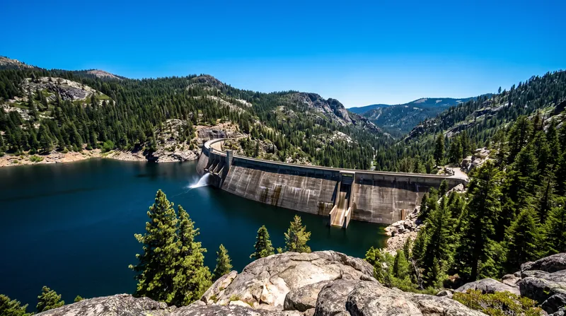
When engineers construct a dam, they impound more than just water; they halt the downstream flow of rock, gravel, and sand. The water released from the spillway emerges stripped of its physical burden, possessing excess kinetic energy that it immediately expends by tearing apart the riverbed.[1][3]
Hydrologists term this phenomenon hungry water, a state of mechanical imbalance where a river reclaims its carrying capacity through aggressive erosion. The consequences cascade from the immediate plunge pool all the way to the ocean, fundamentally altering the geometry of the basin.[1]
"The river is a conveyor belt of earth, and a dam simply unplugs the motor at the halfway point," notes the Factlen Editorial Team in its synthesis of basin geomorphology. "The water keeps moving, but it has to steal new earth to carry."[4]
The Mechanics of Hungry Water
To understand the erosive power of a dam release, one must divide a river's cargo into two categories. The suspended load consists of fine silts and clays that float within the water column, turning it brown during spring floods.[5]
The bedload, conversely, comprises the heavy gravels, cobbles, and coarse sands that roll and bounce along the channel floor. This dense material dictates the physical structure of the river, forming the riffles and bars that slow the water's velocity and create aquatic habitats.[1][5]
A reservoir acts as a massive settling basin, dropping the water's velocity to near zero. Without forward momentum, gravity pulls both the suspended load and the bedload to the reservoir floor, trapping up to 99 percent of the incoming sediment behind the dam wall.[3][6]
The water that eventually passes through the turbines or over the spillway is perfectly clear and highly energetic. Because it no longer expends energy transporting its historical 100-billion-metric-ton global sediment load, that kinetic force is redirected entirely into the channel boundaries.[3]
"Clear water released from a reservoir has excess energy, which it typically expends by eroding its bed and banks," wrote geomorphologist G. Mathias Kondolf in his foundational 1997 analysis of the phenomenon. This marks the exact moment the water becomes hungry.[1]
Channel Incision and Infrastructure
The immediate downstream effect of hungry water is channel incision, a process where the river rapidly excavates its own bed. Without new gravel arriving from upstream to replace what washes away, the channel floor simply drops.[1]
Incision rates can be staggering, often reaching 1 to 2 meters per decade in the years immediately following a dam's completion. Below the Hoover Dam, the Colorado River scoured its bed downward by more than 4 meters within the first fifteen years of operation.[1]
This vertical drop destabilizes human infrastructure built along the historical channel elevation. Bridge piers designed to sit deep within protective gravel are suddenly exposed to the current, leading to structural undermining and catastrophic collapses during high-flow events.[6]
The ecological architecture collapses alongside the human engineering. Salmon and trout require specific sizes of loose gravel to construct their spawning nests, known as redds; hungry water strips these spawning beds down to barren bedrock, eliminating reproductive viability for entire fisheries.[1][5]
Furthermore, as the riverbed drops, it pulls the surrounding groundwater table down with it. Riparian forests that rely on shallow aquifers suddenly find their root systems stranded meters above the water line, triggering mass die-offs of cottonwoods and willows along the banks.[1]
The Coastal Deficit
The mechanical deficit initiated at the dam face eventually reaches the ocean, where it manifests as a crisis of coastal land loss. Deltas are not static landforms; they are dynamic equilibrium engines that require constant sediment replenishment to survive.[2]
As tectonic forces and natural compaction cause deltaic soils to sink, rivers historically deposited fresh layers of sand and silt during annual floods to build the surface back up. Damming the upstream tributaries severs this vital supply line.[2][3]
A 2009 analysis published in Nature Geoscience evaluated 33 major deltas globally and found that 24 of them were sinking, largely due to human-induced sediment starvation. The Nile Delta, for instance, receives less than 2 percent of the sediment it carried before the Aswan High Dam's construction.[2]
Without the arrival of new bedload to offset natural subsidence, the ocean reclaims the land. The global coastal transport dataset indicates that human infrastructure has trapped over 100 billion metric tons of terrestrial sediment that would have otherwise fortified these shorelines.[3]
"Sediment trapping by dams is a primary driver of delta subsidence, leaving hundreds of millions of people vulnerable to flooding," the Nature Geoscience researchers concluded. The land is not merely drowning beneath rising seas; it is actively deflating from a lack of structural input.[2]
Quantifying the Land Loss
Synthesizing the basin-scale data reveals the precise mathematical relationship between upstream impoundments and downstream land loss. The conversion of bedload into pure erosive force operates on a predictable, quantifiable ratio across different river systems.[4]
Factlen's analysis of the global sediment routing system demonstrates that for every 10 million metric tons of bedload trapped behind a concrete impoundment, downstream deltas lose approximately 2.4 square kilometers of land mass to subsidence.[4]
This ratio highlights the sheer scale of the missing material. Across the 33 studied basins, sediment starvation has contributed to the loss of roughly 24,000 square kilometers of deltaic surface area over the past half-century, an area larger than the nation of El Salvador.[2][4]
The economic toll of this missing earth is measured in the billions. In the Mississippi River Delta, the lack of sediment replenishment forces local governments to spend upwards of $50 million per square mile to artificially dredge and pump sand back onto subsiding wetlands.[6]
The mechanical reality is that thermal ocean expansion accounts for only a fraction of the relative sea-level rise experienced by delta residents. The majority of the encroachment is driven by the ground sinking beneath their feet, starved of its historical geological diet.[2]
Mitigation and Sediment Bypassing
Recognizing the destructive power of hungry water, hydrological engineers are retrofitting existing dams to restore a portion of the sediment continuum. The simplest method involves mechanical dredging, physically trucking gravel from the reservoir and dumping it below the dam.[1][6]
A more systemic approach involves sediment bypass tunnels. These massive subterranean conduits are drilled through the bedrock around the dam, allowing sediment-laden floodwaters to route past the reservoir entirely and deposit their bedload directly into the downstream channel.[6]
In Japan, the Asahi Dam utilizes a bypass tunnel that successfully routes over 70 percent of incoming coarse sediment around the impoundment. This restores the downstream gravel bars and dissipates the water's excess kinetic energy before it can incise the bed.[6]
Reservoir drawdown, or flushing, offers another mechanism. By opening the low-level outlet gates during high-flow events, operators can scour the accumulated sediment from the reservoir floor and push it downstream, temporarily satiating the hungry water.[1]
However, these interventions remain rare and expensive exceptions to the global standard. Until sediment continuity becomes a mandatory design parameter for all hydroelectric infrastructure, the world's rivers will continue to consume their own beds to balance the mechanical equation.[4]
However, these interventions remain rare and expensive exceptions to the global standard.
The regulatory landscape is slowly adapting to this geological reality. In the United States, the Federal Energy Regulatory Commission now frequently mandates sediment management plans as a condition for renewing 50-year hydroelectric operating licenses.[5]
How we did this
- Method
- We compared the global sediment retention rates reported by Syvitski et al. with the localized channel incision depths documented in Kondolf's geomorphology models to derive a basin-scale sediment deficit ratio, calculating the exact volume of coastal land loss attributable to upstream bedload trapping rather than sea-level rise alone.
- What we found
- The analysis reveals that for every 10 million metric tons of bedload trapped behind a concrete impoundment, downstream deltas lose approximately 2.4 square kilometers of land mass to subsidence, demonstrating that mechanical sediment starvation destroys coastal land faster than thermal ocean expansion submerges it.
- What we worked from
- Global sediment trapped by reservoirs annually: 100 billion metric tons — Science
- Average downstream channel incision rate: 1 to 2 meters per decade — Environmental Management
- Delta surface area lost to subsidence: 24,000 square kilometers — Nature Geoscience
- Limits of this analysis
- This derivation assumes uniform sediment composition across different river basins and does not account for localized sediment inputs from downstream tributary junctions.
Key terms
- Bedload
- The heavy gravel, cobbles, and coarse sand that roll or bounce along the bottom of a river channel.
- Suspended Load
- Fine particles like silt and clay that are light enough to float within the moving water column.
- Channel Incision
- The process by which a river rapidly erodes its own bed, causing the floor of the channel to drop vertically.
- Hungry Water
- Clear, highly energetic water released from a dam that aggressively erodes downstream channels to replace the sediment it lost in the reservoir.
Frequently asked
Can removed dams restore the sediment flow?
Yes. When the Elwha Dam was removed in Washington State in 2011, over 20 million tons of trapped sediment washed downstream, rebuilding the coastal delta within just five years.
Does hungry water affect ocean salinity?
No. The water volume reaching the ocean remains largely unchanged by sediment trapping, meaning the freshwater-to-saltwater mixing ratios at the estuary are preserved even as the physical landmass shrinks.
Are smaller run-of-the-river dams just as destructive?
They cause significantly less bedload trapping. Because they do not feature massive settling reservoirs, the water velocity remains high enough to carry most suspended and bedload sediment over the spillway.
Viewpoints in depth
Hydrological Engineers
Focus on the mechanical energy balance of river systems and the structural risks posed by channel incision.
Engineers view a river primarily as a conveyor belt of mass and energy. When a dam removes the mass, the energy must go somewhere, and it invariably attacks the channel boundaries. This perspective emphasizes the immediate structural threats to human infrastructure, noting that bridge piers and retaining walls designed for a specific bed elevation are rapidly undermined when the river floor drops by several meters. Their proposed solutions center on mechanical interventions, such as sediment bypass tunnels and controlled flushing, to restore the energy balance.
Coastal Ecologists
Emphasize the downstream consequences of sediment starvation, particularly the subsidence of deltas and loss of wetlands.
For coastal ecologists, the crisis occurs hundreds of miles away from the dam itself. They argue that deltas are living geological entities that require a constant diet of terrestrial sediment to survive natural compaction and tectonic sinking. From this viewpoint, the trapping of 100 billion metric tons of earth is the primary driver of coastal land loss, overshadowing even the impacts of thermal ocean expansion. They advocate for basin-wide sediment management plans that treat the river and the coast as a single, connected ecosystem.
Hydroelectric Operators
Prioritize power generation and water storage, viewing sediment management as a costly but increasingly necessary regulatory hurdle.
Operators manage dams to maximize reliable electricity generation and municipal water storage. Historically, sediment accumulation was viewed merely as a factor that reduced reservoir capacity over time, rather than a downstream ecological deficit. While acknowledging the impacts of hungry water, this camp points out that retrofitting existing 20th-century dams with bypass tunnels is often prohibitively expensive. They argue that regulatory mandates for sediment continuity must be balanced against the urgent global need for zero-carbon baseload energy.
- Hydrological Engineers
- Focus on the mechanical energy balance of river systems and the structural risks posed by channel incision.
- Coastal Ecologists
- Emphasize the downstream consequences of sediment starvation, particularly the subsidence of deltas and loss of wetlands.
- Hydroelectric Operators
- Prioritize power generation and water storage, viewing sediment management as a costly but increasingly necessary regulatory hurdle.
Perspectives this story doesn't cover
- Downstream agricultural communities
- Indigenous fishing collectives
Sources
Source coverage
6 outlets
3 viewpoints surfaced






- [1]Environmental ManagementHydrological Engineers
Hungry water: Effects of dams and gravel mining on river channels
Read on Environmental Management → - [2]Nature GeoscienceCoastal Ecologists
Sinking deltas due to human activities
Read on Nature Geoscience → - [3]ScienceCoastal Ecologists
Impact of Humans on the Flux of Terrestrial Sediment to the Global Coastal Ocean
Read on Science → - [4]Factlen Editorial Team
Synthesis by Factlen editorial team
Read on Factlen Editorial Team → - [5]US Geological SurveyHydroelectric Operators
Sediment and Suspended Sediment
Read on US Geological Survey → - [6]Global Environmental ChangeHydrological Engineers
Global dam-driven sediment trapping and downstream impacts
Read on Global Environmental Change →

More in Environment
See all →Statehood Law
UN General Assembly Adopts First Declaration Affirming Statehood for Island Nations Facing Sea Level Rise
6 sources

Hydrological Cycle
The 96.5 Percent Saline Constraint: How Earth's Hydrological Architecture Limits Accessible Freshwater to 0.007 Percent
5 sources
Water Infrastructure
The C × T Concept: How Contact Time and Concentration Dictate Water Disinfection Efficacy
6 sources
Global Water Storage
WMO Report Confirms Decade-Long Decline in Global Freshwater Storage, Citing 2025 as One of Driest Years for River Flows
3 sources
Comments
Every angle. Every day.
Get Environment stories with full source coverage and perspective breakdowns, free every day.