How Lasers Are Revealing a Vast, Hidden History Beneath the Jungle Canopy
Airborne LiDAR technology is stripping away dense rainforest foliage to reveal that the ancient Americas were home to massive, interconnected urban centers.
By Factlen Editorial Team
- Remote Sensing Advocates
- Argue that LiDAR is the greatest advance in archaeology in a century, capable of mapping entire regional networks and definitively proving high-density urbanism.
- Traditional Excavators
- Emphasize that while LiDAR shows where to look, only painstaking ground excavation can confirm when a site was occupied and who lived there.
- Decolonial Historians
- Push back on the media narrative of 'lost cities,' pointing out that Indigenous populations and early fieldworkers have long known about these settlements.
What's not represented
- · Local Indigenous Communities living near the sites
- · Ecologists studying the long-term environmental impact of ancient urbanism
Why this matters
For decades, history books taught that the Amazon and dense Mesoamerican jungles were too hostile to support massive, complex civilizations. LiDAR technology is rewriting that fundamental understanding of human history, proving that the ancient Americas were home to sprawling, heavily engineered urban networks.
Key points
- Airborne LiDAR technology uses laser pulses to digitally strip away dense jungle canopies and reveal the bare earth below.
- Recent scans in the Ecuadorian Amazon uncovered a 2,500-year-old network of cities connected by 33-foot-wide roads.
- In Guatemala, LiDAR revealed over 61,000 previously unknown Maya structures, drastically increasing historical population estimates.
- The discoveries prove that the ancient Americas were home to massive, interconnected urban centers, not just sparse nomadic tribes.
- While LiDAR provides unprecedented maps, traditional ground excavation is still required to date the structures and understand their history.
For centuries, the prevailing historical narrative painted the Amazon basin and the dense jungles of Mesoamerica as pristine, sparsely populated wildernesses. Traditional textbooks suggested that the highly acidic soil and thick, unforgiving canopy of the rainforest could only support small, nomadic tribes. According to this long-held view, these environments were fundamentally incapable of sustaining the massive agricultural surpluses and architectural feats seen in ancient Rome, Greece, or China.[8]
That narrative is currently undergoing one of the most rapid and profound rewrites in the history of archaeology. Across the Americas, researchers are realizing that the jungle is not an untouched wilderness, but rather an overgrown garden. Beneath the dense green canopy lies undeniable evidence of sprawling, interconnected urban landscapes that rivaled the population densities and engineering complexity of classical Europe.[8]
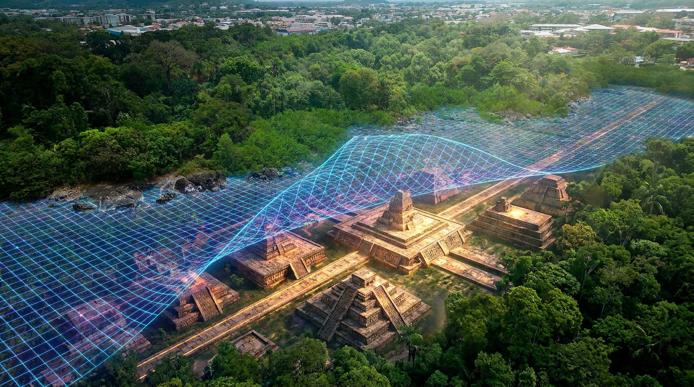
The catalyst for this paradigm shift is not a new type of trowel or excavation technique, but a remote-sensing technology called LiDAR, which stands for Light Detection and Ranging. Originally developed for aerospace, meteorology, and autonomous navigation, LiDAR has unexpectedly become the ultimate archaeological X-ray, allowing researchers to peer through millions of leaves and branches to see the bare earth below.[4][7]
The mechanism behind this mapping revolution is elegantly simple in concept but computationally massive in execution. An aircraft equipped with a LiDAR scanner flies over a target region, firing hundreds of thousands of laser pulses per second directly toward the ground. While the vast majority of the light bounces off the dense forest canopy, a tiny fraction of the pulses slip through the microscopic gaps in the leaves and reflect off the forest floor.[5][7]

By measuring the exact microsecond it takes for those specific ground-level pulses to return to the sensor, computers can digitally strip away the vegetation. What remains is a high-resolution, three-dimensional topographical map of the bare ground. Mounds, causeways, defensive walls, and agricultural terraces that are completely invisible to a person standing just ten feet away suddenly emerge in stark, geometric clarity on a digital monitor.[5]
The sheer scale of what this technology is uncovering is staggering. In early 2024, a landmark paper published in the journal Science detailed the mapping of the Upano Valley in the Ecuadorian Amazon. Archaeologist Stéphen Rostain and his team revealed a 2,500-year-old network of settlements that completely upended expectations of Amazonian history and urban development.[1][3]
The Upano scans exposed more than 6,000 rectangular earthen platforms arranged carefully around central plazas. Connecting these distinct neighborhoods was a highly organized grid of remarkably straight roads, some measuring up to 33 feet wide and stretching for over a dozen miles across the landscape. The infrastructure points to a highly complex society that managed vast agricultural terraces and sophisticated drainage canals to control the heavy rainfall.[1][3]
The Upano scans exposed more than 6,000 rectangular earthen platforms arranged carefully around central plazas.
Researchers estimate that the Upano Valley complex was home to at least 10,000 people, and perhaps up to 30,000 at its peak between 500 BCE and 600 CE. To put that density in perspective, the population of this Amazonian network was roughly comparable to that of London during the height of the Roman Empire, challenging the idea that large-scale urbanism was exclusive to Eurasia.[3]

Further north, in the Maya Biosphere Reserve of Guatemala, LiDAR has triggered a similar historical earthquake. A massive survey covering 830 square miles identified more than 61,000 previously unknown Maya structures. The data definitively proved that Maya cities were not isolated, self-sustaining city-states, but were heavily interconnected by elevated highways, massive defensive fortifications, and shared water management systems.[4]
This sheer volume of newly discovered infrastructure has forced historians to drastically revise their population estimates for the Maya classical period, which spanned from roughly 250 to 900 CE. Where previous demographic models suggested a regional population of around 5 million, the LiDAR data indicates that between 10 and 15 million people lived in the region, heavily modifying their landscape with reservoirs and irrigation channels to survive.[4]

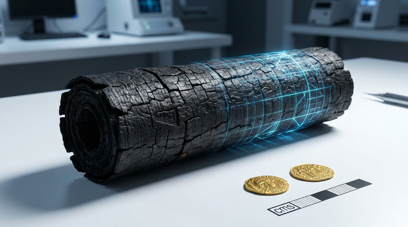
The technology has become so potent that massive discoveries are now happening entirely by accident. In late 2024, a doctoral student re-analyzed an old LiDAR dataset originally commissioned by a conservation group to monitor forest carbon levels in Campeche, Mexico. Hidden within that ecological data was a massive, previously unrecorded Maya city, complete with pyramids and plazas, which researchers named Valeriana.[2][5]
However, the rapid pace of these discoveries has sparked intense debate within the archaeological community about how the findings are framed to the public. Media reports frequently rely on the cinematic trope of "lost cities" being suddenly "discovered" by lasers. Critics point out that this framing often erases the deep knowledge of local Indigenous communities and the decades of grueling groundwork done by early archaeologists.[6]
In many cases, including the Upano Valley, researchers had known about the earthen mounds for decades through traditional foot surveys and local guidance. What LiDAR provided was not the initial discovery of human presence, but the macro-level context—revealing how individual mounds connected into a vast, regional urban system that was simply impossible to comprehend from the ground level.[3][6]

Furthermore, traditional excavators caution that a laser map is only a starting point, not a conclusion. LiDAR can definitively prove that a massive structure was built, but it cannot tell researchers when it was constructed, how long it was occupied, or why it was eventually abandoned. Only painstaking physical excavation—digging trenches, analyzing pottery shards, and carbon-dating organic material—can fill in the historical timeline.[2][5]
Despite these necessary caveats, the integration of LiDAR into archaeology marks a permanent, irreversible shift in how humanity understands its own past. The digital maps being generated today prove beyond a doubt that the ancient Americas were crowded, heavily engineered, and deeply interconnected. As more datasets are analyzed, the question is no longer whether the jungle hides ancient cities, but whether there is any truly "empty" space left to find.[8]
How we got here
250–900 CE
The Maya classical period, during which millions of people inhabit heavily engineered, interconnected cities in Mesoamerica.
Late 1990s
Archaeologists conducting foot surveys in the Upano Valley first identify the presence of ancient earthen mounds, though the scale remains unknown.
2018
A massive LiDAR survey in Guatemala reveals over 61,000 previously unknown Maya structures, drastically altering population estimates.
January 2024
Researchers publish LiDAR data revealing a 2,500-year-old network of cities and roads in the Ecuadorian Amazon.
October 2024
A doctoral student discovers the massive ancient city of Valeriana by re-analyzing old LiDAR data originally collected for forest monitoring.
Viewpoints in depth
Remote Sensing Advocates
Focus on the unprecedented scale and speed of discovery enabled by laser mapping.
For proponents of remote sensing, LiDAR is nothing short of a revolution. They point out that a single aircraft can map more terrain in a weekend than a team of archaeologists could survey in a lifetime of hacking through the jungle with machetes. By providing a macro-level view of causeways, defensive walls, and agricultural terraces, LiDAR allows researchers to see the 'big picture' of ancient urban planning, proving that these civilizations were highly interconnected and densely populated.
Traditional Excavators
Caution that maps must be paired with physical digging to establish a timeline.
Field archaeologists acknowledge the power of LiDAR but warn against treating a topographical map as a complete historical record. A laser scan flattens time; it shows every structure ever built in a region, even if they were occupied centuries apart. To understand the rise and fall of these cities, researchers argue they still must dig trenches, analyze pottery, and carbon-date organic remains. Without ground-truthing, a map of mounds is just geometry, not history.
Decolonial Historians
Critique the sensationalized framing of 'discovering' empty, lost cities.
Scholars focused on the history of archaeology frequently criticize how LiDAR findings are presented to the public. The trope of the 'lost city' implies that these regions were completely forgotten, ignoring the fact that local Indigenous communities often live among these ruins and know of their existence. Furthermore, framing the jungle as 'empty' prior to laser scanning erases the decades of difficult, unglamorous foot surveys conducted by early researchers who first identified these earthen mounds.
What we don't know
- How many more ancient cities remain hidden in the millions of square miles of unmapped Amazonian and Mesoamerican rainforest.
- The exact reasons why these massive, highly organized urban centers were eventually abandoned by their populations.
- Whether the agricultural techniques used by these ancient dense populations could offer sustainable farming solutions for modern tropical environments.
Key terms
- LiDAR
- A remote sensing technology that uses rapid laser pulses to map the surface of the earth, capable of digitally removing vegetation to reveal the ground below.
- Pre-Columbian
- The history and cultures of the Americas before the arrival of Christopher Columbus and European colonizers in 1492.
- Earthen Mound
- A large, artificially constructed hill of dirt and stone used by ancient cultures as a foundation for homes, temples, or ceremonial plazas.
- Ground-truthing
- The process of physically verifying data gathered by remote sensing through direct observation and excavation at the actual site.
Frequently asked
What does LiDAR stand for?
LiDAR stands for Light Detection and Ranging. It is a remote sensing method that uses pulsed lasers to measure variable distances to the Earth.
Does LiDAR damage the rainforest?
No. LiDAR is completely non-invasive. The lasers reflect off the canopy and the ground without causing any physical harm to the trees, wildlife, or the archaeological sites below.
How old are the cities found in the Upano Valley?
The settlements in the Upano Valley of Ecuador were occupied between roughly 500 BCE and 600 CE, making them around 2,500 years old.
Why couldn't archaeologists see these cities before?
The dense vegetation of the Amazon and Mesoamerican jungles completely obscures large-scale topography. While researchers could find individual mounds on foot, they could not see how the structures connected into massive urban grids.
Sources
Source coverage
8 outlets
3 viewpoints surfaced


[1]ScienceTraditional Excavators
Two thousand years of garden urbanism in the Upper Amazon
Read on Science →[2]AntiquityTraditional Excavators
Running out of empty space: environmental lidar and the crowded ancient landscape of Campeche, Mexico
Read on Antiquity →[3]The GuardianTraditional Excavators
Valley of lost cities that flourished 2000 years ago found in Amazon
Read on The Guardian →[4]Smithsonian MagazineRemote Sensing Advocates
Laser Scans Reveal 60,000 Hidden Maya Structures in Guatemala
Read on Smithsonian Magazine →[5]Space DailyRemote Sensing Advocates
A lost Maya city surfaced almost by chance inside old lidar data
Read on Space Daily →Lidar and Lost Cities: Examining the Public Presentation of Recent Lidar Findings through News Media
Read on Advances in Archaeological Practice →[7]CBC RadioRemote Sensing Advocates
Deep in the Amazon, researchers have uncovered a complex of ancient cities — using laser technology
Read on CBC Radio →[8]Factlen Editorial TeamDecolonial Historians
Synthesis by Factlen editorial team
Read on Factlen Editorial Team →


Every angle. Every day.
Get culture stories with full source coverage and perspective breakdowns delivered to your inbox.