How Commercial Satellites and OSINT Are Democratizing Global Security
The monopoly on orbital surveillance has ended, empowering NGOs, journalists, and citizens to use commercial satellite imagery to hold states and corporations accountable.
By Factlen Editorial Team

- Civil Society & NGOs
- Argues that open-source intelligence is a vital democratizing tool for holding powerful actors accountable and verifying environmental compliance.
- State Intelligence & Defense
- Values the supplementary capabilities of commercial imagery but worries about operational security and symmetric vulnerability.
- Multilateral Institutions
- Focuses on the practical application of remote sensing for peacekeeping, ceasefire monitoring, and objective treaty verification.
What's not represented
- · Privacy Advocates concerned about persistent civilian surveillance
- · Global South nations lacking domestic satellite infrastructure
Why this matters
By breaking the state monopoly on intelligence, open-source satellite data allows independent watchdogs to verify geopolitical claims, track environmental destruction, and expose human rights abuses with irrefutable visual evidence.
Key points
- Commercial satellite imagery has broken the state monopoly on geospatial intelligence, making high-resolution orbital data accessible to the public.
- Small open-source intelligence (OSINT) cells can generate up to 90 percent of the analytic value of classified collections at a fraction of the cost.
- NGOs and citizen analysts use this data to verify geopolitical claims, track environmental abuses, and monitor nuclear proliferation.
- The democratization of surveillance creates 'symmetric vulnerability,' meaning adversaries can also access imagery to track allied military or humanitarian movements.
For decades, the ability to peer down from orbit and read the movements of nations was a superpower reserved exclusively for the world's wealthiest governments. If a state wanted high-resolution pictures of a foreign adversary's nuclear facility or troop movements, it required a multi-billion-dollar space program, a security clearance, and a three-letter agency. The evidentiary record of global security was entirely classified, leaving the public to rely on the curated statements of defense officials.
Today, that monopoly has evaporated. The proliferation of commercial satellite constellations and the democratization of cloud computing have ushered in a golden age of Open-Source Intelligence (OSINT). Anyone with a laptop and a modest subscription fee can now access sub-meter resolution imagery of almost any location on Earth, fundamentally altering the balance of information power and creating a new baseline for global transparency.
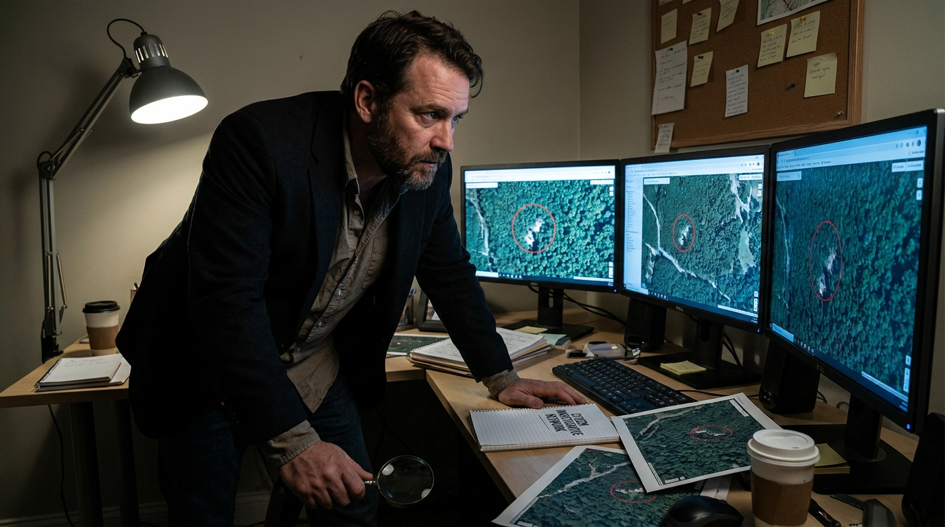
This shift is empowering a new class of non-state actors. Nongovernmental organizations (NGOs), investigative journalists, and citizen analysts are leveraging commercial geospatial intelligence (GEOINT) to hold both corporations and rogue states accountable. The "God's eye view" is no longer classified; it is crowdsourced, allowing civil society to verify claims with hard, visual evidence.
The evidence of this transformation is most visible in the realm of global security and conflict monitoring. According to comprehensive analyses by the Center for Strategic and International Studies (CSIS), the intelligence landscape has been permanently altered by the fact that commercial platforms now provide information once exclusive to advanced state intelligence services. This shift narrows the capability gap between well-resourced nation-states and independent researchers.[1]
Prior to the 2022 Russian invasion of Ukraine, the Kremlin's military buildup was not just tracked by classified U.S. satellites, but by independent researchers using commercial imagery from companies like Maxar and Planet Labs. This public, verifiable evidence robbed the invading force of strategic surprise and allowed the international community to counter state-sponsored disinformation in real-time, a feat pioneered by investigative groups like Bellingcat.[1][6]
The cost asymmetry of this new paradigm heavily favors the public. The U.S. intelligence enterprise operates with an appropriated budget exceeding $101 billion for fiscal year 2025. Yet, research from the RAND Corporation indicates that small, independent OSINT cells can generate 70 to 90 percent of the analytic value of classified collection while operating at roughly two percent of the cost of a comparable government program.[2]

This democratization extends far beyond traditional warfare. Environmental organizations are increasingly utilizing satellite data to enforce corporate accountability. Global Witness, for instance, has successfully combined satellite imagery, animal transit records, and customs data to expose illegal deforestation in the Amazon, linking major beef conglomerates to environmental degradation with irrefutable visual evidence that regulators can no longer ignore.[5]
This democratization extends far beyond traditional warfare.
Similarly, the Stanley Center for Peace and Security highlights how commercial imagery forms a crucial foundation for fact-checking claims about nuclear proliferation. Independent analysts have used daily satellite passes to create 3-D maps of underground nuclear testing sites in North Korea and to monitor civilian nuclear energy facilities in Iran, bypassing the need for declassified scraps from government agencies.[4]
The United Nations Institute for Disarmament Research (UNIDIR) has also documented the utility of these tools in humanitarian contexts. Satellite imagery is now routinely used for remote ceasefire monitoring in non-permissive environments, identifying illicit arms movements, and tracking the construction of unauthorized infrastructure in conflict zones where deploying human observers is too dangerous.[3]

The mechanism behind this transparency relies on a convergence of three technologies: the sheer volume of commercial satellites in orbit, the infinite scalability of unclassified cloud computing, and the application of machine learning algorithms. Companies are now launching satellites every few months rather than every decade, providing persistent, near-daily global coverage that makes hiding large-scale activities nearly impossible.[1]
When combined with artificial intelligence, this massive data stream becomes actionable. Machine learning models can automatically detect changes in terrain, count aircraft on a runway, or identify the sudden appearance of military vehicles, alerting human analysts to anomalies that warrant closer inspection. The speed of discovery has been reduced from weeks to hours.
However, this era of radical transparency is not without significant friction and uncertainty. Traditional intelligence agencies face profound operational security challenges. Covert activities that once relied on plausible deniability are now subject to exposure by independent researchers. Defense analysts note that this "democratization of ISR" (Intelligence, Surveillance, and Reconnaissance) creates a condition of symmetric vulnerability.[2]

Furthermore, the open availability of high-resolution imagery means that adversaries and malicious non-state actors have access to the same tools. Publicly available satellite data can be used to identify vulnerabilities in critical infrastructure, track the logistical routes of humanitarian aid, or monitor the deployment of allied forces, complicating the ethical landscape for commercial providers.
There is also the persistent risk of misinterpretation. While the "show-your-work" ethos of the OSINT community allows for peer review, experts warn that inexperienced "armchair analysts" can inadvertently spread misinformation by misidentifying civilian infrastructure as military targets. The speed of social media often outpaces the rigorous verification processes employed by established organizations.[4][6]
Despite these risks, the consensus among security experts is that the benefits of democratization far outweigh the drawbacks. The ability to back up diplomatic statements with verifiable visual evidence allows governments and NGOs alike to "show, not just tell." In a world increasingly fractured by disinformation, open-source satellite intelligence provides a shared, objective baseline of reality.[1]

Ultimately, the shift from secret intelligence to public evidence represents a structural transformation in global affairs. As commercial satellite resolution continues to improve and analytical tools become even more accessible, the power to monitor the planet will rest increasingly in the hands of the public, ensuring that the actions of states and corporations remain visible to the world.[7]
How we got here
Late 1990s
Commercial satellite companies begin offering high-resolution imagery, breaking the government monopoly on orbital reconnaissance.
2002
An NGO publishes commercial satellite imagery exposing clandestine nuclear enrichment facilities in Iran, marking a watershed moment for non-state OSINT.
2014
Open-source analysts use commercial imagery and social media to track the militarization of civilian infrastructure following the annexation of Crimea.
August 2020
Bellingcat researchers use OSINT techniques to identify the individuals responsible for the poisoning of Russian dissident Alexey Navalny.
February 2022
Commercial satellite imagery provides the public with verifiable, real-time evidence of the Russian military buildup prior to the invasion of Ukraine, preventing strategic surprise.
Viewpoints in depth
Civil Society Investigators
Non-state actors who view commercial satellite imagery as a democratizing force for global accountability.
Organizations like Bellingcat and Global Witness operate on the principle of radical transparency. By relying exclusively on publicly available data, they bypass the need for classified clearances and avoid accusations of state-sponsored bias. Their "show-your-work" methodology allows anyone to verify their findings, turning citizen analysts into a decentralized network of fact-checkers who can expose war crimes, track illegal deforestation, and monitor nuclear proliferation faster than traditional bureaucracies.
Traditional Intelligence Agencies
State security apparatuses adapting to a world where their monopoly on geospatial data has evaporated.
For decades, the U.S. Intelligence Community relied on the assumption that its multi-billion-dollar satellite constellations provided an exclusive "God's eye view." Today, defense analysts acknowledge that commercial providers offer near-parity in resolution and superior revisit rates. While agencies utilize this data to declassify evidence and shape public narratives—such as exposing military buildups before conflicts—they also face unprecedented operational security risks. Covert deployments and sensitive infrastructure are now continuously visible to adversaries and the public alike.
Commercial Aerospace Sector
The private companies building, launching, and managing the constellations that capture the Earth daily.
Firms like Planet, Maxar, and BlackSky are driven by the commercial demand for geospatial data across agriculture, finance, and logistics. However, they increasingly find themselves acting as arbiters of global security information. During active conflicts, these companies must navigate complex ethical and regulatory landscapes, sometimes implementing "managed access" models to delay the release of high-resolution imagery that could be used by combatants for immediate tactical targeting, balancing their commitment to transparency with the imperative to prevent harm.
What we don't know
- How commercial satellite companies will standardize 'managed access' policies during active conflicts to prevent their imagery from being used for immediate tactical targeting.
- The extent to which artificial intelligence will successfully filter out deepfakes and manipulated satellite imagery as generative AI tools become more sophisticated.
- Whether international regulatory frameworks will eventually impose restrictions on the resolution of commercially available imagery to protect state operational security.
Key terms
- Geospatial Intelligence (GEOINT)
- Intelligence derived from the exploitation and analysis of imagery and geospatial information that describes, assesses, and visually depicts physical features and geographically referenced activities on Earth.
- Open-Source Intelligence (OSINT)
- Intelligence collected from publicly available sources, legally obtainable without requiring covert access or classified permissions.
- Sub-meter Resolution
- Satellite imagery where each pixel represents an area on the ground smaller than one meter across, allowing analysts to identify specific vehicles, equipment, and infrastructure details.
- Symmetric Vulnerability
- A security condition where the widespread availability of a technology provides equal advantages and risks to both allied forces and adversaries.
- Plausible Deniability
- The ability of a state or actor to deny involvement in covert activities; a tactic increasingly undermined by the persistent surveillance of commercial satellites.
Frequently asked
What is Open-Source Intelligence (OSINT)?
OSINT is the collection and analysis of information gathered from publicly available sources, including commercial satellite imagery, social media, and public databases, to produce actionable intelligence.
How much does commercial satellite imagery cost?
While state-run spy satellites cost billions of dollars to develop and launch, commercial satellite subscriptions can provide sub-meter resolution imagery for just a few thousand dollars a month, and some moderate-resolution data is available for free.
Can anyone access this high-resolution satellite data?
Yes, the democratization of the commercial space sector means that NGOs, journalists, and private citizens can purchase or access satellite imagery that was once restricted to government intelligence agencies.
What are the risks of publicly available satellite imagery?
The primary risks include 'symmetric vulnerability,' where adversaries and non-state actors use the same imagery to target critical infrastructure, as well as the potential for inexperienced analysts to misinterpret images and spread misinformation.
Sources
Source coverage
7 outlets
3 viewpoints surfaced


[1]Center for Strategic and International StudiesState Intelligence & Defense
Intelligence in a Transparent World
Read on Center for Strategic and International Studies →[2]RAND CorporationState Intelligence & Defense
Commercial Satellite Imagery and Analytics: Risks and Opportunities
Read on RAND Corporation →[3]United Nations Institute for Disarmament ResearchMultilateral Institutions
Remote Ceasefire Monitoring and Verification
Read on United Nations Institute for Disarmament Research →[4]Stanley Center for Peace and SecurityCivil Society & NGOs
Commercial Satellite Imagery and Nuclear Proliferation
Read on Stanley Center for Peace and Security →[5]Global WitnessCivil Society & NGOs
Using OSINT to Track Illegal Deforestation in the Amazon
Read on Global Witness →[6]BellingcatCivil Society & NGOs
Open Source Intelligence and Independent Investigations
Read on Bellingcat →[7]Factlen Editorial TeamMultilateral Institutions
Synthesis by Factlen editorial team
Read on Factlen Editorial Team →
Every angle. Every day.
Get defense security stories with full source coverage and perspective breakdowns delivered to your inbox.