How Century-Old Ship Logs Are Powering Modern Climate Models
A hundred years after the research ship William Scoresby set sail, its meticulous oceanographic records are providing the vital historical baseline needed to predict modern El Niño events.
By Factlen Editorial Team
- Climate Modelers
- Scientists who rely on historical data to extend the baseline of predictive climate models.
- Maritime Historians
- Researchers focused on the preservation and historical context of early 20th-century exploration.
- Factlen Editorial Team
- Synthesizing the intersection of maritime history and modern climate science.
What's not represented
- · Indigenous navigators whose historical knowledge of ocean currents predates European instrumental records
Why this matters
Modern climate algorithms require long-term historical data to accurately predict extreme weather and ocean warming. The digitization of century-old ship logs provides the crucial baseline that makes today's advanced climate forecasting possible.
Key points
- The research ship William Scoresby set sail from Hull 100 years ago to study Antarctic marine biology.
- The ship's meticulous recordings of the Humboldt and El Niño currents now serve as foundational data for modern climate models.
- Satellite data only covers the last 40 years, making historical ship logs essential for understanding long-term climate cycles.
- Scientists are actively digitizing and calibrating centuries of whaling and research logs to reconstruct historical ice edges and ocean temperatures.
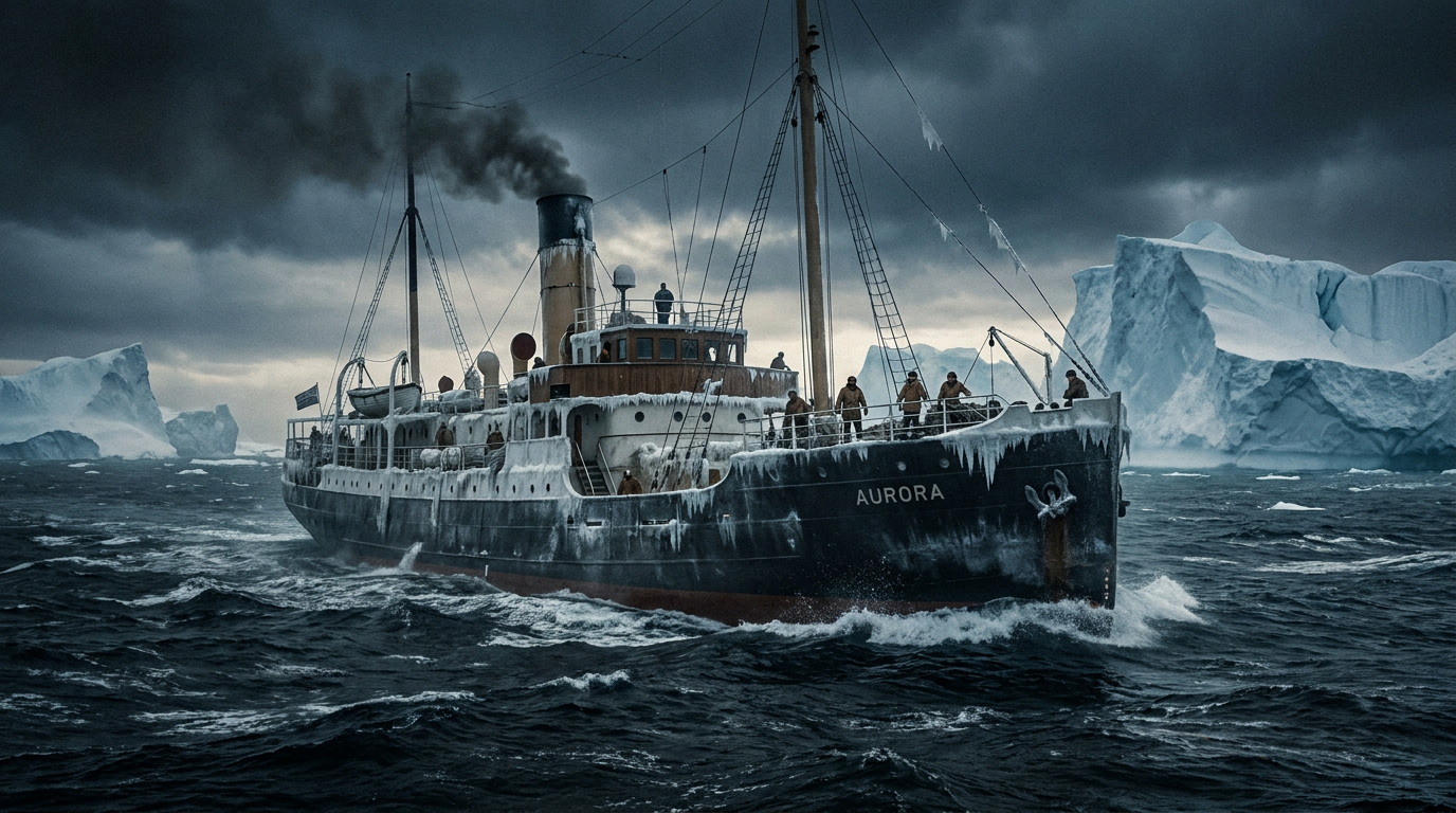
A century ago this month, the Royal Research Ship William Scoresby slipped its moorings at Humber Dock in Hull, England, and set a course for the southern oceans. Purpose-built in a Yorkshire shipyard, the vessel was designed to navigate the treacherous, ice-choked waters of the Antarctic. Its primary mission in June 1926 was to study marine biology and track the region's rapidly depleting whale stocks. Yet, the crew of the Scoresby could not have known that the meticulous daily measurements they took—dropping canvas buckets and brass thermometers into the freezing depths—would eventually become a cornerstone of 21st-century climate science.[1][6]
Today, as global temperatures reach near-record highs and the cyclical climate pattern known as El Niño threatens to disrupt weather systems worldwide, modern meteorologists face a distinct data problem. The satellite era, which provides the high-resolution, real-time global coverage that powers modern forecasting, only began in earnest in the late 1970s. To accurately model long-term oceanic cycles and separate natural variability from human-induced climate change, algorithms require a much deeper historical baseline.[2][6]
This is where the "forgotten voyages" of the early 20th century step in to fill the void. The William Scoresby, alongside a fleet of other early research and whaling vessels, inadvertently compiled the foundational datasets that now underpin the world's most advanced climate models. By digitizing the handwritten logbooks of these expeditions, researchers are effectively traveling back in time, reconstructing the thermal memory of the world's oceans long before the first weather satellite reached orbit.[1][2][6]
The Scoresby was uniquely equipped for this task. Named after the renowned 19th-century Whitby whaler and scientist William Scoresby Jr., the ship carried a state-of-the-art scientific laboratory for its era. During a grueling 19-month deployment in the 1930s, the vessel was tasked with examining the Humboldt Current—the massive, cold-water system that flows north along the western coast of South America.[1][5]

As the Scoresby navigated the Pacific, its scientists took continuous soundings, measuring the temperature, salinity, and chemical composition of the water column at various depths. In doing so, they accurately delineated the boundaries where the cold Humboldt waters met the warm, counter-flowing currents of El Niño. The data they returned to Britain helped lay the physical foundations for the modern sciences of oceanography and marine biology, providing the first rigorous, three-dimensional map of the El Niño phenomenon.[1][5]
The integration of this historical data into modern systems is a monumental scientific undertaking. The World Ocean Database 2023, the most comprehensive digital collection of oceanographic profiles ever assembled, relies heavily on the instrumental records initiated by ships like the Scoresby. The database contains over 18.6 million water column profiles, with the earliest chemical measurements dating back to the late 19th century.[2]
The integration of this historical data into modern systems is a monumental scientific undertaking.
Every time a modern climate supercomputer runs a simulation to predict the intensity of an upcoming El Niño season, it is anchoring its projections in the baseline data collected by these early mariners. Without the historical context provided by the Scoresby and its contemporaries, climate modelers would struggle to determine whether a modern marine heatwave is an unprecedented anomaly or part of a century-long cyclical pattern.[2][6]
The value of historical maritime records extends far beyond the Pacific currents. In recent years, climatologists have turned their attention to the logbooks of 18th and 19th-century whaling ships to reconstruct the historical extent of Arctic sea ice. Because whalers sought out the ice edge to hunt their prey, their daily navigational logs provide a highly accurate, day-by-day map of where the ice froze and melted centuries before the industrial revolution.[3][4]

However, utilizing century-old data presents significant methodological challenges. The primary uncertainty lies in the standardization of historical terminology and the calibration of antique instruments. When an 1820s whaling captain recorded "loose ice" or "heavy ice," modern scientists must translate those subjective descriptions into quantifiable metrics that a computer algorithm can process.[3][6]
To solve this, researchers have created extensive sea ice dictionaries, cross-referencing historical terms with the writings of early scientists like William Scoresby Jr., who meticulously categorized polar ice formations. By validating these historical definitions against modern observations taken from contemporary polar icebreakers, scientists can confidently map the historical ice edge with remarkable precision.[3][4]
A similar calibration process is required for historical temperature readings. Early 20th-century sailors often measured sea surface temperatures by hauling water onto the deck in canvas or wooden buckets. Because water evaporates and cools as it is hauled aboard, these historical readings contain known biases. Climate statisticians apply complex correction algorithms to these datasets, adjusting the historical temperatures to align with the highly precise readings taken by modern Argo floats and digital sensors.[2][6]

The effort to digitize and correct these logs is yielding profound insights. Comparisons between the whaling logbooks of the 1800s and satellite data from the last thirty years reveal that the Arctic ice edge was once far more advanced than it is today, providing stark, empirical evidence of the scale of modern ice retreat. Similarly, the deep-water temperature profiles recorded by the Scoresby off the coast of Peru allow scientists to track the long-term warming of the Pacific Ocean with a degree of confidence that would otherwise be impossible.[1][3][5]
As the global community scrambles to prepare for the extreme weather events driven by shifting ocean currents, the legacy of the William Scoresby serves as a powerful reminder of the enduring value of foundational science. The sailors and scientists who braved the freezing gales of the southern oceans a century ago were not attempting to solve a 21st-century climate crisis. They were simply observing the world with rigor and curiosity.[1][6]

Yet, their meticulous dedication to the scientific method has provided humanity with an irreplaceable gift. By preserving the memory of the oceans as they existed a century ago, these forgotten voyages have given modern society the exact tools it needs to navigate the uncertain climate of the future.[1][6]
How we got here
1926
The Royal Research Ship William Scoresby is launched in Beverley and sets sail from Hull.
1931
The Scoresby conducts extensive surveys of the Peru Coastal Current, mapping deep-water temperatures.
1970s
The satellite era begins, providing global, real-time ocean coverage but lacking historical depth.
2014
Researchers begin systematically digitizing 18th and 19th-century whaling logbooks to reconstruct Arctic ice edges.
2023
The World Ocean Database 2023 is released, integrating millions of historical ship observations.
June 2026
The centenary of the Scoresby's maiden voyage highlights the ongoing reliance on historical maritime data.
Viewpoints in depth
Climate Modelers
Historical data provides the missing baseline for modern algorithms.
For climatologists and data scientists, the value of historical ship logs lies in their ability to train modern predictive models. Because natural climate cycles like the El Niño-Southern Oscillation operate over decades, the 40-year window of satellite data is insufficient to map long-term trends. By feeding digitized, calibrated logbook data into supercomputers, modelers can extend their baselines back to the 19th century, allowing algorithms to better distinguish between natural ocean variability and human-induced warming.
Maritime Historians
The legacy of the early 20th-century scientific method.
Historians view the contributions of ships like the William Scoresby as a testament to the rigor of early 20th-century exploration. Crews operating in freezing, hazardous conditions took daily soundings and temperature readings without knowing the ultimate value their data would hold. The preservation and digitization of these logs not only advances modern science but also honors the meticulous, often dangerous labor of the mariners who charted the world's oceans before the advent of digital technology.
What we don't know
- Exactly how much human error was introduced during the manual transcription of early 20th-century temperature readings.
- How many undiscovered or untranslated maritime logbooks still exist in private collections or uncatalogued naval archives.
Key terms
- El Niño
- A climate pattern characterized by the warming of surface waters in the eastern Pacific Ocean, which significantly impacts global weather.
- Humboldt Current
- A cold, low-salinity ocean current that flows north along the western coast of South America.
- World Ocean Database
- The world's most comprehensive digital collection of historical and modern oceanographic profile data.
- Salinity
- The concentration of dissolved salts in water, a key metric used by oceanographers to track ocean currents and climate shifts.
- Instrumental Record
- The period of human history during which direct, measured observations of weather and climate have been recorded.
Frequently asked
Why do climate scientists need 100-year-old ship logs?
Modern satellite data only goes back to the late 1970s. To understand long-term climate cycles and accurately model future warming, scientists need a much longer baseline of ocean temperatures and ice coverage.
How accurate were the instruments used in the 1920s?
While less precise than modern digital sensors, early 20th-century thermometers and salinity tests were rigorously calibrated. Scientists use statistical methods to adjust for known historical measurement biases, such as water cooling in canvas buckets.
What was the original purpose of the William Scoresby?
The ship was built in 1926 primarily to research whale stocks and marine biology in the Antarctic, though its extensive oceanographic surveys proved equally valuable to modern science.
Sources
Source coverage
6 outlets
3 viewpoints surfaced


[1]BBCMaritime Historians
How forgotten voyages helped track El Nino
Read on BBC →[2]Scientific DataClimate Modelers
World Ocean Database 2023: A Foundational Data Resource for and by the Global Ocean and Coastal Communities
Read on Scientific Data →[3]ScienceDailyMaritime Historians
Whaling logbooks could hold key to retreating Arctic ice fronts
Read on ScienceDaily →[4]Polar RecordMaritime Historians
British Arctic whaling logbooks and journals: a provisional listing
Read on Polar Record →[5]Discovery ReportsMaritime Historians
Report on the Discovery Committee's Investigations
Read on Discovery Reports →[6]Factlen Editorial TeamFactlen Editorial Team
Synthesis by Factlen editorial team
Read on Factlen Editorial Team →
Every angle. Every day.
Get science stories with full source coverage and perspective breakdowns delivered to your inbox.