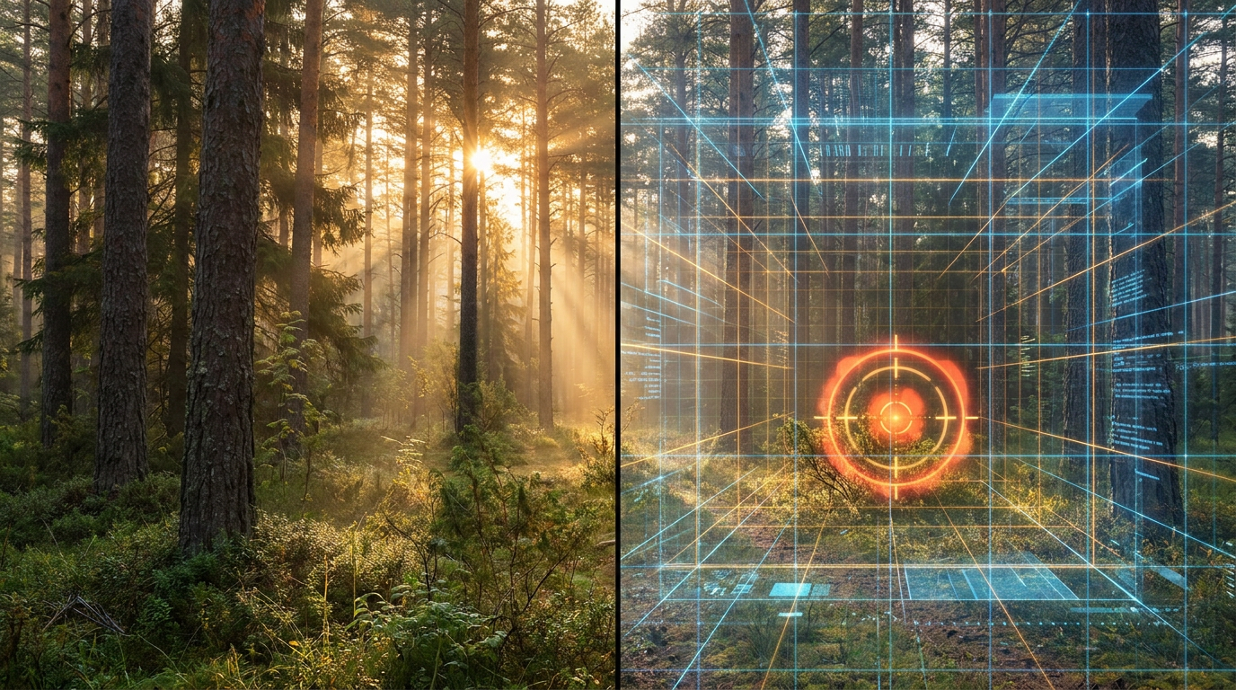
How AI and Satellite Constellations are Revolutionizing Wildfire Early Detection
A new wave of artificial intelligence, thermal-imaging satellites, and smart camera networks is allowing emergency responders to detect and predict wildfires within minutes of ignition, dramatically reducing response times.
By Factlen Editorial Team
- Emergency Responders
- Focus on rapid deployment, tactical decision-making, and keeping fires small to protect communities.
- Technology Innovators
- Focus on improving sensor resolution, AI accuracy, and reducing false positives through machine learning.
- Utility & Infrastructure Operators
- Focus on grid protection, liability reduction, and continuous monitoring of high-risk corridors.
What's not represented
- · Rural & Indigenous Communities
- · Insurance Industry Analysts
Why this matters
As climate change fuels longer and more intense fire seasons, shifting the focus from suppression to early detection is the key to preventing catastrophic damage. By catching fires when they are the size of a classroom rather than a football field, communities can evacuate safely and firefighters can extinguish blazes before they become uncontrollable.
Key points
- New AI and satellite technologies are shifting wildfire strategies from massive suppression to rapid early detection.
- The FireSat satellite constellation will scan the globe every 20 minutes, detecting fires as small as a 5x5 meter classroom.
- Ground-level AI camera networks are continuously sweeping landscapes for smoke, successfully beating 911 calls in states like California.
- Researchers are using generative AI to combine satellite data and physics to predict a fire's exact path and intensity in real-time.
- The global market for AI wildfire detection systems is expected to grow from $1.8 billion in 2025 to nearly $7 billion by 2034.
For decades, the global approach to combating wildfires has been reactive, relying heavily on human observation and massive suppression efforts. By the time a hiker spots smoke or a resident calls emergency services, a fire has often grown too large to easily contain, especially in dry, wind-swept conditions. This reliance on delayed human reporting has allowed small ignition points to rapidly evolve into catastrophic infernos that consume thousands of acres and threaten entire communities.[1][2]
But the fight against wildfires is entering a new era, shifting the fundamental strategy from suppression to early detection. A new wave of technology—combining artificial intelligence, thermal-imaging satellites, high-definition camera networks, and ground sensors—is enabling authorities to spot fires within minutes of ignition. The goal is no longer just to fight massive fires, but to prevent them from ever reaching that scale.[2][3]
At the forefront of this shift is the deployment of purpose-built satellite constellations. Historically, firefighters relied on satellite imagery that was either too low in resolution to spot small fires or only updated a few times a day. This meant a fire could burn for hours before being flagged from orbit, giving it ample time to establish a destructive foothold in dry vegetation.[4]

To solve this critical blind spot, a global nonprofit called the Earth Fire Alliance partnered with Google Research and Muon Space to launch FireSat, a fleet of more than 50 satellites designed specifically for wildfire detection. Equipped with custom infrared sensors, the FireSat constellation scans the entire planet in near real-time, providing high-resolution imagery that is updated globally every 20 minutes.[3][4]
The mechanism behind FireSat relies heavily on machine learning. Using AI, the system rapidly compares any 5-by-5-meter spot on Earth—roughly the size of a classroom—with previous imagery of that exact location. By combining these visual comparisons with data on local weather conditions and nearby infrastructure, the AI can accurately determine if a heat anomaly is a genuine fire or just a solar reflection, triggering an alert long before the flames grow out of control.[3][4]
While satellites monitor from above, AI-enabled camera networks are keeping watch closer to the ground. Companies like Pano AI have deployed high-definition cameras on tall, existing structures across the United States, Canada, and Australia. These cameras perform a continuous 360-degree sweep of their surroundings every minute, specifically trained to identify the visual signature of smoke.[1][6]

While satellites monitor from above, AI-enabled camera networks are keeping watch closer to the ground.
When the computer vision algorithm detects a potential fire, it doesn't immediately sound the alarm. To keep the risk of false positives low, the system flags the anomaly for human analysts who quickly verify whether the visual is smoke, a low-hanging cloud, or kicked-up dust. Once verified, the system triangulates the exact location and instantly notifies local fire agencies and dispatch centers.[1][6]
This ground-level AI is already proving its worth in the field. In California, the ALERTCalifornia network utilizes some 1,240 AI-enabled cameras to monitor high-risk areas. According to the network's founders, the AI running on these cameras is now consistently beating 911 calls, alerting authorities to ignitions before any human has noticed them. In Arizona, a similar system spotted the early signs of the Diamond Fire, allowing crews to race to the scene and contain the blaze to just seven acres.[1]
Beyond cameras and satellites, localized ground sensors are adding a third layer to the detection stack. In high-risk ecological corridors like the Irvine Open Space Preserve in California, the Orange County Fire Authority has deployed SensoRy AI, a system developed by youth innovator Ryan Honary. This network of wireless infrared sensors uses machine learning to detect fires as small as a single square foot, providing an ultra-localized early warning system for vulnerable perimeters.[7]
Detecting a fire early is only half the battle; emergency responders also need to know exactly what the fire will do next. This is where predictive AI modeling comes into play. Researchers at the USC Viterbi School of Engineering have developed a generative AI model that combines high-resolution satellite data with physics-based simulations to forecast a wildfire's path, intensity, and growth rate in real-time.[5]

Traditional predictive models often relied on intermittent satellite snapshots, leaving long intervals where the fire's evolution was unknown. The new USC model is trained on simulations of real wildfires, capturing the complex variability of weather, vegetation, and topography. This allows the tool to reconstruct and predict fire progression with unprecedented accuracy, transforming emergency response from a process of waiting for observations into one of proactive, data-driven prediction.[5]
The rapid adoption of these technologies is driving a massive new industry. The global AI wildfire detection market, valued at $1.8 billion in 2025, is projected to reach nearly $7 billion by 2034. Utility companies, recognizing the liability and infrastructure risks posed by wildfires, are among the biggest early adopters. Providers like Xcel Energy and Arizona Public Service are actively installing AI cameras along high-risk power line corridors to protect the grid and limit damage.[1][6][8]

Despite these breakthroughs, experts caution that AI is not a silver bullet. The technology is highly effective at early detection, but its utility diminishes once extreme weather events—such as hurricane-force winds—take over and cause flames to shift unpredictably. In those chaotic moments, the human factor remains irreplaceable. AI can provide real-time information, but seasoned fire commanders must still decide which tactics are best on the ground.[1]
Ultimately, the integration of AI into wildfire management represents a profound shift in how humanity coexists with a warming planet. As these systems become more ubiquitous, the lines between "AI wildfire detection" and standard emergency response will blur. By giving firefighters the gift of time, this technology is ensuring that the devastating mega-fires of the past decade do not have to be the blueprint for the future.[1][2]
How we got here
2020
Early AI-enabled camera networks, such as Pano AI, launch to provide continuous smoke detection.
July 2024
USC researchers publish a breakthrough generative AI model that combines satellite data and physics to forecast fire paths.
September 2024
Google Research and the Earth Fire Alliance announce FireSat, a purpose-built satellite constellation for early detection.
Early 2025
The first FireSat satellites are scheduled to launch, bringing 20-minute global update frequencies online.
May 2026
Major utilities like Xcel Energy begin large-scale deployments of AI camera networks to protect grid infrastructure.
Viewpoints in depth
Emergency Responders
Focus on rapid deployment, tactical decision-making, and keeping fires small to protect communities.
For fire chiefs and ground crews, the primary value of AI detection is the gift of time. By receiving alerts minutes after ignition rather than hours, responders can deploy a 'rapid initial attack' to extinguish flames while they are still manageable. However, they emphasize that AI is a support tool, not a replacement for human judgment; once a fire grows and weather conditions become extreme, human commanders must still make the critical tactical decisions.
Technology Innovators
Focus on improving sensor resolution, AI accuracy, and reducing false positives through machine learning.
Engineers and data scientists view the wildfire crisis as a computational and hardware challenge. Their focus is on launching purpose-built satellite constellations like FireSat and refining computer vision algorithms to distinguish between actual smoke and lookalikes like dust or clouds. For this camp, the goal is building a seamless, automated global network that continuously monitors the Earth's surface with zero latency.
Utility & Infrastructure Operators
Focus on grid protection, liability reduction, and continuous monitoring of high-risk corridors.
Power companies and infrastructure managers are rapidly adopting AI detection to protect their assets and mitigate liability. By installing AI-enabled cameras on existing towers and integrating satellite data, utilities can monitor high-risk corridors in real-time. This allows them to preemptively shut off power if a fire threatens a line, or quickly dispatch crews to prevent a small brush fire near a substation from escalating into a grid-threatening disaster.
What we don't know
- How well these AI models will adapt to entirely unprecedented fire behaviors caused by accelerating climate change.
- Whether developing nations with fewer resources will be able to access and afford these advanced early-warning satellite networks.
- The exact threshold at which extreme weather events, like hurricane-force winds, render AI predictive models ineffective.
Key terms
- Computer Vision
- A field of artificial intelligence that trains computers to interpret and understand the visual world, used here to distinguish smoke from clouds or dust.
- Generative AI
- Artificial intelligence capable of generating new data or predictions based on learned patterns, used to forecast how a fire will spread over time.
- Infrared Sensor
- An instrument that detects infrared radiation (heat), allowing satellites and cameras to spot fires even before visible smoke appears.
- False Positive
- An instance where an AI system incorrectly flags a non-threatening anomaly, such as a solar reflection, as a wildfire.
- Physics-based Simulation
- A computer model that uses the laws of physics to replicate real-world scenarios, such as how wind and terrain affect fire behavior.
Frequently asked
How small of a fire can these new satellites detect?
The FireSat constellation is designed to detect fires as small as 5 by 5 meters, which is roughly the size of a standard classroom.
Do AI cameras replace human 911 calls?
They don't replace them, but they often beat them. In networks like ALERTCalifornia, the AI frequently detects and reports smoke before any human observer has a chance to call 911.
Can AI predict where a fire will go?
Yes. Researchers have developed generative AI models that combine real-time satellite data with terrain and weather information to accurately forecast a fire's path and growth rate.
Who is paying for these AI detection systems?
Funding comes from a mix of government agencies, private utility companies protecting their infrastructure, and philanthropic investments from tech companies.
Sources
Source coverage
8 outlets
3 viewpoints surfaced


[1]AP NewsEmergency Responders
A technology driven by worsening blazes: How AI is spotting wildfires
Read on AP News →[2]Ynet NewsEmergency Responders
Detecting fire before it spreads: new technology aims to protect forests in Israel and beyond
Read on Ynet News →[3]CNNUtility & Infrastructure Operators
Satellites and AI transform wildfire detection
Read on CNN →[4]Google BlogTechnology Innovators
A breakthrough in wildfire detection: How a new constellation of satellites can detect smaller wildfires earlier
Read on Google Blog →[5]USC ViterbiTechnology Innovators
By combining high-resolution satellite data, terrain data and realistic fire simulations, USC Viterbi researchers have developed a reconstruction and prediction tool
Read on USC Viterbi →[6]Xcel EnergyUtility & Infrastructure Operators
Xcel Energy is bringing artificial intelligence-driven wildfire detection cameras to Wisconsin
Read on Xcel Energy →[7]One EarthTechnology Innovators
Youth innovator develops SensoRy AI for early wildfire detection
Read on One Earth →[8]DataInteloUtility & Infrastructure Operators
AI Wildfire Detection System Market Outlook 2025-2034
Read on DataIntelo →

Every angle. Every day.
Get environment stories with full source coverage and perspective breakdowns delivered to your inbox.