How AI and Satellite Constellations Are Catching Wildfires Before They Spread
A new generation of AI-powered satellites is spotting wildfires as small as a campfire, giving emergency responders a critical head start.
By Factlen Editorial Team
- Emergency Responders
- Focused on tactical advantage and rapid deployment.
- Space Tech Innovators
- Focused on hardware capabilities and orbital logistics.
- Climate & Data Scientists
- Focused on predictive modeling and carbon mitigation.
- Forestry Management
- Focused on fuel moisture, controlled burns, and resource allocation.
What's not represented
- · Local communities living in high-risk zones
- · Insurance companies assessing fire risk
Why this matters
Wildfires are becoming more frequent and destructive, threatening lives, property, and global climate goals. By using AI to detect and contain fires in their infancy, communities can prevent mass evacuations and catastrophic damage.
Key points
- AI-powered satellites can now detect wildfires as small as 5 by 5 meters.
- The FireSat constellation aims to provide global updates every 20 minutes by 2030.
- Onboard AI processes thermal data instantly, beaming GPS coordinates to dispatchers.
- Radar technology measures forest dryness to predict where fires are most likely to start.
- Early detection allows responders to contain fires before they require mass evacuations.
The terrifying reality of wildfires is their exponential growth. A spark in dry brush can become an uncontrollable inferno in a matter of hours, often outpacing the ability of human observers to detect it, report it, and dispatch crews. For decades, emergency responders have relied on a mix of 911 calls, hilltop lookout towers, and legacy weather satellites to spot smoke. But in remote wilderness areas, a fire might burn unnoticed until it has already consumed hundreds of acres. The critical window for containment—often called the "golden hour" of firefighting—is frequently lost simply because nobody knew the fire existed.[3][4]
That paradigm is undergoing a radical shift thanks to the convergence of artificial intelligence and next-generation orbital sensors. Rather than waiting for a fire to grow large enough to be seen by the naked eye or older satellites, a new global infrastructure is being deployed to catch ignitions when they are no larger than a campfire. This system doesn't just look for smoke; it analyzes invisible light, radar backscatter, and historical data to identify the exact moment a forest begins to burn.[1][2]
The technological leap relies on moving past the limitations of legacy satellite systems like MODIS and VIIRS. While these older tools have been vital for tracking massive, established fires, their low resolution means a fire often needs to be several acres in size before it registers as a heat anomaly. Furthermore, they only pass over specific regions a few times a day. If a fire starts shortly after a satellite passes, it has hours to spread before the next orbital scan.[3][6]
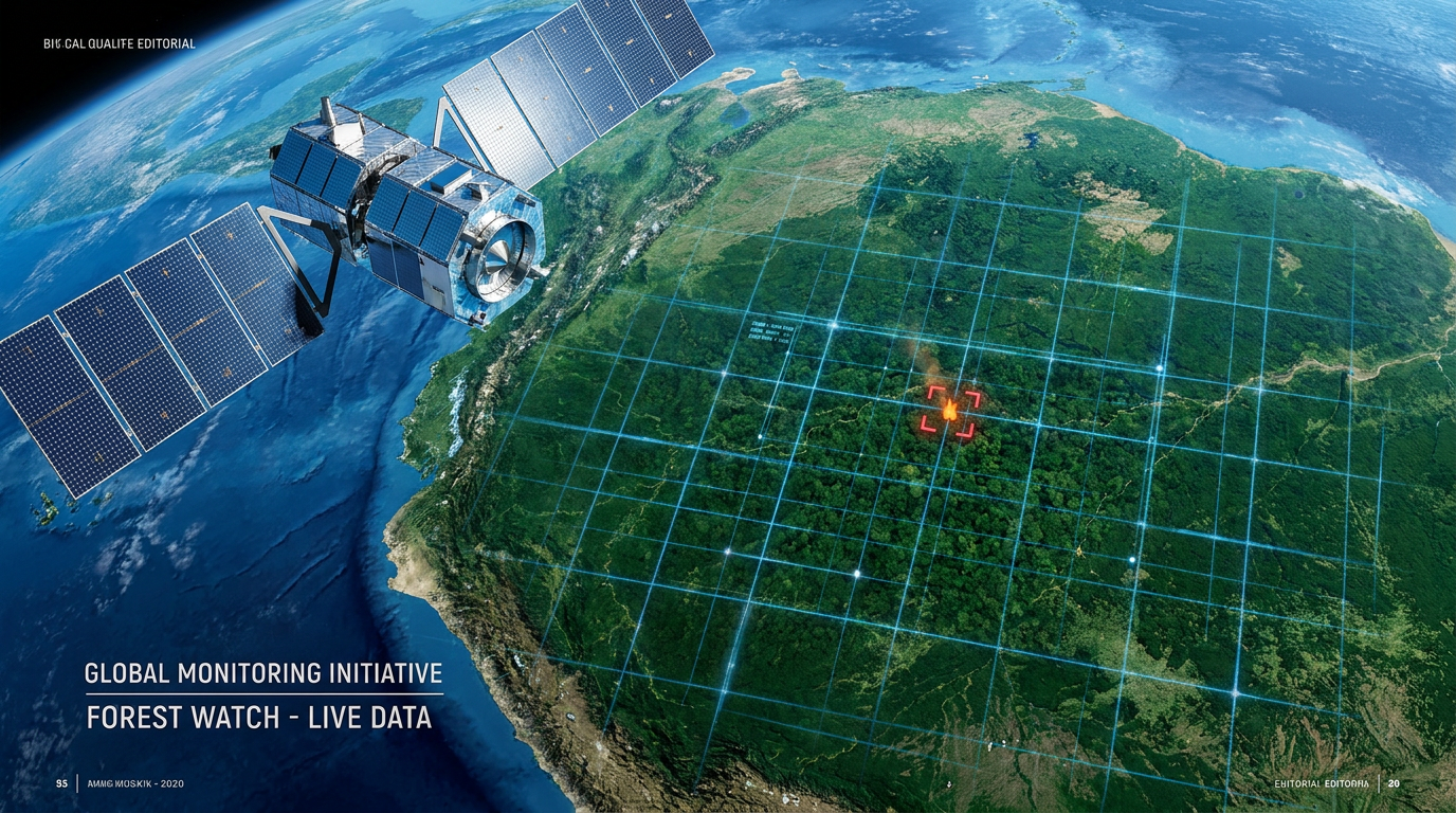
To solve this, a coalition of tech companies, nonprofits, and scientists formed the Earth Fire Alliance, launching a purpose-built satellite constellation known as FireSat. The first of these satellites rode into orbit aboard a SpaceX Transporter-13 rocket in March 2025. Unlike its predecessors, FireSat is equipped with custom six-band infrared sensors designed specifically to hunt for the unique thermal signature of burning vegetation.[1][6]

The resolution of this new hardware is staggering. FireSat can detect a blaze as small as 5 by 5 meters—roughly 16 by 16 feet, or 1/400th the size of what legacy early-detection satellites could spot. But hardware alone cannot process the terabytes of visual data generated by scanning the Earth's surface. This is where artificial intelligence becomes the critical engine of the operation, acting as an untiring, hyper-vigilant observer.[3][6]
As the satellite orbits, its onboard AI continuously compares the live infrared feed against thousands of previous images of the exact same location. It factors in local weather, time of day, and topography. When a new heat signature appears, the AI must instantly answer a complex question: is this a wildfire, or is it an industrial smokestack, a solar reflection off a lake, or simply a rock that absorbed too much afternoon sun?[2][6]
By training on massive datasets of both real fires and false positives, the machine learning models have become incredibly adept at isolating the specific spectral fingerprint of a wildfire. Once the AI confirms an ignition, it doesn't wait to downlink the raw video to a ground station for human review. Instead, it processes the alert onboard and beams a precise GPS coordinate directly to emergency dispatchers within minutes.[2][3]

Once the AI confirms an ignition, it doesn't wait to downlink the raw video to a ground station for human review.
The ultimate vision for this system is a 50-satellite constellation, slated for completion by 2030. Once fully deployed, the network will provide a global refresh rate of just 20 minutes. This means that virtually anywhere on Earth, a new fire will be spotted, analyzed, and reported to local authorities before it has the chance to establish a dangerous crown fire in the forest canopy.[1][3]
But AI's role in the new era of firefighting begins long before the first spark is struck. To truly outsmart wildfires, agencies must know where they are most likely to ignite. Historically, forest rangers measured "Fuel Moisture Content"—the dryness of the vegetation—by physically cutting branches and baking them in ovens. It was precise, but it only provided data for a tiny patch of land.[5]
Today, AI models map this hidden dryness from space. Because optical cameras only see the green top layer of leaves, AI ingests data from Synthetic Aperture Radar (SAR) satellites. These instruments shoot microwave pulses that penetrate the forest canopy. Because water conducts electricity differently than dry wood, the radar signal that bounces back tells the AI exactly how much moisture is locked inside the tree trunks and soil.[5]

By combining this radar data with temperature, wind, and historical fire behavior, the AI generates dynamic, high-resolution risk maps. A forest might look perfectly healthy and green to the human eye, but the AI can flag it as dangerously desiccated. This allows forestry departments to pre-position bulldozers, water drops, and hand crews in high-risk zones days before a dry lightning storm rolls through.[5]
On the ground, this orbital intelligence is being seamlessly integrated with terrestrial AI networks. Companies like Pano AI and various government agencies have deployed networks of AI-enhanced, solar-powered cameras on mountaintops. When a satellite detects a heat anomaly, these ground cameras can automatically pan to the coordinates, using near-infrared sensors to cut through the haze and provide dispatchers with a live visual of the smoke plume.[4][5]
The National Oceanic and Atmospheric Administration (NOAA) has also brought its "Next Generation Fire System" online, utilizing AI to process weather satellite data and flag potential fires for human verification. Tested extensively in Colorado and other western states, the system provides highly accurate GPS locations, which is a massive upgrade over the traditional method of trying to triangulate a fire based on panicked 911 calls from distant highways.[4]

The impact of these combined technologies is already being felt in pilot programs across California, British Columbia, and Australia. Fires that would have previously burned unnoticed for hours are being detected and contained within minutes. By catching fires while they are still manageable, agencies are drastically reducing the need for mass evacuations, saving millions of dollars in suppression costs, and preventing the catastrophic destruction of property.[1][3]
Beyond the immediate preservation of life and property, stopping mega-fires is a critical climate intervention. Wildfires are a massive source of carbon emissions, creating a feedback loop that accelerates global warming. By utilizing artificial intelligence to keep fires small, we are not just adapting to a hotter world—we are actively deploying our most advanced technology to protect the fragile ecosystems that keep the planet breathing.[3][5]
How we got here
August 2024
NOAA begins real-time testing of its Next Generation Fire System AI for early detection.
March 2025
The first FireSat prototype launches aboard a SpaceX Transporter-13 rocket.
Mid-2025
Early pilot programs in California and Australia demonstrate rapid containment of AI-detected ignitions.
2030 (Planned)
The full 50-satellite FireSat constellation is expected to be operational, providing 20-minute global updates.
Viewpoints in depth
Emergency Responders
Focused on tactical advantage and rapid deployment.
For firefighting agencies, the primary value of AI detection is time. The 'golden hour' of firefighting dictates that catching a blaze early exponentially increases the chances of containment. Responders emphasize that while AI provides the coordinates, the ultimate success still relies on having well-funded, rapidly deployable ground and air crews ready to act on the intelligence.
Climate & Data Scientists
Focused on predictive modeling and carbon mitigation.
Researchers view the continuous stream of high-resolution thermal data as a goldmine for understanding fire behavior. Every detected fire feeds back into the machine learning models, improving future predictions. Furthermore, scientists highlight that preventing mega-fires is a crucial climate intervention, as massive wildfires release millions of tons of sequestered carbon back into the atmosphere.
Space Tech Innovators
Focused on hardware capabilities and orbital logistics.
Aerospace engineers and tech coalitions emphasize the unprecedented integration of custom hardware and onboard AI processing. By analyzing data directly on the satellite rather than downlinking raw video, the system bypasses traditional bandwidth bottlenecks. Their long-term challenge is maintaining the constellation, as low-Earth orbit satellites typically require replacement every three to five years.
What we don't know
- How the cost of constantly replacing the 3-to-5-year lifespan satellites will be funded long-term.
- Whether ground response teams will receive enough funding to match the speed of the new AI detection alerts.
Key terms
- Fuel Moisture Content (FMC)
- The ratio of water to dry mass in vegetation, used as a primary indicator of how easily a forest will burn.
- Synthetic Aperture Radar (SAR)
- A type of radar used by satellites that can penetrate forest canopies to measure the moisture locked inside tree trunks and soil.
- Multispectral Infrared Sensor
- A specialized camera that captures light across multiple invisible infrared bands, allowing it to detect specific heat signatures.
- Constellation
- A group of artificial satellites working together as a single system to provide continuous, overlapping global coverage.
Frequently asked
How small of a fire can the new AI satellites detect?
The FireSat constellation uses custom infrared sensors to detect fires as small as 5 by 5 meters (roughly 16 by 16 feet).
Does cloud cover block the satellites from seeing fires?
While thick clouds can obscure optical and infrared sensors, AI models also ingest microwave and radar data that penetrate clouds to assess forest conditions.
Who is funding the FireSat constellation?
The project is backed by a coalition including Google.org, the Gordon and Betty Moore Foundation, and the Earth Fire Alliance.
Will this technology replace human fire lookouts?
No. It is designed to augment human responders, particularly by monitoring remote wilderness areas where human lookouts or 911 calls are impossible.
Sources
Source coverage
6 outlets
4 viewpoints surfaced


[1]Earth Fire AllianceSpace Tech Innovators
FireSat: A breakthrough in wildfire detection
Read on Earth Fire Alliance →[2]Google ResearchClimate & Data Scientists
Partnering to detect wildfires with AI
Read on Google Research →[3]Homeland Security TodayEmergency Responders
First FireSat Satellite Launches to Transform Wildfire Detection
Read on Homeland Security Today →[4]NOAAClimate & Data Scientists
Next Generation Fire System
Read on NOAA →[5]Factlen Editorial TeamForestry Management
Synthesis by Factlen editorial team
Read on Factlen Editorial Team →[6]R&D WorldSpace Tech Innovators
AI-enhanced FireSat satellite aims to spot wildfires early
Read on R&D World →
Every angle. Every day.
Get environment stories with full source coverage and perspective breakdowns delivered to your inbox.