How AI and Satellites Are Closing the Oil and Gas Industry's Methane Blind Spot
A new generation of methane-tracking satellites, powered by artificial intelligence, is pinpointing invisible leaks from space and forcing the energy sector to plug them.
By Factlen Editorial Team
- Climate Scientists & Advocates
- View satellite data as the ultimate accountability tool to force immediate reductions in greenhouse gases.
- Regulatory Agencies
- Utilize the new data to enforce emissions fees, guide state-level interventions, and verify corporate reporting.
- Energy Producers
- Increasingly view leak detection as an operational necessity to capture lost product and avoid steep regulatory fines.
What's not represented
- · Local communities living near major extraction sites who suffer from co-pollutants released alongside methane.
- · Smaller, independent oil and gas operators who may struggle with the capital costs of rapid infrastructure repairs.
Why this matters
Methane is responsible for roughly 30% of global warming, but until now, finding leaks was like searching for an invisible needle in a haystack. This space-based transparency gives regulators and companies the exact coordinates needed to stop emissions overnight, turning a major climate liability into a highly solvable problem.
Key points
- New satellites like MethaneSAT and Tanager-1 are providing unprecedented, high-resolution tracking of global methane leaks.
- AI algorithms trace atmospheric gas plumes back to specific faulty equipment, enabling rapid repairs.
- California successfully used satellite data in 2025 to resolve major leaks, sometimes within 24 hours.
- Data reveals actual emissions in regions like the Permian Basin are vastly higher than official estimates.
- New US and EU regulations impose steep financial penalties on operators who fail to plug leaks.
Methane is the invisible accelerant of climate change. Responsible for roughly a third of current global warming, the gas is 80 times more potent than carbon dioxide over a 20-year timeframe. For decades, the oil and gas industry has leaked massive quantities of this valuable fuel into the atmosphere, largely because the infrastructure spans millions of miles of remote terrain where leaks go unnoticed.[1]
Historically, finding these leaks was a slow, expensive process akin to searching for a needle in a haystack. Operators relied on ground crews with handheld sensors or sporadic aircraft flyovers. Because comprehensive monitoring was impossible, official emissions inventories were built on theoretical engineering estimates rather than actual measurements, masking the true scale of the problem.[2]
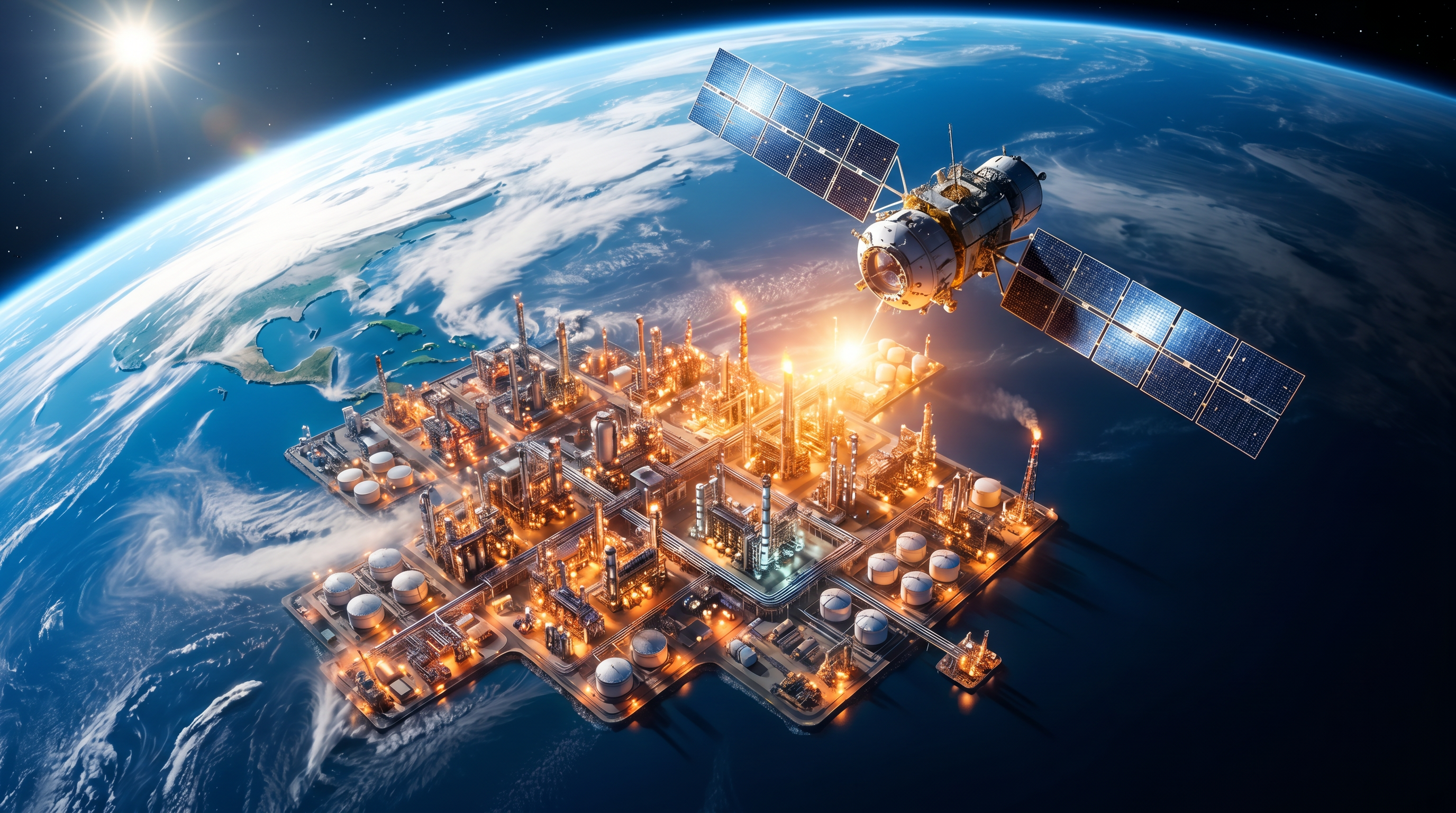
That era of plausible deniability is ending. A new ecosystem of highly specialized satellites is now orbiting the Earth, providing an unblinking, high-resolution view of global methane emissions. This space-based transparency is transforming methane mitigation from a guessing game into an exact science, giving regulators and energy companies the precise coordinates needed to plug leaks overnight.[6][7]

The breakthrough relies on a complementary pairing of satellite technologies. In early 2024, the Environmental Defense Fund launched MethaneSAT, an $88 million spacecraft designed to capture the big picture. MethaneSAT scans wide swaths of the planet, measuring methane concentrations with astonishing precision—detecting differences as small as two parts per billion.[1]
While MethaneSAT maps the broader regional emissions, another satellite named Tanager-1 acts as the sniper. Launched by the Carbon Mapper coalition and Planet Labs, Tanager-1 specializes in identifying point sources. It can zoom in on specific oil fields, landfills, or agricultural sites to pinpoint the exact piece of equipment responsible for a mega-leak.[6]
Gathering the raw data is only half the battle; making sense of it requires immense computational power. This is where artificial intelligence enters the equation. Tech giants and environmental groups have developed machine learning algorithms that process the satellite imagery in near-real-time, turning raw atmospheric data into actionable intelligence.[5]
These AI models overlay the invisible methane plumes onto detailed maps of oil and gas infrastructure. By analyzing wind patterns and atmospheric conditions, the software traces the gas backward from the cloud to its exact source—a faulty compressor station, an unlit flare, or a broken pipeline valve.[1][7]

These AI models overlay the invisible methane plumes onto detailed maps of oil and gas infrastructure.
The initial data returns in 2025 and 2026 delivered a shock to the industry: actual emissions were vastly higher than official estimates. MethaneSAT's system-wide analysis of 45 major oil and gas basins revealed that the Permian Basin in Texas and New Mexico alone was releasing an estimated 410 metric tons of methane per hour.[2]
Globally, the highest-emitting individual sites are heavily concentrated in a few countries. In 2026, researchers at UCLA's Stop Methane Project used Carbon Mapper data to rank the world's top 25 methane mega-leaks. A staggering 15 of these massive leaks were located in Turkmenistan, with others clustered in Venezuela, Iran, and the United States.[4]

But the purpose of these satellites is not merely to name and shame; it is to drive immediate action. Because the data is highly specific and publicly accessible, it creates an unprecedented accountability mechanism. When a massive plume is detected, the responsible operator can be notified almost instantly, removing any excuse for inaction.[7]
California has already proven how effective this rapid-response model can be. Through the California Satellite Methane Project, the state's Air Resources Board utilized Tanager-1 data to identify and resolve 10 massive leaks at oil and gas facilities in 2025.[3]
In one remarkable instance in Kern County, a severe leak caused by failing equipment was completely repaired within 24 hours of the operator receiving the satellite-derived notification. Stopping those 10 leaks alone had the climate equivalent of removing 18,000 gasoline-powered cars from the road for a year.[3]

Beyond environmental stewardship, there is a massive financial incentive for companies to fix these leaks. Methane is the primary component of natural gas; every ton leaked into the atmosphere is lost revenue. Furthermore, regulatory frameworks are rapidly tightening around the globe to penalize excessive emissions.[7]
In the United States, the Inflation Reduction Act introduced a methane emissions fee that scales up aggressively, reaching $1,500 per metric ton in 2026 for operators who exceed permitted thresholds. Meanwhile, the European Union has implemented strict monitoring, reporting, and verification rules that apply not just to domestic producers, but to all oil and gas imports.[5]
With three more methane-tracking satellites scheduled to launch by 2027, the global monitoring net will only grow tighter. For the first time in the history of the fossil fuel industry, the technology, the financial incentives, and the regulatory pressure are perfectly aligned to solve one of the planet's most urgent climate challenges.[3][7]
How we got here
March 2024
The Environmental Defense Fund successfully launches MethaneSAT into orbit.
August 2024
The Tanager-1 satellite is launched to focus on pinpointing specific mega-leaks.
Mid-2025
California begins using satellite data to successfully identify and repair major leaks within 24 hours.
Early 2026
MethaneSAT data is released, revealing that global oil and gas emissions are significantly higher than official estimates.
2026
The US methane emissions fee under the Inflation Reduction Act reaches its maximum penalty of $1,500 per metric ton.
Viewpoints in depth
Climate Scientists & Advocates
Advocates view space-based monitoring as the ultimate tool to force transparency on an historically opaque industry.
For years, environmental groups argued that the oil and gas industry was drastically underreporting its emissions by relying on theoretical math rather than actual measurements. The deployment of MethaneSAT and Tanager-1 vindicates this stance, proving that basins like the Permian are emitting far more than EPA estimates suggested. Advocates argue that because methane degrades in the atmosphere after about a decade, aggressively plugging these leaks is the fastest possible way to slow the immediate rate of global warming.
Regulatory Agencies
Regulators are using the data to transition from passive oversight to active, real-time enforcement.
Agencies like the California Air Resources Board (CARB) have embraced satellite data as a game-changer for enforcement. Instead of conducting random, expensive ground inspections, regulators can now monitor entire states daily from space. This allows them to notify operators of massive leaks immediately. Furthermore, federal regulators in the US and EU are using this verifiable data to enforce strict new financial penalties, ensuring that companies pay a steep price for negligence.
Energy Producers
Operators are integrating the data to capture lost revenue and avoid steep regulatory fines.
While the initial data releases were a public relations challenge for the industry, many major operators are now actively utilizing satellite intelligence. Because leaked methane is essentially lost natural gas, fixing broken valves and unlit flares directly translates to recovered product that can be sold. Combined with the threat of the $1,500-per-ton US methane fee, the financial calculus has shifted: it is now significantly cheaper for companies to proactively monitor and repair their infrastructure than to ignore the leaks.
What we don't know
- It remains unclear how quickly national oil companies in countries like Turkmenistan and Iran will respond to the public release of their mega-leak data.
- The exact long-term cost savings for operators who capture leaked gas versus the cost of continuous satellite monitoring is still being calculated.
Key terms
- Methane
- The primary component of natural gas and a potent greenhouse gas that traps significantly more heat than carbon dioxide in the short term.
- Point Source
- A single, identifiable localized source of emissions, such as a specific broken pipe, unlit flare, or faulty compressor station.
- MethaneSAT
- A satellite launched by the Environmental Defense Fund in 2024 designed to measure methane concentrations over wide regional areas with extreme precision.
- Tanager-1
- A satellite operated by the Carbon Mapper coalition that specializes in zooming in on specific facilities to pinpoint exact point-source leaks.
- Engineering Estimates
- Theoretical calculations previously used by the industry to guess total emissions based on equipment averages, rather than actual physical measurements.
Frequently asked
Why is methane so dangerous for the climate?
Methane is a highly potent greenhouse gas that traps roughly 80 times more heat in the atmosphere than carbon dioxide over a 20-year period. It is responsible for about 30% of current global warming.
How do satellites actually see methane?
Satellites use specialized spectrometers that measure how sunlight reflects off the Earth. Because methane absorbs specific wavelengths of infrared light, the sensors can detect the unique 'fingerprint' of the gas in the atmosphere.
What happens when a leak is found?
AI algorithms trace the gas plume back to its exact source on an infrastructure map. Regulators or operators are notified, and ground crews can be dispatched to repair the faulty valve or compressor, sometimes within 24 hours.
Are companies penalized for leaking methane?
Yes. In the United States, the Inflation Reduction Act imposes a fee that reaches $1,500 per metric ton in 2026 for excess emissions. The EU also has strict monitoring rules that apply to domestic producers and importers.
Sources
Source coverage
7 outlets
3 viewpoints surfaced


[1]Environmental Defense FundClimate Scientists & Advocates
MethaneSAT data reveals full picture of oil and gas emissions
Read on Environmental Defense Fund →[2]Inside Climate NewsClimate Scientists & Advocates
MethaneSAT Data Reveals Higher-Than-Expected Methane Emissions From Oil and Gas
Read on Inside Climate News →[3]California Air Resources BoardRegulatory Agencies
California's methane satellite helps stop 10 large leaks
Read on California Air Resources Board →[4]GizmodoClimate Scientists & Advocates
The 25 Largest Methane Mega-Leaks in the World Have Been Ranked
Read on Gizmodo →[5]World Economic ForumRegulatory Agencies
Tackling methane emission blind spots with satellite technology
Read on World Economic Forum →[6]UC BerkeleyEnergy Producers
Years in the Making, New Satellite Offers Breakthrough in Global Methane Emissions Tracking
Read on UC Berkeley →[7]Factlen Editorial TeamEnergy Producers
Synthesis by Factlen editorial team
Read on Factlen Editorial Team →
Every angle. Every day.
Get energy stories with full source coverage and perspective breakdowns delivered to your inbox.