How AI and Satellites Are Catching Wildfires Before They Spread
A new generation of AI-powered satellite and camera networks is detecting wildfires in minutes, beating traditional systems and giving responders a critical head start.
By Factlen Editorial Team
- Climate Tech Developers
- Focus on pushing the boundaries of AI, edge computing, and satellite constellations to achieve near-instant detection.
- Emergency Responders
- Focus on the operational utility of the data, requiring high accuracy, low false positives, and seamless integration into dispatch systems.
- Risk Management Researchers
- Focus on predictive modeling, using AI to map vulnerabilities and guide long-term urban planning and land management.
What's not represented
- · Local communities living in high-risk zones
- · Insurance providers pricing wildfire risk
Why this matters
Early detection is the difference between a manageable brush fire and a catastrophic mega-fire. By shrinking the detection window from hours to minutes, this technology is saving lives, protecting infrastructure, and reducing the massive carbon emissions caused by uncontrolled burns.
Key points
- AI models are shrinking wildfire detection times from over an hour to under three minutes.
- Startups are aggregating satellite data to eliminate the blind spots of legacy orbital systems.
- On-orbit edge computing processes thermal data directly in space, bypassing transmission delays.
- Ground-based ultra-HD camera networks scan landscapes every minute to verify ignitions.
- Predictive AI models use climate and vegetation data to map dynamic wildfire risk before fires start.
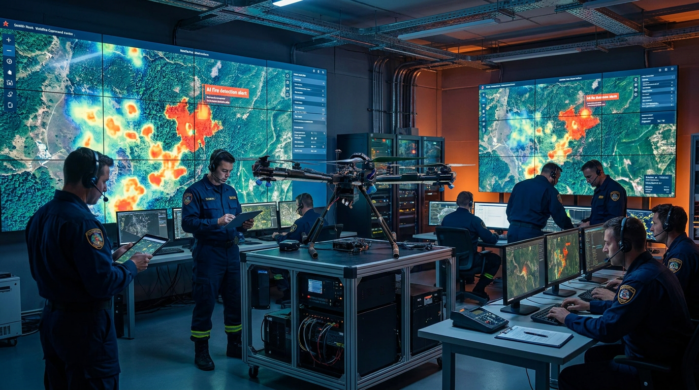
Every mega-fire begins with a single, manageable spark. For decades, the greatest vulnerability in forest management has been the gap between ignition and detection. By the time a human spotter sees smoke or a hiker dials emergency services, a small brush fire can easily evolve into an uncontrollable inferno. The critical window for containment is measured in minutes, not hours.[6]
Historically, emergency responders have relied on a patchwork of lookout towers, civilian reports, and legacy satellite systems. Platforms like NASA's Fire Information for Resource Management System (FIRMS) have been invaluable, but they are limited by the physical orbit of satellites. If a fire starts just after a satellite passes over, it might burn undetected until the next orbit, creating a dangerous blind spot.[1]
Over the past two years, a new generation of climate-technology startups and academic researchers has fundamentally changed this equation. By layering artificial intelligence over continuous satellite feeds and ground-based camera networks, they are shrinking the detection window from hours to mere minutes. This shift from reactive observation to proactive, AI-driven early warning is redefining global disaster response.[6]
Leading this charge is Satellites on Fire, a startup founded by three Argentine teenagers that has rapidly grown into a global detection network. The platform aggregates imagery from more than eight satellites across NASA, NOAA, and the European Space Agency. Because these feeds are updated as frequently as every five minutes, the system effectively eliminates the orbital blind spots that plague older models.[1]

The raw visual data from these constellations is far too voluminous for human analysts to review in real-time. Instead, Satellites on Fire deploys proprietary artificial intelligence models to scan the incoming imagery. These algorithms are trained to detect faint heat signatures and subtle smoke plumes, instantly flagging anomalies and generating spread simulations.[1][5]
The results have been transformative. Internal metrics indicate that the AI system detects ignitions an average of 35 minutes faster than NASA's FIRMS. In one documented instance in an Argentine national park, the platform spotted a fire at 1:40 a.m.—nearly two hours ahead of traditional alerts. That head start provided responders with the precious extra time needed to contain the blaze before it threatened nearby communities.[1][3]
The scale of this technological intervention is expanding rapidly. In 2025 alone, the Satellites on Fire system helped authorities respond to over 600 wildfires across 21 countries. By catching fires early, the technology prevented forced displacements, protected biodiversity, and mitigated severe economic damage. Recognizing this impact, investors poured $2.7 million into the company in April 2026 to fund its expansion into the United States.[1][3]
While software aggregation is one approach, other innovators are pushing the artificial intelligence directly into space. German cleantech company OroraTech operates a proprietary constellation of nanosatellites equipped with on-orbit AI processing. By analyzing the thermal data directly on the satellite—a technique known as edge computing—the system bypasses the delay of beaming raw data back to Earth.[2][5]
While software aggregation is one approach, other innovators are pushing the artificial intelligence directly into space.
This on-orbit processing cuts alert times from an average of 90 minutes down to under three minutes. The technology has proven so effective that Greece recently partnered with OroraTech to power the world's first national satellite wildfire warning system, creating a continuous, automated shield over its vulnerable Mediterranean forests.[2]
Space-based detection is increasingly being paired with highly sophisticated ground networks. U.S.-based Pano AI deploys 360-degree ultra-high-definition cameras on elevated towers across high-risk landscapes. These cameras scan their surroundings every single minute, feeding the visual data into machine learning models trained to recognize the specific visual characteristics of smoke.[2]

During deployments in Colorado, the Pano AI system demonstrated the ability to detect and verify wildfires within three minutes of ignition. The platform automatically delivers these verified alerts to over 250 emergency agencies and utility companies, ensuring that dispatchers can route helicopters and ground crews before the fire establishes a strong foothold.[2]
Even when a fire does spread, advanced sensors are ensuring that responders are never flying blind. Finnish aerospace company ICEYE utilizes the world's largest Synthetic Aperture Radar (SAR) constellation to monitor active disaster zones. Unlike optical cameras, SAR can penetrate thick smoke and darkness, providing near-real-time situational awareness regardless of visibility conditions.[2]
During the devastating Los Angeles wildfires of 2025, ICEYE's radar technology achieved 99 percent accuracy in identifying building damage within 24 hours. This capability fundamentally redefines post-fire assessment, allowing emergency services to safely route evacuation teams and immediately begin recovery planning while the fire is still burning.[2]
The ultimate goal of this technological revolution is not just to detect fires faster, but to predict them before they ignite. Researchers at the University at Buffalo have developed GeoFlame VISION, a sophisticated computer model that merges remote sensing data with machine learning to produce dynamic, highly granular wildfire risk maps.[4]
The GeoFlame VISION model analyzes a complex web of climate conditions, topographical features, and vegetation density to pinpoint exact locations at the highest risk of a severe burn. By processing historical data, the system can forecast dynamic risk at a spatiotemporal scale, highlighting specific vulnerabilities in areas like California's Mono, Inyo, and Mariposa counties.[4]

This predictive capability is crucial for long-term land management. By understanding exactly where the risk is concentrated, forestry officials can strategically plan controlled burns, clear dry brush, and manage the expansion of the Wildland-Urban Interface (WUI)—the high-risk zones where human development encroaches on natural landscapes.[4]
The underlying architecture powering these systems relies heavily on Convolutional Neural Networks (CNNs) and Transformer-based time-series forecasting. CNNs excel at turning raw pixels into actionable intelligence, while Transformers—originally designed for language processing—are highly effective at modeling the complex, long-range sequences of weather and seismic data.[5]

Despite these massive leaps forward, the technology is not without limitations. Artificial intelligence models can still generate false positives, occasionally confusing a highly reflective cloud formation or an industrial flare with a forest fire. Furthermore, ground-based camera networks require continuous power and internet connectivity, infrastructure that is inherently vulnerable during extreme weather events.[5][6]
Ultimately, the success of modern wildfire management depends on "solution stacking"—the seamless integration of predictive risk mapping, instant AI detection, and rapid autonomous suppression. As these digital ecosystems mature, they are transforming early warning systems from a reactive safety net into a proactive shield, offering a profound new advantage in the escalating fight against climate-driven disasters.[2][6]
How we got here
2020
Satellites on Fire is founded as a school project by Argentine teenagers after local wildfires destroy homes.
2024
The integration of AI with satellite imagery begins to mature, moving from academic research to commercial deployment.
2025
AI-driven platforms assist in over 600 wildfires globally, with radar systems achieving 99% accuracy in damage assessment during the Los Angeles fires.
March 2026
Satellites on Fire presents at ChangeNOW in Paris, showcasing detection times 35 minutes faster than legacy systems.
April 2026
Investors back the AI detection network with a $2.7 million seed round to expand operations into the United States.
Viewpoints in depth
Technology Innovators
Argue that AI and continuous satellite monitoring are the only scalable ways to catch fires during the critical first hour.
Developers of these systems emphasize that human observation and legacy satellites are fundamentally bottlenecked by physical limitations. By pushing processing to the 'edge'—directly onto satellites or camera towers—they argue that AI can eliminate the data transmission delays that allow fires to spread. Their focus is on creating a seamless, automated pipeline from ignition detection to dispatch.
Emergency Responders
Value the early alerts but stress that technology must be paired with well-funded, rapid-response ground crews.
While fire chiefs and dispatchers welcome the extra 35 minutes of lead time, they caution that an alert is only as useful as the resources available to respond to it. If a department lacks the helicopters, bulldozers, or personnel to immediately attack the coordinates provided by the AI, the technological advantage is lost. They advocate for pairing software investments with heavy hardware and staffing.
Ecological Planners
Focus on the predictive power of AI to manage land and prevent fires before they ever ignite.
Land management experts argue that while rapid detection is a vital band-aid, the long-term cure lies in predictive modeling. By using AI to map dynamic risk based on vegetation and climate, they believe authorities can proactively clear brush, execute controlled burns, and restrict development in the Wildland-Urban Interface, fundamentally reducing the fuel available for future mega-fires.
What we don't know
- How well these AI models will adapt to entirely unprecedented fire behaviors caused by accelerating climate change.
- Whether rural and underfunded fire departments will have the budget to integrate these advanced software subscriptions into their operations.
Key terms
- Synthetic Aperture Radar (SAR)
- A type of radar used by satellites to create detailed reconstructions of landscapes, capable of seeing through clouds, smoke, and darkness.
- Edge Computing
- Processing data directly at the source—such as on a satellite or a remote camera—rather than sending it to a centralized server, which drastically reduces delay.
- Convolutional Neural Networks (CNNs)
- A type of artificial intelligence specifically designed to analyze visual imagery, used to spot the visual markers of a fire.
- Wildland-Urban Interface (WUI)
- The zone where human development meets or intermingles with undeveloped natural land, representing the highest risk area for wildfire damage.
- False Positive
- An instance where the AI incorrectly identifies a harmless anomaly, such as a reflective cloud or industrial flare, as a wildfire.
Frequently asked
How does AI detect a fire from space?
Artificial intelligence models analyze high-resolution satellite imagery and thermal data, looking for specific heat signatures and smoke plumes that match historical fire patterns.
Why is this faster than older systems?
Legacy systems often wait for a satellite to pass over and beam raw data to Earth for processing. New systems aggregate data from multiple satellites or process the imagery directly in space using edge computing.
Can AI predict where fires will start?
Yes. Models analyze climate, topography, and vegetation data to create dynamic risk maps that highlight areas most vulnerable to ignition.
Can the cameras see through thick smoke?
Standard optical cameras cannot, but specialized satellites using Synthetic Aperture Radar (SAR) can penetrate smoke and darkness to monitor active fires.
Sources
Source coverage
6 outlets
3 viewpoints surfaced


[1]The Next WebClimate Tech Developers
Argentine wildfire AI startup raises $2.7M after building a detection system that beats NASA's alerts by 35 minutes
Read on The Next Web →[2]North American Clean EnergyClimate Tech Developers
Innovation Spotlight: The Front-Runners in Early Wildfire Detection
Read on North American Clean Energy →[3]G20 Global Land InitiativeEmergency Responders
Satellites on fire: a new era of wildfire detection
Read on G20 Global Land Initiative →[4]PreventionWebRisk Management Researchers
GeoFlame VISION: Using AI and satellite imagery to predict future wildfire risk
Read on PreventionWeb →[5]E2MC ProjectRisk Management Researchers
Deep Learning for Satellite-Image Analysis in Early Warning Systems
Read on E2MC Project →[6]Factlen Editorial TeamEmergency Responders
Synthesis by Factlen editorial team
Read on Factlen Editorial Team →
Every angle. Every day.
Get environment stories with full source coverage and perspective breakdowns delivered to your inbox.