How AI and Autonomous Drones Are Solving the Global Landmine Crisis
Defense technologists and humanitarian organizations are deploying AI-powered drones equipped with miniaturized radar to detect buried explosives, reducing survey times from days to hours.
By Factlen Editorial Team
- Humanitarian Organizations
- Prioritize the rapid, safe return of contaminated land to civilian and agricultural use.
- Defense Technologists
- Focus on sensor fusion, AI accuracy, and hardware miniaturization to detect invisible threats.
- Policy & Oversight
- Analyze the broader implications, limitations, and evolving countermeasures in mine warfare.
What's not represented
- · Local farmers awaiting land clearance
- · Manufacturers of modern high-tech landmines
Why this matters
With an estimated 110 million unexploded landmines globally, traditional manual clearance would take centuries. The integration of AI and autonomous drones is exponentially accelerating this process, saving thousands of lives and rapidly returning contaminated land to farmers and displaced communities.
Key points
- AI-powered drones are replacing manual, high-risk landmine surveys in post-conflict zones.
- Machine learning algorithms have reduced aerial imagery analysis time from five days to hours.
- Miniaturized synthetic aperture radar allows drones to detect plastic-cased mines buried underground.
- Modern mines are increasingly deployed remotely on the surface, making aerial detection highly effective.
- Drones serve as diagnostic tools; human experts and ground robots are still required for neutralization.
- The technology is accelerating the return of contaminated land to farmers and displaced civilians.
For decades, humanitarian mine clearance has been defined by a terrifyingly slow and manual process. Across the globe, an estimated 110 million unexploded landmines contaminate post-conflict zones, claiming thousands of civilian casualties annually. The traditional approach—human operators inching forward with metal detectors and prodders—is not only perilous but agonizingly inefficient. Scrap metal and shrapnel trigger endless false alarms, turning the reclamation of agricultural land into a generational endeavor.[1][5]
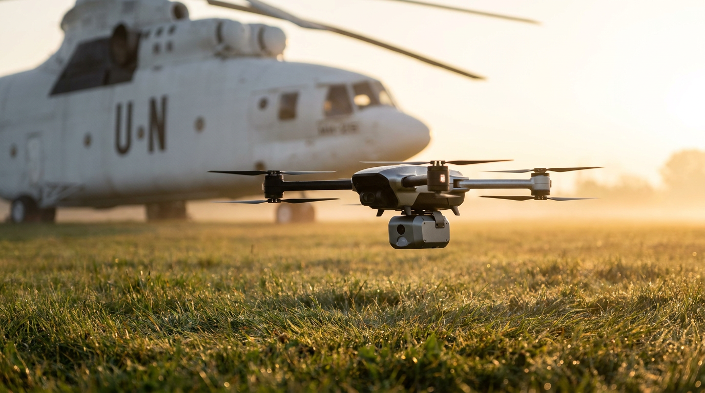
But a rapid convergence of defense technology, artificial intelligence, and autonomous robotics is fundamentally altering the mathematics of mine clearance. Driven by the urgent scale of contamination in recent conflicts, technologists are deploying autonomous drone swarms equipped with advanced sensors to map and analyze minefields from the sky. This shift moves human operators out of the immediate blast radius and transforms demining from a physical crawl into a high-speed, data-driven operation.[2][4][7]
The most immediate breakthrough has been in the realm of optical analysis. Historically, the initial "non-technical survey" of a suspected minefield required teams to physically visit perimeters and interview locals—a process that could take weeks. Today, autonomous drones fly grid patterns over contaminated areas, capturing thousands of high-resolution images. The HALO Trust, the world's largest humanitarian demining organization, logged over 85,800 drone flight minutes in a single conflict zone in 2024.[1][2]
However, human analysts cannot process that volume of visual data efficiently. By partnering with cloud computing providers, demining organizations have integrated machine learning models trained to spot the subtle visual signatures of explosive ordnance. This AI pipeline has reduced the time required to analyze aerial imagery from five days to a matter of hours, allowing clearance teams to pinpoint hazards with unprecedented speed.[1]

The technology is also benefiting from cross-industry innovation. Algorithms originally designed for civilian environmental monitoring are being repurposed for defense and humanitarian applications. For example, Norwegian technology firm Biodrone successfully adapted computer vision models—initially built to count trees and track unauthorized tire marks in national parks—to identify surface-level explosives in varied terrains, from the forests of Eastern Europe to the arid landscapes of Iraq.[4]
While optical AI excels at spotting surface threats, it cannot see underground. This is a critical limitation, as many legacy minefields feature buried explosives. Furthermore, modern armed forces increasingly utilize plastic-cased mines that are entirely invisible to traditional magnetic metal detectors. To solve this, aerospace engineers have begun miniaturizing complex radar systems so they can be carried by low-altitude commercial drones.[3][5]
A consortium of European defense tech firms, including Lithuanian startup Broswarm, has developed autonomous platforms equipped with the world's lightest synthetic aperture radar (X-SAR). When fused with AI object detection, these drones can identify both metallic and plastic-cased threats buried up to 0.5 meters beneath the surface. The system creates high-accuracy 3D maps of the subterranean environment, highlighting anomalies that match the geometric profiles of known explosives.[3]
When fused with AI object detection, these drones can identify both metallic and plastic-cased threats buried up to 0.5 meters beneath the surface.
Academic research corroborates the efficacy of this multi-modal approach. Studies published by the IEEE demonstrate that fusing data from drone-mounted ground-penetrating radar and magnetometers significantly enhances detection rates while filtering out the background noise of battlefield debris. At the Ulm University of Applied Sciences, researchers developed automated sensor platforms that incorporate specific target signatures, drastically reducing the false alarm rate that plagues manual demining.[5][6]

The deployment of these technologies is also shifting in response to changing battlefield tactics. The UN Mine Action Service notes that in contemporary conflicts, the majority of mines are deployed remotely—scattered across the surface by artillery, helicopters, or drones, rather than buried by hand. This surface-level scattering makes aerial detection via drone highly effective, allowing AI systems to map vast swathes of newly contaminated territory almost immediately after deployment.[2]
Despite these breakthroughs, the evidence clearly delineates the limitations of the technology. Drones are exceptional diagnostic tools, but they are not a complete clearance solution. Once a drone maps a threat, the physical neutralization still requires intervention. While remotely operated ground robots can detonate some devices, human experts remain vital for the final, delicate stages of rendering an area safe.[2][7]
Furthermore, the technological arms race is bidirectional. As demining tech advances, so do the explosives themselves. Deminers are increasingly encountering "high-tech" mines equipped with seismic or magnetic influence sensors. These devices are designed to detonate when they detect the approach of a vehicle, a human footstep, or even the magnetic field of a low-flying drone, adding a new layer of complexity to aerial surveys.[2]
To mitigate these risks, the latest autonomous systems employ a "human-in-the-loop" operational framework. Drones stream real-time magnetic field data to operators stationed at a safe distance, who supervise the flight paths via virtual reality interfaces. This ensures that if a drone detects a highly sensitive magnetic trigger, it can automatically alter its altitude or abort the pass before initiating a detonation.[6][7]

The ultimate metric of success in humanitarian mine action is not just the number of devices removed, but the restoration of land for productive use. By accelerating the survey and detection phases tenfold, AI and drone technologies are allowing displaced civilians to return home and farmers to replant their fields years ahead of traditional schedules.[1][2]
This technological shift is also reshaping the local economies of post-conflict zones. Rather than solely employing locals for the dangerous physical labor of manual prodding, organizations are training community members to pilot autonomous drones and operate AI analysis software. This provides stable, high-skill income in regions where economic opportunities have been devastated by war.[1]
The integration of artificial intelligence and autonomous robotics into humanitarian demining represents a rare, unequivocally positive application of defense technology. While the global landmine crisis remains vast, the transition from a perilous, manual crawl to a precise, data-driven aerial operation is saving lives, protecting operators, and accelerating the reclamation of the earth.[1][3][7]
How we got here
1990s-2010s
Humanitarian demining relies almost entirely on handheld metal detectors and physical prodding, a slow and dangerous process.
2018
Humanitarian organizations begin testing commercial drones for basic aerial mapping of suspected minefields.
2022-2023
Cloud computing and machine learning are introduced to analyze drone imagery, drastically cutting survey times.
2025-2026
Drones equipped with miniaturized synthetic aperture radar successfully detect buried, plastic-cased explosives.
Viewpoints in depth
Humanitarian Organizations
Focused on the speed of returning land to civilian use and reducing operator casualties.
For groups like the HALO Trust and the UN Mine Action Service, the primary value of AI is scale. Traditional methods are too slow to address the 110 million unexploded mines globally. By reducing survey analysis from days to hours, they can prioritize which fields to clear first, allowing farmers to plant crops and displaced people to return home much faster.
Defense Technologists
Focused on sensor miniaturization, algorithmic accuracy, and overcoming hardware limitations.
Engineers and software developers view the challenge as a data problem. Their focus is on fusing multiple data streams—optical imagery, ground-penetrating radar, and magnetometers—to filter out the "noise" of battlefield scrap metal. The breakthrough of mounting synthetic aperture radar on lightweight drones represents a major leap in overcoming the invisibility of plastic-cased mines.
Field Operators
Focused on practical reliability, false-alarm reduction, and physical safety.
For the deminers on the ground, technology is only useful if it is highly reliable. While they welcome drones that remove them from the blast radius during the survey phase, they remain cautious about the physical clearance phase. Drones cannot dig up or defuse the mines, meaning human expertise and extreme caution are still required to finish the job.
What we don't know
- How effectively these AI models will adapt to entirely new terrains, such as dense jungles, without extensive retraining.
- Whether the cost of miniaturized radar systems will drop enough to be deployed universally across all underfunded demining regions.
- How quickly adversarial forces will develop new countermeasures to specifically evade drone-based radar detection.
Key terms
- Synthetic Aperture Radar (SAR)
- A form of radar that creates two-dimensional images or three-dimensional reconstructions of objects, capable of penetrating the ground to find buried items.
- Unexploded Ordnance (UXO)
- Explosive weapons such as bombs, shells, grenades, and landmines that did not explode when they were employed and still pose a lethal risk.
- Non-Technical Survey
- The initial phase of demining involving mapping and gathering information about a hazardous area without physically entering it.
Frequently asked
How do drones detect plastic landmines?
They use miniaturized synthetic aperture radar (SAR) and ground-penetrating radar, which can detect the physical shape and density of objects underground, rather than relying on magnetic metal detection.
Can drones physically remove the landmines?
No. Drones are used for mapping and detection. Once a threat is identified, it must be neutralized by remotely operated ground robots or highly trained human experts.
Why is artificial intelligence necessary for this?
Drones capture thousands of high-resolution images and radar data points per flight. AI is required to process this massive volume of data quickly, spotting visual and geometric anomalies that human eyes might miss.
Sources
Source coverage
7 outlets
3 viewpoints surfaced


[1]The HALO TrustHumanitarian Organizations
Eradicating landmines with drones and AI
Read on The HALO Trust →[2]UN NewsHumanitarian Organizations
In conflict zones, deminers must innovate to avoid being left behind
Read on UN News →[3]AgmisDefense Technologists
Broswarm – Revolutionizing Underground Object Detection
Read on Agmis →[4]BiodroneDefense Technologists
Mine Clearance in Ukraine: AI-powered drones for landmine detection
Read on Biodrone →[5]Aerospace & DefenceDefense Technologists
Radar Drones for Safe Landmine Detection
Read on Aerospace & Defence →[6]IEEE AccessDefense Technologists
Automated Airborne Ordnance Detection Via Data Fusion of Ground Penetrating Radar and Magnetometers
Read on IEEE Access →[7]Factlen Editorial TeamPolicy & Oversight
Synthesis by Factlen editorial team
Read on Factlen Editorial Team →
Every angle. Every day.
Get defense security stories with full source coverage and perspective breakdowns delivered to your inbox.