
Lidar vs. Radar vs. Camera: The Definitive Comparison of Autonomous Vehicle Sensor Suites
The autonomous vehicle industry is divided over how cars should perceive the world, pitting camera-only AI systems against multi-sensor arrays. Understanding the physics behind Lidar, radar, and cameras reveals why your vehicle's driver-assistance features behave the way they do in rain, glare, and darkness.

- Multi-Sensor Pragmatists
- Maintain that the mathematical certainty of Lidar combined with the weather-penetration of radar is a non-negotiable requirement for true autonomy.
- Camera-Only Advocates
- Argue that pure AI trained on high-resolution video is the only scalable path to human-like driving, viewing other sensors as unnecessary crutches.
- Cost-Conscious Automakers
- View Lidar as an expensive luxury, preferring to rely on the cheap, proven combination of cameras and basic radar for standard consumer features.
Key terms
- Point Cloud
- A highly accurate 3D digital map of the environment created by millions of individual laser measurements from a Lidar sensor.
- Sensor Fusion
- The software process of combining inputs from multiple different types of sensors to create a single, reliable model of the world.
- Solid-State Lidar
- A newer generation of Lidar that uses microchips instead of physically spinning mirrors to direct lasers, drastically reducing cost and size.
- Time-of-Flight
- The method used by Lidar and radar to determine distance by measuring exactly how long it takes a wave of light or radio energy to bounce back.
Key points
- Cameras provide high-resolution color and context but struggle in bad weather and require heavy AI to infer depth.
- Radar penetrates fog and rain perfectly to measure speed and distance, but lacks the resolution to identify object shapes.
- Lidar creates flawless 3D maps in total darkness but is expensive and can be blinded by heavy snow or dense fog.
- The industry is largely converging on 'sensor fusion,' combining all three technologies to ensure redundant safety.
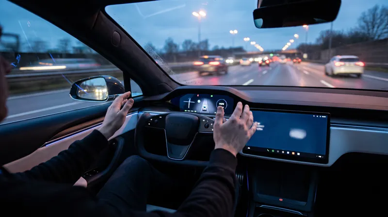
The automotive industry is currently locked in a billion-dollar philosophical debate over how a car should see the world. On one side, companies like Tesla argue that since human beings drive using only two optical sensors (eyes) and a neural network (the brain), vehicles can achieve full autonomy using only cameras and artificial intelligence. On the other side, companies operating true robotaxis, such as Waymo and Cruise, insist that cameras are too easily blinded by the elements, requiring a redundant suite of lasers and radio waves to guarantee passenger safety.[1][4]
For the average consumer, this is not an abstract academic debate. The sensors bolted behind the rearview mirror and hidden inside the front bumper dictate exactly how a new vehicle behaves on the morning commute. The resolution to this engineering tension lies in the physics of the electromagnetic spectrum, as no single sensor is perfect. Cameras see color but lack inherent depth; radar sees depth and speed but lacks shape; Lidar sees perfect three-dimensional shape but struggles in heavy weather and carries a premium price tag.[2]
When a driver activates adaptive cruise control on the highway, they are handing their safety over to the strengths and weaknesses of these devices. Understanding the mechanics of each sensor explains why a vehicle might confidently navigate a foggy mountain pass but suddenly beep and disengage its steering assist when driving directly into a low, glaring winter sun.[1][4]
Cameras are passive sensors, meaning they capture ambient light bouncing off objects in the environment. They are the only sensors in the automotive toolkit capable of reading the numbers on a speed limit sign, identifying the red or green state of a traffic light, or distinguishing between a solid yellow line and a dashed white lane marker. Because they operate in the visible light spectrum, they provide the highest-resolution contextual data available to the vehicle's computer.[2]
However, because they rely entirely on ambient light, cameras are easily compromised. Direct sunlight glare, heavy rain, or a mud-splattered windshield severely degrades their capability. Furthermore, a single camera image is two-dimensional. To determine how far away an object is, camera-only systems must use complex artificial intelligence to infer depth from the flat pixels, a computationally heavy process that can occasionally be tricked by optical illusions, such as a picture of a person painted on the back of a commercial truck.[3]
Radar, which stands for Radio Detection and Ranging, solves the depth problem by emitting active radio waves, typically at 77 gigahertz, and measuring how long they take to bounce back to the receiver. Because radio waves are physically long, they pass effortlessly through fog, rain, and snow. This makes radar the ultimate all-weather failsafe for detecting the exact distance and relative speed of the car ahead, ensuring the vehicle can brake in a whiteout snowstorm.[1][2]
The fatal flaw of traditional automotive radar is its exceptionally low spatial resolution. It can easily determine that a large, dense object is exactly 100 meters away, but it cannot easily distinguish whether that object is a stalled fire truck blocking the lane or a metal overhead bridge safely spanning the highway. To prevent the car from constantly slamming on the brakes for overpasses, engineers often program radar systems to ignore stationary returns at highway speeds, a software compromise that has historically led to high-profile collisions.[2]
The fatal flaw of traditional automotive radar is its exceptionally low spatial resolution.
Enter Lidar, or Light Detection and Ranging. Instead of broad radio waves, Lidar fires millions of targeted laser pulses per second, usually in the 905 to 1550 nanometer wavelength range. By measuring the time of flight for each individual photon as it bounces back, the sensor builds a flawless, high-resolution three-dimensional topographical map of the world, known in the industry as a point cloud.[1]
Unlike cameras, Lidar provides exact, mathematically certain distance measurements without needing artificial intelligence to guess the depth. Unlike radar, it has the granular resolution to tell the difference between a pedestrian stepping into the road and a mailbox standing on the curb. Because it generates its own light source, it works perfectly in pitch blackness, giving commercial robotaxis their signature cautious but highly precise nighttime driving style.[1][3]
Yet, Lidar is not magic. Because it relies on the optical spectrum, it suffers in heavy precipitation. Snowflakes, exhaust steam, and dense fog droplets can scatter the laser pulses, creating "ghost" obstacles in the point cloud that confuse the vehicle's computer. Furthermore, the mechanical spinning units historically cost tens of thousands of dollars, though the advent of solid-state Lidar—which uses microchips to steer the lasers without moving parts—is rapidly driving that price down to a few hundred dollars per unit.[1][2]
For the everyday car buyer, the industry standard has largely become "sensor fusion." This pragmatic approach acknowledges that cameras, radar, and Lidar have overlapping strengths that perfectly cancel out each other's weaknesses. A central computing module takes the color and context from the camera, the all-weather speed data from the radar, and the precise 3D shape from the Lidar, weaving them together into a single, robust digital twin of the environment.[2][4]
The counter-movement argues that sensor fusion is an expensive crutch. Proponents of pure vision posit that adding Lidar and radar creates conflicting data streams—what happens when the radar says the road is clear, but the camera sees an obstacle? By feeding billions of miles of human driving video into massive supercomputers, these automakers aim to train AI to understand depth and context purely from camera pixels, eliminating the need for expensive secondary hardware.[3][4]
Interestingly, researchers are now exploring hybrid software architectures, such as "LiDAR-as-Camera" systems. These frameworks take the 3D point clouds generated by Lidar and project them into 2D image spaces, allowing the highly optimized AI models originally built for cameras to process Lidar data natively. This bridges the gap between the two warring engineering philosophies, maximizing the hardware's physical certainty with the software's contextual intelligence.[3]
For the consumer, the sensor suite ultimately dictates the vehicle's operational design domain—the specific conditions under which the car can legally and safely drive itself. A camera-only system might require the driver to keep their hands on the wheel and eyes on the road at all times, ready to take over when the system gets confused by a shadow or a sudden downpour.[2]
Conversely, true "eyes-off" autonomous systems universally rely on the redundant combination of all three sensors. As solid-state Lidar becomes cheaper and imaging radar resolution improves, the vehicles arriving in consumer driveways over the next five years will increasingly adopt this multi-sensor approach, turning the abstract physics of light and radio waves into tangible peace of mind on the highway.[1][4]
Frequently asked
Why does my car brake for shadows?
Camera-based systems must use AI to infer depth from a flat 2D image. High-contrast shadows can trick the software into perceiving a solid object where none exists.
Can Lidar see through heavy fog?
No. Because Lidar uses pulses of light, dense fog droplets and heavy snow can scatter the lasers, reducing its effective range and creating false obstacles.
Why did some automakers remove radar?
Some manufacturers removed radar to avoid 'sensor disagreement'—situations where the camera says the road is clear but the low-resolution radar detects a false positive, causing phantom braking.
What is sensor fusion?
Sensor fusion is the process of combining data from cameras, radar, and Lidar into a single computer model, allowing the strengths of one sensor to cover the weaknesses of another.
Sources
Source coverage
4 outlets
3 viewpoints surfaced



- [1]ResearchGateMulti-Sensor Pragmatists
Comparative Analysis of LiDAR, Radar, and Camera Sensors for Autonomous Perception: Principles, Challenges, and Fusion Strategies
Read on ResearchGate → - [2]ResearchGateMulti-Sensor Pragmatists
Perception Technologies for Autonomous Transportation: A Comparative Analysis of LiDAR, Radar, Camera, and Sonar
Read on ResearchGate → - [3]PMCMulti-Sensor Pragmatists
LiDAR-as-Camera for End-to-End Driving
Read on PMC → - [4]Factlen Editorial Team
Synthesis by Factlen editorial team
Read on Factlen Editorial Team →
Comments
Every angle. Every day.
Get automotive stories with full source coverage and perspective breakdowns delivered to your inbox.