
The R-Factor, K-Factor, and LS-Factor: How the Universal Soil Loss Equation Predicts Erosion Rates from Rainfall, Soil Type, and Topography
The Universal Soil Loss Equation uses six distinct variables to calculate long-term soil erosion rates across different landscapes. By quantifying rainfall, soil erodibility, and topography, the model allows conservationists to predict and mitigate agricultural and environmental degradation.
By Hao Li

- Agricultural Planners
- Focus on optimizing the C and P factors to maximize crop yield while minimizing topsoil loss.
- Watershed Managers
- Focus on the downstream effects of the total soil loss as sediment yield that impacts water quality.
- Climate Researchers
- Focus on how shifting R-factors due to changing weather patterns will alter historical erosion baselines.
Perspectives this story doesn't cover
- Urban Developers
- Forestry Managers
At a glance
- The Universal Soil Loss Equation (USLE) uses six variables to predict long-term soil erosion rates.
- The R-factor measures the kinetic energy of rainfall, which drives the initial detachment of soil particles.
- The K-factor quantifies the inherent vulnerability of different soil types, with silty soils being the most erodible.
- The LS-factor calculates how slope length and steepness accelerate water runoff and increase scouring power.
- Land managers can alter the C-factor (cover) and P-factor (practices) to mathematically reduce baseline erosion rates.
- The equation specifically models sheet and rill erosion, excluding wind or deep gully erosion.
The Universal Soil Loss Equation (USLE) predicts long-term average annual erosion rates by multiplying six specific variables: rainfall erosivity (R), soil erodibility (K), slope length (L), slope steepness (S), cover management (C), and support practices (P). Together, these factors translate the physical forces of weather and topography into a quantifiable metric of soil loss, typically measured in metric tons per hectare per year.[2][5]
Developed over decades of field experimentation by the U.S. Department of Agriculture, the USLE was first published in 1965 in USDA Agriculture Handbook 282, and later updated in 1978 in Handbook 537. It operates on a simple mechanical principle: erosion is the product of the kinetic energy applied to the landscape and the landscape's inherent resistance to that energy. The model has since been adopted in more than 100 countries to guide conservation planning.[1][5]
The R-factor, or rainfall erosivity, represents the driving meteorological force behind soil detachment. It accounts for both the total volume of rainfall and the kinetic energy of individual raindrop impacts during intense storms, measured in megajoule millimeters per hectare per hour per year.[4][5]
In regions with highly variable climates, such as semi-desert environments, the R-factor becomes the dominant variable in the equation. Infrequent but severe rain events deliver massive kinetic energy to dry, unprotected earth, driving sudden and severe erosion spikes that the equation captures through localized rainfall data.[4]
Resisting this meteorological force is the K-factor, which quantifies the inherent erodibility of the soil itself. This variable is determined by the soil's physical composition—specifically the proportions of silt, sand, and clay—as well as its organic matter content and permeability.[1][2]
Resisting this meteorological force is the K-factor, which quantifies the inherent erodibility of the soil itself.
Soils high in silt and very fine sand are typically the most vulnerable to detachment, resulting in higher K-factor values. Conversely, soils with high clay content resist detachment due to strong cohesive forces, while sandy soils allow rapid water infiltration, reducing the surface runoff that transports detached particles.[2]
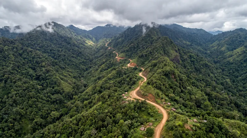
The topographic influence on erosion is captured by the LS-factor, a combined metric representing slope length (L) and slope steepness (S). As water moves down a gradient, it accumulates both volume and velocity, exponentially increasing its capacity to scour and transport soil.[3][5]
In steep alpine grasslands and mountainous terrains, the LS-factor often overrides other variables. Even moderate rainfall on a severe gradient can generate enough runoff velocity to strip topsoil, making topographic mapping essential for accurate USLE application in high-altitude environments.[3]
The final two variables, the C-factor (cover and management) and the P-factor (support practices), represent human intervention. The C-factor measures the protective effect of vegetation, crop residues, or mulch, which intercept raindrops before they strike the soil surface.[1][2]
The P-factor accounts for structural conservation methods, such as contour farming, terracing, or retention basins. By adjusting the C and P factors within the equation, land managers can mathematically model how different agricultural practices will reduce the baseline erosion rate established by the R, K, and LS factors.[2][5]
While the original USLE was designed primarily for agricultural landscapes, it has strict boundaries. As noted by the Ontario Ministry of Agriculture, Food and Rural Affairs, "The USLE only predicts the amount of soil loss that results from sheet or rill erosion on a single slope and does not account for additional soil loss that might occur from gully, wind or tillage erosion."[2]
To address these limitations, the Revised Universal Soil Loss Equation (RUSLE) was released in 1992, integrating geographic information systems to model complex topographies. Today, as detailed in a 2018 comprehensive review published in Hydrology and Earth System Sciences, the USLE family of models remains the international standard for environmental risk assessment, providing a universal language for preserving the foundation of the global food web.[5]
Terms to know
- Universal Soil Loss Equation (USLE)
- An empirical mathematical model used worldwide to estimate average annual soil erosion from water runoff.
- Rainfall Erosivity (R-factor)
- A metric quantifying the kinetic energy of raindrop impacts and the volume of rainfall during storm events.
- Soil Erodibility (K-factor)
- A measure of a specific soil type's inherent susceptibility to detachment and transport by water, based on its physical composition.
- Topographic Factor (LS-factor)
- A combined variable representing the length and steepness of a slope, which dictates the velocity of surface runoff.
- Cover Management (C-factor)
- A variable representing the protective effect of vegetation, crops, or mulch in preventing raindrops from striking bare earth.
- Support Practice (P-factor)
- A metric accounting for physical conservation structures, such as terracing or contour farming, that slow water runoff.
Questions readers ask
What is the Universal Soil Loss Equation?
The USLE is a mathematical model developed in the 1960s to predict the long-term average annual rate of soil erosion on a specific slope based on rainfall, soil type, topography, and management practices.
What does the R-factor measure?
The R-factor, or rainfall erosivity, measures the kinetic energy and volume of rainfall. It represents the primary meteorological force that detaches soil particles during a storm.
How does topography affect soil erosion?
Topography is represented by the LS-factor, which combines slope length and steepness. Steeper and longer slopes allow water runoff to accumulate more volume and velocity, exponentially increasing its ability to wash away soil.
Does the USLE predict all types of erosion?
No. The USLE specifically predicts sheet and rill erosion caused by water runoff. It does not account for wind erosion, gully erosion, or tillage erosion.
Sources
Source coverage
6 outlets
3 viewpoints surfaced






- [1]NRCS - IowaAgricultural Planners
Index Section I - (USLE) Erosion Prediction
Read on NRCS - Iowa → - [2]Ontario Ministry of AgricultureAgricultural Planners
Universal Soil Loss Equation
Read on Ontario Ministry of Agriculture → - [3]PMCClimate Researchers
Modification of the RUSLE slope length and steepness factor (LS-factor) based on rainfall experiments at steep alpine grasslands
Read on PMC → - [4]MDPIClimate Researchers
Rain Erosivity Factor (R) and Topographic Factor (LS) of the Universal Soil Loss Equation (USLE) in a Semi-Desert Area
Read on MDPI → - [5]Hydrology and Earth System SciencesWatershed Managers
A review of the Universal Soil Loss Equation (USLE) and its family of models
Read on Hydrology and Earth System Sciences → - [6]Factlen Editorial Team
Synthesis by Factlen editorial team
Read on Factlen Editorial Team →
Comments
More in Environment
See all →Climate Modeling
The 2.5-Degree Threshold: How the Paris Agreement's Temperature Goal Maps Long-Term Climate Risk
6 sources

Hydrological Cycle
The 96.5 Percent Saline Constraint: How Earth's Hydrological Architecture Limits Accessible Freshwater to 0.007 Percent
6 sources

Water Accounting
The Blue, Green, and Grey Water Footprint: How the ISO 14046 Standard Calculates Total Water Use
7 sources

Biodiversity Tech
How Environmental DNA is Rewriting the Rules of Wildlife Conservation
6 sources

Every angle. Every day.
Get Environment stories with full source coverage and perspective breakdowns delivered to your inbox.