
Mapping Dark Fleets: The Accuracy and Limits of Commercial RF Satellite Geolocation
Commercial satellite constellations are mapping the raw radio frequency emissions of uncooperative ships, closing the visibility gap left by traditional tracking systems.
By Aarav Khanna

Share this story
In short
- Commercial RF satellites track vessels by intercepting their raw electromagnetic emissions, such as marine radar and VHF radios.
- These systems close the visibility gap created when ships disable their cooperative AIS transponders to hide illicit activities.
- Modern RF constellations can geolocate a non-cooperative emitter to within 1 kilometer across a 300,000-square-kilometer area.
The global maritime tracking system relies on a fundamental assumption of cooperation: vessels over 300 gross tons are required to broadcast their identity and location. When that cooperation is withdrawn—as it is by illegal fishing fleets, sanctioned oil tankers, and maritime militias—the ocean goes dark.
In contested zones, entire fleets have been observed disappearing from the Automatic Identification System (AIS) network to harvest hundreds of millions of dollars in illicit catch. Closing that visibility gap requires shifting from cooperative beacons to passive interception, a transition now being driven by commercial satellite constellations that map the raw radio frequency (RF) emissions of uncooperative ships.[4]
The infrastructure of maritime domain awareness has historically depended on AIS, a VHF-based system designed primarily for collision avoidance. Because AIS transponders automatically broadcast a ship's position, course, and speed, they provide a highly detailed picture of compliant traffic. However, the system's reliance on self-reporting is its primary vulnerability. As noted by the European Space Agency regarding the Unseenlabs constellation, "While AIS is the most conventional maritime security shipborne system, it can be turned-off voluntarily, easily jammed or spoofed, leading to significant blind spots when monitoring the maritime traffic."[2]
When a vessel disables its AIS, it becomes a "dark" target, invisible to standard commercial tracking platforms. Finding these vessels across millions of square miles of open ocean requires sensors that do not ask for a ship's cooperation. This is the operational gap that commercial RF satellite operators, such as HawkEye 360 and Unseenlabs, have begun to fill over the past decade.[1][5]
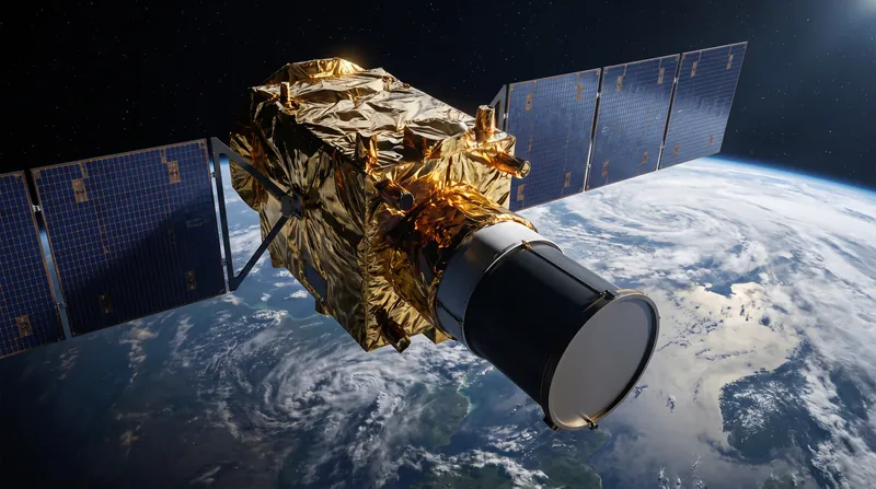
Rather than waiting for a formatted AIS message, these satellite constellations listen for the incidental electromagnetic noise generated by a ship's routine operations. Marine navigation radars, VHF radios, satellite phones, and even microwave communication links emit distinct RF signatures. By capturing these emissions from low Earth orbit, analysts can detect the presence of a vessel even when it is actively attempting to hide.[6]
The mechanics of space-based RF geolocation rely on precise timing and orbital geometry. HawkEye 360, an American geospatial analytics company, was founded in 2015 "to leverage small satellites for the commercial collection and geolocation of RF signals." The company operates its satellites in clusters of three. When a ship emits a radio signal, the electromagnetic wave reaches each of the three satellites at slightly different times and with slight frequency shifts due to the Doppler effect.[1]
By measuring the Time of Arrival (TOA) and Frequency of Arrival (FOA) across the cluster, the system uses multilateration to calculate the signal's origin. The onboard software-defined radios (SDR) are capable of frequency tuning from 70 MHz to 6 GHz, with an instantaneous bandwidth of up to 56 MHz, allowing them to scan a wide swath of the electromagnetic spectrum simultaneously.[1]
European operator Unseenlabs employs a different architectural approach, utilizing a proprietary mono-satellite technology rather than formation-flying clusters. Each nanosatellite in their constellation is designed to independently detect, characterize, and geolocate RF emitters. During a single orbital pass, one of these satellites can cover an area of up to 300,000 square kilometers.
The accuracy of these commercial systems has reached levels previously reserved for classified military platforms. Unseenlabs reports that the geolocation of a detected emitter can achieve an accuracy of 1 kilometer. This precision allows maritime authorities to narrow their search grids drastically, vectoring coast guard cutters or surveillance aircraft directly to the coordinates of a suspected dark vessel.
The evidence base for RF geolocation demonstrates its utility in tracking illegal, unreported, and unregulated (IUU) fishing. Distant-water fishing fleets frequently operate at the edges of exclusive economic zones (EEZs), turning off their AIS transponders before crossing maritime boundaries to fish illegally. The so-called dark fleet has harvested an estimated $440 million to $500 million worth of squid in North Korean waters since 2017. RF satellites capture the emissions from their marine radars—which the crews must keep active to avoid colliding with one another in the dark.[4]
However, the data also reveals the strict limitations of passive RF tracking. The method depends entirely on the target vessel emitting some form of electromagnetic energy. If a ship enforces strict emission control (EMCON)—turning off its radar, radios, and all external transmitters—it becomes electromagnetically silent and invisible to RF satellites.[6]
To counter this limitation, intelligence analysts fuse RF data with Synthetic-aperture radar (SAR) imagery. SAR is an active sensor that transmits high-frequency microwave pulses toward the Earth's surface and measures the backscattered echoes. Because it provides its own illumination, SAR can generate high-resolution images of physical structures, such as a ship's steel hull, through heavy cloud cover and in total darkness.[3]
When a vessel is electromagnetically silent, SAR satellites can still detect its physical presence on the water. By overlaying SAR detections, RF geolocations, and cooperative AIS tracks, analysts can isolate the dark fleet. A physical ship detected by SAR that lacks a corresponding AIS signal but emits a localized RF signature represents a highly suspicious target.[3]
The democratization of this intelligence marks a structural shift in global security. A decade ago, the ability to track non-cooperative vessels from space was the exclusive domain of major state intelligence agencies. Today, non-governmental organizations, environmental groups, and smaller nations can purchase commercial RF and SAR data to monitor their own waters.[5]
This commercial availability complicates the strategic calculus for state-sponsored maritime militias and sanctioned fleets. The traditional tactic of disabling a transponder to conduct a ship-to-ship oil transfer or to loiter in a contested zone is no longer a guarantee of anonymity. The electromagnetic spectrum itself has become a transparent domain.[7]
The next phase of this capability involves reducing the latency between detection and enforcement. As constellation sizes grow, the revisit time—the interval between satellite passes over a specific area—is shrinking. Operators are targeting revisit times of under one hour, moving the industry closer to persistent, real-time monitoring of the global ocean.
Terms to know
- Automatic Identification System (AIS)
- A cooperative tracking system that uses VHF transponders on ships to broadcast their identity, position, and speed.
- Radio Frequency (RF) Geolocation
- The process of determining the physical location of an object by intercepting and analyzing its electromagnetic emissions.
- Synthetic-aperture radar (SAR)
- An active satellite sensor that transmits microwave pulses to create high-resolution images of the Earth's surface, regardless of weather or daylight.
- Multilateration
- A navigation technique that calculates the position of an emitter by measuring the difference in the time and frequency of the signal's arrival at multiple receivers.
- Emission Control (EMCON)
- The practice of restricting or managing the use of electromagnetic, acoustic, or other emitters to conceal a vessel's presence.
Different angles
Maritime Intelligence Analysts
Focus on the operational advantage of passive detection over cooperative tracking.
For intelligence analysts tracking sanctions evasion and illicit trade, the primary value of RF geolocation lies in its unspooferable nature. While a ship's captain can easily manipulate an AIS transponder to broadcast a false location, they cannot easily alter the physical physics of a marine radar emission. Analysts argue that this raw electromagnetic data provides a ground truth that cooperative systems lack, fundamentally changing how maritime blockades and embargoes are monitored.
Defense Planners
Emphasize the limitations of commercial systems against sophisticated state adversaries.
Military strategists view commercial RF data as a valuable supplementary layer, but they caution against over-reliance in high-end conflicts. State-operated naval vessels and sophisticated maritime militias are trained in strict emission control (EMCON). If a fleet goes completely electromagnetically silent, passive RF satellites will detect nothing. Planners argue that while commercial constellations excel at catching careless or commercial violators, active military-grade sensors remain necessary for tracking disciplined adversaries.
Environmental NGOs
Leverage the democratization of satellite data to enforce conservation boundaries.
Organizations like Global Fishing Watch view the fusion of RF, SAR, and AIS data as a critical tool for ocean conservation. Historically, developing nations lacked the coast guard resources to patrol their massive exclusive economic zones, allowing distant-water fleets to overfish with impunity. NGOs argue that commercially available satellite intelligence levels the playing field, allowing under-resourced nations to vector their limited patrol assets directly toward active, non-cooperative targets.
- Maritime Intelligence Analysts
- Focus on the operational advantage of passive detection over cooperative tracking.
- Commercial RF Operators
- Emphasize the democratization of space-based SIGINT and the rapid deployment of small satellite clusters.
- Defense Planners
- Focus on the electromagnetic order of battle and the limits of commercial data in high-end conflict.
- Environmental NGOs
- Leverage the democratization of satellite data to enforce conservation boundaries.
Perspectives this story doesn't cover
- Sanctioned State Operators
- Commercial Shipping Crews
Sources
Source coverage
7 outlets
4 viewpoints surfaced




- [1]WikipediaCommercial RF Operators
HawkEye 360
Read on Wikipedia → - [2]WikipediaCommercial RF Operators
Automatic identification system
Read on Wikipedia → - [3]WikipediaCommercial RF Operators
Synthetic-aperture radar
Read on Wikipedia → - [4]WikipediaCommercial RF Operators
China's dark fleet
Read on Wikipedia → - [5]Global Fishing WatchEnvironmental NGOs
Map and Data
Read on Global Fishing Watch → - [6]TechTargetDefense Planners
Radio frequency (RF)
Read on TechTarget → - [7]Factlen Editorial TeamMaritime Intelligence Analysts
Synthesis by Factlen editorial team
Read on Factlen Editorial Team →

More in Defense & Security
See all →RouterOS Security
MikroTrick Exploit Chain Grants Unauthenticated Full Admin Access to Global MikroTik Routers
5 sources

Hybrid Warfare
Poland Confirms Sabotage of Starlink Ground Station as Russian Drones Crash in NATO-Member Romania
6 sources

Orbital Reconnaissance
The GSD-Swath Trade-Off: How Ground Sample Distance and Coverage Area Dictate Satellite Reconnaissance Utility
7 sources
Operational Art
The Source of Power: How a Center of Gravity is Identified and Targeted in Operational Art
7 sources

Comments
Every angle. Every day.
Get Defense & Security stories with full source coverage and perspective breakdowns, free every day.