
How Open-Source Intelligence and AI Are Eradicating the Ocean's 'Dark Fleets'
A convergence of commercial satellite imagery and artificial intelligence is stripping away the anonymity of the open ocean, providing concrete evidence that marine protected areas are successfully deterring illegal fishing.
By Hao Li

Share this story
For decades, the sheer vastness of the global ocean provided an impenetrable cloak for environmental crime. Illegal, unreported, and unregulated (IUU) fishing operations routinely exploited the horizon, deploying "dark fleets" that disabled their mandatory tracking transponders to plunder protected waters. Traditional maritime enforcement, reliant on physical coast guard patrols and limited aerial reconnaissance, was mathematically outmatched by the millions of square miles of open water. The ocean was simply considered too big to watch, allowing illicit networks to operate with near-total impunity.
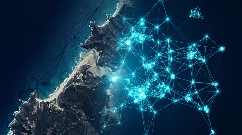
That era of maritime impunity is rapidly closing. A convergence of open-source intelligence (OSINT), commercial satellite constellations, and artificial intelligence is fundamentally democratizing ocean surveillance. By fusing disparate public datasets—from radar bounces to optical imagery—civilian watchdogs and academic researchers are now generating actionable intelligence that rivals the capabilities of state-level military agencies. This shift is transforming ocean conservation from a reactive guessing game into a precise, data-driven science, yielding concrete evidence that global marine protection efforts are actually working.
The primary claim emerging from this new surveillance architecture is that Marine Protected Areas (MPAs)—often criticized as mere "paper parks" lacking real enforcement—are highly effective deterrents when backed by satellite monitoring. For years, conservationists struggled to prove that declaring a patch of ocean off-limits actually stopped industrial trawlers. The lack of empirical data allowed skeptics to argue that MPAs simply displaced illegal fishing rather than reducing it, casting doubt on international biodiversity targets.
Robust evidence published in the journal Science dismantled that skepticism. An exhaustive study analyzed 1,380 strictly managed MPAs worldwide, utilizing a combination of AI algorithms and satellite datasets to track industrial fishing activity. The researchers found that 78.5 percent of these protected zones experienced absolutely no commercial fishing activity. The data demonstrated that when governments establish clear legal boundaries, the overwhelming majority of the industrial fleet complies.[1]
Even in the minority of MPAs where illegal incursions were detected, the evidence suggests the violations were fleeting rather than systemic. The Science study revealed that in the zones where poaching did occur, the illicit activity averaged less than 24 hours per year for 82 percent of the affected areas. This quantitative baseline proves that while the ocean's crown jewels are occasionally breached, they are not being systematically strip-mined by industrial fleets.[1]
The mechanism driving this unprecedented visibility is the defeat of the "dark vessel" tactic. Historically, captains engaged in illicit activity would simply turn off their Automatic Identification System (AIS)—a collision-avoidance transponder required on large ships—effectively vanishing from public monitoring screens. This loophole was the foundational enabler of the global dark fleet, allowing vessels to slip into protected waters or transfer sanctioned cargo undetected.
To counter this, researchers deployed Synthetic Aperture Radar (SAR). Unlike standard optical cameras, SAR sends active radar pulses down to the ocean surface and measures the signal that bounces back, allowing it to detect large metallic structures through heavy cloud cover and in total darkness.
By feeding these radar detections into AI models developed by organizations like Global Fishing Watch, analysts can cross-reference the physical radar bounces against active AIS broadcasts. If a massive vessel appears on radar but is not broadcasting an AIS signal, the AI instantly flags it as a dark vessel.
However, the evidence pack surrounding SAR technology carries transparent uncertainties and limitations. While highly effective against large industrial trawlers, SAR struggles to reliably detect smaller wooden or fiberglass boats. Furthermore, SAR satellites do not provide continuous video feeds; their revisit times mean they capture snapshots of the ocean at specific intervals, leaving temporal blind spots where fast-moving illicit activity can still occur between satellite passes.
To address this critical weakness, the OSINT community has rapidly integrated high-cadence optical imagery to monitor the nearshore environment. The vast majority of the world's fishing fleet consists of small-scale artisanal vessels operating close to the coast, a demographic that has historically been entirely invisible to global monitoring systems. Tracking these smaller boats is essential for protecting local coastal economies from being overrun by larger, aggressive fleets.
In early 2026, Global Fishing Watch provided the evidence that this nearshore blind spot is being illuminated. The organization successfully integrated daily, high-resolution optical imagery from commercial provider Planet Labs into its public monitoring platform. This integration allowed researchers to process roughly 2 million square kilometers of coastal ocean per day, capturing the highly biodiverse waters where human maritime activity is most concentrated.
The quantitative impact of this optical data integration was immediate. By fusing Sentinel-2 and Planet Labs imagery, analysts effectively tripled their vessel detection capabilities. The upgraded AI models can now consistently identify boats as small as 5 meters in length. This breakthrough provides the first truly global assessment of small-scale vessel activity, allowing authorities to verify whether industrial ships are illegally encroaching on zones reserved exclusively for local artisanal fishers.
The proliferation of this intelligence is not merely recording crimes; it is actively forcing illicit networks to retreat. Open-source intelligence is reshaping the operational environment, making traditional smuggling and poaching routes financially unviable. As civilian watchdogs publish their findings, the cost of doing illegal business rises, forcing bad actors to adopt costlier, less efficient methods to evade detection.
Intelligence reports from the Center for Advanced Defense Studies (C4ADS) provide concrete evidence of this behavioral shift. By tracking the ultimate beneficial ownership of distant-water squid fleets and exposing their logistical networks, OSINT analysts have triggered targeted port inspections. In response, C4ADS observed illegal fishing fleets abandoning their preferred ports in Peru, transitioning to less optimal jurisdictions to avoid the newly informed authorities. The intelligence is systematically tightening the noose around transnational criminal operations.[2]
The success of these civilian initiatives has catalyzed a broader institutional embrace of open-source data. The U.S. Intelligence Community and the State Department's Bureau of Intelligence and Research recently elevated OSINT to a primary intelligence discipline, acknowledging that commercial datasets and AI analytics now frequently outpace classified collection methods in speed and scale. The government is increasingly relying on these civilian-built architectures to monitor everything from environmental degradation to sanctions evasion.
Yet, the rapid democratization of AI-driven surveillance carries its own set of systemic risks. As these powerful open-source models become universally accessible, researchers caution that without proper governance, the technology could be co-opted by the very actors it seeks to police, or used by authoritarian regimes to expand maritime territorial claims. The dual-use nature of AI means that the algorithms identifying illegal fishing could theoretically be reverse-engineered to optimize illicit extraction.
A June 2026 study published in Nature Communications highlighted these exact vulnerabilities, arguing that open-source AI must be actively steered to accelerate sustainable development goals. The international research team warned that uncoordinated deployment could deepen technological inequalities, leaving developing nations reliant on platforms controlled by Western tech companies. They advocate for participatory governance frameworks that ensure coastal nations in the Global South have equitable access to the intelligence generated in their own sovereign waters.[3]
Ultimately, the most significant limitation of this technological revolution is the "last mile" problem of physical enforcement. Satellites and AI can definitively prove that a dark vessel is plundering a marine reserve, but an algorithm cannot arrest a poacher.
The intelligence must be handed off to underfunded coast guards and local maritime police who still have to intercept the perpetrators on the water. While the ocean is no longer too big to watch, securing it still requires the political will and physical resources to act on the evidence shining down from space.
Key points
- Artificial intelligence and Synthetic Aperture Radar (SAR) are successfully identifying 'dark vessels' that disable their tracking transponders.
- A landmark study of 1,380 Marine Protected Areas found that 78.5 percent experienced zero commercial fishing activity.
- New integrations of high-resolution optical satellite imagery in 2026 have tripled detection capabilities, spotting boats as small as 5 meters.
- While satellite intelligence provides exact coordinates of illicit activity, physical interdiction by underfunded coast guards remains a critical bottleneck.
Unanswered questions
- It remains unclear how quickly illicit networks will develop new technological countermeasures to spoof or evade AI-driven radar detection.
- The long-term funding models for providing developing coastal nations with equitable, free access to commercial satellite intelligence are not yet secured.
How we got here
July 2025
A landmark study in the journal Science proves that strictly managed Marine Protected Areas successfully deter industrial fishing.
Late 2025
C4ADS reports that intelligence-led inspections are successfully forcing illegal squid fleets to abandon traditional ports in South America.
Early 2026
Global Fishing Watch integrates high-resolution optical imagery, tripling vessel detections and illuminating the nearshore artisanal fleet.
June 2026
Researchers publish a framework in Nature Communications urging global governance for open-source AI to ensure equitable access.
- Marine Conservationists
- Advocate for radical transparency and open-source data to expose and deter environmental crime.
- State Enforcement Agencies
- Focus on the practical challenges of translating satellite intelligence into physical maritime interdiction.
- Data Governance Advocates
- Emphasize the need for equitable access and ethical regulation of open-source AI tools.
Perspectives this story doesn't cover
- Artisanal Fishing Communities
- Industrial Fishing Fleet Operators
Sources
Source coverage
3 outlets
3 viewpoints surfaced



- [1]ScienceMarine Conservationists
Tracking industrial fishing activity in marine protected areas
- [2]C4ADSState Enforcement Agencies
Staying Afloat: Uncovering the Networks Enabling the Distant Water Squid Fishing Fleet
- [3]Nature CommunicationsData Governance Advocates
Steering Open-Source AI to Accelerate the Sustainable Development Goals

More in Defense & Security
See all →OSINT Applications
How Open-Source Intelligence is Revolutionizing Environmental Defense
2 sources

Intelligence Oversight
David J. Rush's Fake CIA Special Access Program and Alleged $40 Million Gold Theft
2 sources

Open-Source Intelligence
The Democratization of Intelligence: How Open-Source Analysts Are Matching State Capabilities
1 sources

Open-Source Intelligence
How Open-Source Intelligence Became the Ultimate Tool for Global Accountability
3 sources
Comments
Every angle. Every day.
Get Defense & Security stories with full source coverage and perspective breakdowns, free every day.