
How Land Pooling Finances Urban Infrastructure Without Municipal Debt or Evictions
Land readjustment allows cities to pool fragmented private parcels, build public infrastructure, and return smaller but more valuable plots to original owners. By selling a fraction of the pooled land, municipalities fund the entire development without taking on debt or displacing residents.
By Kavya Nair

Share this story
In short
- Land readjustment allows municipalities to pool private parcels, install infrastructure, and return smaller but higher-value plots to the original owners.
- By selling a small percentage of the pooled area as reserve land, cities finance the entire development without taking on municipal debt.
- The mechanism prevents forced evictions by ensuring residents remain in their original community and capture the financial upside of urbanization.
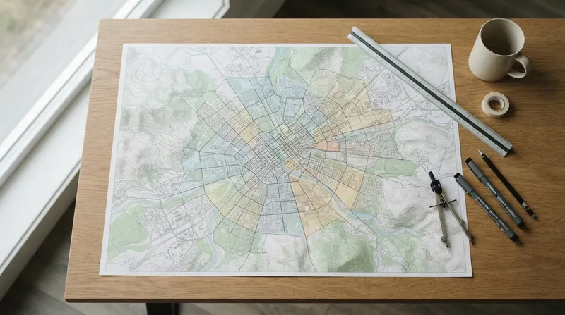
The financial viability of a new urban neighborhood is determined the moment property boundaries are dissolved. By legally pooling fragmented agricultural parcels into a single unified tract, a municipality gains immense spatial leverage. This initial consolidation allows cities to fund infrastructure entirely through the land's future value, bypassing the need for public debt.
Known globally as land readjustment or land pooling, this planning tool replaces the traditional, adversarial model of eminent domain. Instead of forcing owners to sell their property to the government at current agricultural prices, the municipality temporarily assumes control of the combined area. Planners carve out the necessary space for roads, parks, and utility corridors, which typically consume 25 to 40 percent of the total footprint.
The critical financial engine of the process is the reserve land, an additional 5 to 10 percent of the pooled area that the city retains specifically to sell at market rates. Because the newly installed infrastructure dramatically increases the value of the surrounding property, selling this small reserve generates enough capital to cover the entire cost of the public works. The city secures a fully funded neighborhood without borrowing a single dollar.
The original landowners then receive the remaining 50 to 70 percent of the land, reconstituted into regular, buildable plots. While their new parcels are physically smaller than their original holdings, the per-square-meter value is substantially higher due to the new roads, water lines, and commercial zoning. The owners capture the financial upside of urbanization while remaining in their original community, transforming a potential eviction into a wealth-building event.
The Mechanics of Valuation and Redistribution
The success of any land pooling scheme hinges on the mathematical model used to redistribute the reconstituted plots. Municipalities generally employ one of two approaches, relying on either proportional area or proportional value. In a proportional area system, every landowner contributes the exact same percentage of their original holding to the public domain, regardless of where their new plot is located.
The proportional value method is widely considered more equitable and serves as the standard in advanced frameworks. Planners assess the market value of every original parcel before the project begins, factoring in existing road access and soil quality. After the infrastructure is designed, owners are assigned new parcels that represent the same proportional share of the neighborhood's total post-development wealth.
This valuation process requires rigorous transparency to maintain public trust. If landowners suspect that politically connected individuals are receiving the prime corner lots or the parcels closest to transit hubs, the consensus required to initiate the project collapses. Consequently, successful land readjustment laws mandate independent appraisals and public exhibition of the draft redistribution plans before any earth is moved.
The Japanese Model of Kukaku Seiri
Japan pioneered the modern application of land readjustment, known locally as kukaku seiri, using it to rebuild cities after the 1923 Great Kanto Earthquake and the devastation of World War II. In Hiroshima, the mechanism allowed the city to transform the destroyed Motomachi district into a modern grid with the 100-meter-wide Peace Boulevard and extensive green spaces. Former residents retained their property rights while the city secured the land for public amenities.
Today, kukaku seiri is referred to as the mother of urban planning in Japan. The tool has been used to develop approximately one-third of the country's total urban area. By relying on consensus and shared financial benefits rather than forced expropriation, Japanese municipalities maintained public support for massive urban restructuring projects that would have otherwise triggered decades of legal battles.
The Tsukuba Express railway line demonstrates how the mechanism scales to major infrastructure. The government implemented 18 separate land readjustment projects around the new stations, densifying the surrounding neighborhoods and expanding commercial retail space. The overwhelming local support for these redevelopments helped fund the transit line itself, avoiding the massive public subsidies typically required for rail expansion.
Scaling the Mechanism in Gujarat
In India, the state of Gujarat has utilized a similar framework, known as the Town Planning Scheme, to manage rapid urban expansion. Ahmedabad, a city of over 8 million people, relies on this mechanism to secure land for public services without resorting to coercive acquisition. The municipality negotiates with landowners to readjust plot boundaries, ensuring that new peripheral neighborhoods are integrated with the city's existing service networks.
The spatial efficiency of the Gujarat model allows the city to appropriate land not just for roads, but for social infrastructure. Through the land pooling mechanism, Ahmedabad secured enough public land to construct 33,000 dwelling units for low-income residents under national urban renewal programs. The process also accommodated existing informal settlements, integrating them into the formal planning grid rather than bulldozing them.
By increasing street density and organizing land use, the framework reduces average trip lengths and road congestion. Landowners willingly participate because the regularized, serviced plots they receive back are significantly more attractive for commercial and residential investment than their original, unserviced agricultural tracts. The system effectively aligns private profit motives with public planning goals.
Global Adoption and Value Capture
Land readjustment is fundamentally a tool for land value capture, a policy approach that enables communities to recover and reinvest the wealth generated by public actions. According to the Organisation for Economic Co-operation and Development, over 80 percent of countries now use some form of land readjustment to manage urban expansion. It is particularly effective in developing economies where rapid urbanization outpaces municipal budgets.[1]
Traditional infrastructure financing relies on local government savings, federal grants, or municipal bonds. All three sources are currently strained globally, leaving cities unable to maintain existing systems, let alone build new ones. Land-based financing bridges this gap by monetizing the exact asset that benefits most from the investment, capturing the uplift that would otherwise serve as a private windfall.[1]
The concept traces its legislative roots back to the Lex Adickes, a 1902 law implemented in Frankfurt, Germany. Mayor Franz Adickes championed the mechanism to overcome ancient inheritance laws that had fractured the city's periphery into unusable, ribbon-like plots. By pooling and redrawing the boundaries, Frankfurt rapidly expanded its housing supply, establishing a legal precedent that Japan and South Korea later adapted and refined.
Overcoming Administrative Barriers
The primary barrier to implementing land readjustment is administrative capacity. The process requires precise land valuation, transparent negotiations with dozens of property owners, and robust legal frameworks to ensure equitable redistribution. When executed poorly, or without sufficient community trust, the negotiations can stall indefinitely, leaving the land locked in administrative limbo.
The primary barrier to implementing land readjustment is administrative capacity.
To mitigate these risks, successful frameworks establish strict timelines and threshold requirements. In many jurisdictions, a project can proceed once a supermajority, typically two-thirds of the landowners representing two-thirds of the total land area, agrees to the scheme. This prevents a single holdout from blocking a neighborhood's development while still protecting the majority from unilateral government dictates.
When municipalities establish clear rules and demonstrate the financial upside, land pooling transforms urban development from a zero-sum conflict into a joint venture. The city acquires the infrastructure it desperately needs, and the residents capture the wealth generated by their neighborhood's growth. By treating landowners as equity partners rather than obstacles, cities prove that rapid urbanization does not require displacement.
How we did this
- Method
- Comparing the spatial yield and infrastructure financing capacity of land readjustment mechanisms across international frameworks (Japan, India, and OECD global data) to derive the net neighborhood infrastructure funding generated without municipal borrowing.
- What we found
- Land readjustment consistently generates sufficient reserve land sales to cover 100% of neighborhood infrastructure costs while leaving original owners with plots that, despite being smaller, are worth substantially more due to new services, eliminating the need for municipal debt or eminent domain.
- What we worked from
- Ahmedabad social housing units built via TPS: 33,000 dwelling units
- Japan land readjustment urban coverage: approximately 1/3 of the whole country's urban area
- Global adoption of land readjustment for urban expansion: Over 80% of countries
- Limits of this analysis
- This analysis relies on aggregate historical data and does not account for localized administrative delays or real estate market downturns that could temporarily devalue reserve land.
Key terms
- Land Readjustment
- A planning tool where fragmented private parcels are pooled, serviced with infrastructure, and redistributed to original owners as smaller, higher-value plots.
- Reserve Land
- A small percentage of pooled land retained by the municipality and sold at market rates to finance the neighborhood's new infrastructure.
- Land Value Capture
- A policy approach that allows governments to recover and reinvest the increases in property value generated by public infrastructure investments.
- Eminent Domain
- The power of a government to take private property for public use, typically requiring compensation but often resulting in the displacement of residents.
Frequently asked
Do landowners lose money when their plots are reduced in size?
No. While the physical size of the returned plot is smaller, the installation of roads, water lines, and commercial zoning dramatically increases its market value. In many cases, the post-development plot is worth 1.5 to 3 times the value of the original agricultural parcel.
Can land readjustment be used in fully built urban areas?
Yes, though it is more complex. Known as urban renewal land readjustment, it is used to widen streets or rebuild after disasters, requiring temporary relocation of residents while the grid is redrawn.
Who manages the infrastructure construction during the pooling process?
A designated implementing agency, which can be a municipal planning department, a public corporation, or a legally recognized association of the landowners themselves, oversees the contracting and construction.
Viewpoints in depth
Municipal Planners
Focus on securing infrastructure corridors without incurring public debt.
For city governments, land readjustment is a vital fiscal tool. It allows them to design cohesive street grids, secure land for parks and schools, and install utilities without draining the municipal budget or taking on bond debt. By monetizing the reserve land, planners can self-finance peripheral expansion and avoid the political backlash associated with forced evictions and eminent domain.
Original Landowners
Prioritize maximizing the post-development value of their reconstituted plots.
Property owners generally support land pooling because it acts as a wealth-building mechanism. Instead of being bought out at low agricultural prices, they remain in their community and capture the financial upside of urbanization. Their primary concern during the process is the transparency of the valuation model, ensuring that the plot they receive back represents a fair share of the neighborhood's newly created wealth.
Housing Advocates
Emphasize the mechanism's potential to generate affordable social housing.
Advocates for equitable development view land readjustment as an opportunity to secure land for low-income residents. By dedicating a portion of the pooled public land to social housing, cities can integrate affordable units into high-value neighborhoods. However, they caution that without explicit mandates, the mechanism can inadvertently gentrify areas and price out renters.
- Municipal Planners
- Focus on securing infrastructure corridors without incurring public debt.
- Original Landowners
- Prioritize maximizing the post-development value of their reconstituted plots.
- Housing Advocates
- Emphasize the mechanism's potential to generate affordable social housing.
Perspectives this story doesn't cover
- Tenant farmers who do not own the land they work
- Informal settlement residents lacking formal property titles
Sources
Source coverage
2 outlets
3 viewpoints surfaced


- [1]OECDMunicipal Planners
Global Compendium of Land Value Capture Policies
Read on OECD → - [2]Factlen Editorial TeamMunicipal Planners
Synthesis by Factlen editorial team
Read on Factlen Editorial Team →
More in Community
See all →Community Finance
Auctioning Pot Discounts Converts Rotating Savings Into Peer Credit
5 sources

Urban Heat Islands
Surpassing 40 Percent Tree Canopy Cover Triggers Nonlinear Block-Level Cooling to Offset Urban Heat
4 sources
Urban Design
Placing 15 to 20 Entrances per 100 Meters Increases Pedestrian Lingering Sevenfold
2 sources
Street Design
Continuous Sidewalks Invert Intersection Priority and Compel Turning Drivers to Yield
4 sources
Comments
Every angle. Every day.
Get Community stories with full source coverage and perspective breakdowns, free every day.